Micro-reserve
Laguna de Talayuelas micro-reserve
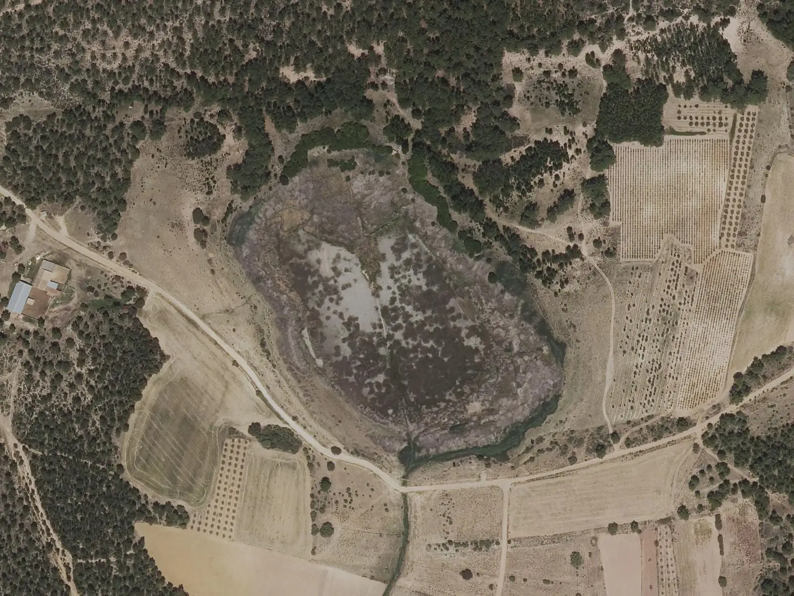
Laguna de Talayuelas is a shallow, endorheic lake fed by groundwater and rain, surrounded by maritime-pine forest and red sands forming gullies. It has been a natural micro-reserve since 2003 and is part of Natura 2000. A refuge for waterbirds, amphibians and mammals, it is surrounded by a 2.3 km interpretive trail with a hide.
- Designation
- Micro-reserve
- Area
- 29.66 ha
- Municipalities
- 1
- Micro-reserve
- Endorheic lake
- Rodeno
- Waterbirds
- Natura 2000
A lake that rises and falls
The lake at Talayuelas is shallow and its level changes through the year. Underwater are stonewort beds with water-crowfoots and amphibious bistort, which can colour it pink. Reeds, bulrushes and rushes grow on the shore. Around it are maritime-pine forest and red sands forming ravines and gullies, such as the one called «Plaza de Toros» (Bullring).
Who lives here
It is a refuge for waterbirds: little grebe, mallard, water rail, moorhen and coot. Grey herons and shovelers arrive in winter; great reed warblers and Cetti’s warblers breed here, and Eleonora’s falcon passes through in spring. There are many Iberian ribbed newts, and in the surrounding woods, wild boar, rabbits, hares, squirrels, badgers, stone martens, genets and wildcats.
The Valle del Cabriel Biosphere Reserve has a project under way to improve its habitats.
A lake that was almost lost
It has been a micro-reserve since 21 February 2003, with 29.66 hectares, and forms part of Natura 2000 within the Sierras de Talayuelas y Aliaguilla Special Area of Conservation. It is a very fragile ecosystem: so shallow that it easily silts up or dries out. Artificial drainage almost made it disappear, and a dam had to be built to save it. To the north are deposits of wind-blown sand, and a well and irrigation hut, now converted into a bird hide. In a province made almost entirely of limestone, its siliceous rodeno, the red sandstone of the south-east, setting makes it different.
Plan your visit
The interpretive trail circles the shore and ends at the bird hide.
Before you travel
This is a micro-reserve: do not enter the water, disturb birds or take anything from the shore.
Combine with
The Cañón Rojo, the red sands of the same municipality.
Frequently asked questions
What kind of lake is it?
Endorheic and shallow, fed by groundwater and rain, with seasonal changes in level. Being so shallow, it is vulnerable to sedimentation and water loss, and a small dam was built years ago.
What trail is there?
An easy 2.3 km circular interpretive trail with 10 m of elevation gain and a bird hide in a converted irrigation hut.
Carry on from here
Lands and landscapes
From here, follow the memory of the land
These readings connect Laguna de Talayuelas micro-reserve with the stories, the work and the villages around it.
Which municipalities it covers
Where the data on this page come from
- Name
- Junta de Castilla-La Mancha, Red de Áreas Protegidas: Microrreserva Laguna de Talayuelas (ficha) source consulted, 14 October 2026
- Designation and legal basis
- Junta de Castilla-La Mancha, Red de Áreas Protegidas: Microrreserva Laguna de Talayuelas (ficha) source consulted, 14 October 2026
«Source consulted»: the primary source has been read. «Reference located»: the source has been identified but not yet read. «Open question»: the figure needs confirmation.