Village · Cuenca
Talayuelas
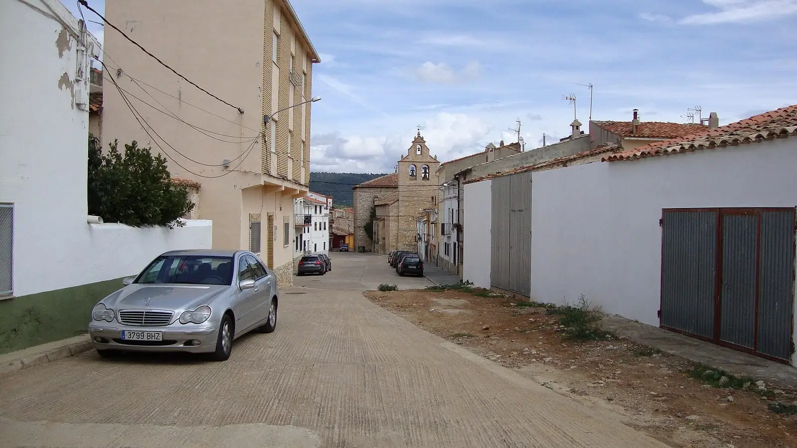
Talayuelas is a village in Serranía Baja (lower Serranía), in the Valle del Cabriel Biosphere Reserve, with a protected endorheic lake, the sandstone Cañón Rojo and a long history of iron and copper mines. It celebrates Candlemas with a torta de turroncillos prepared by the festival stewards. It reached 1,648 inhabitants in 1950 and had 852 in 2021.
On this page 9 sections
A village among pine woods and red sands
Talayuelas lies in eastern Serranía Baja (lower Serranía), within the Valle del Cabriel Biosphere Reserve. It is one of the area’s most populous villages. Reddish clays and sandstones, the rodeno, form ravines and gullies around the lake and give their name to the Cañón Rojo, red walls in a province of grey limestone.
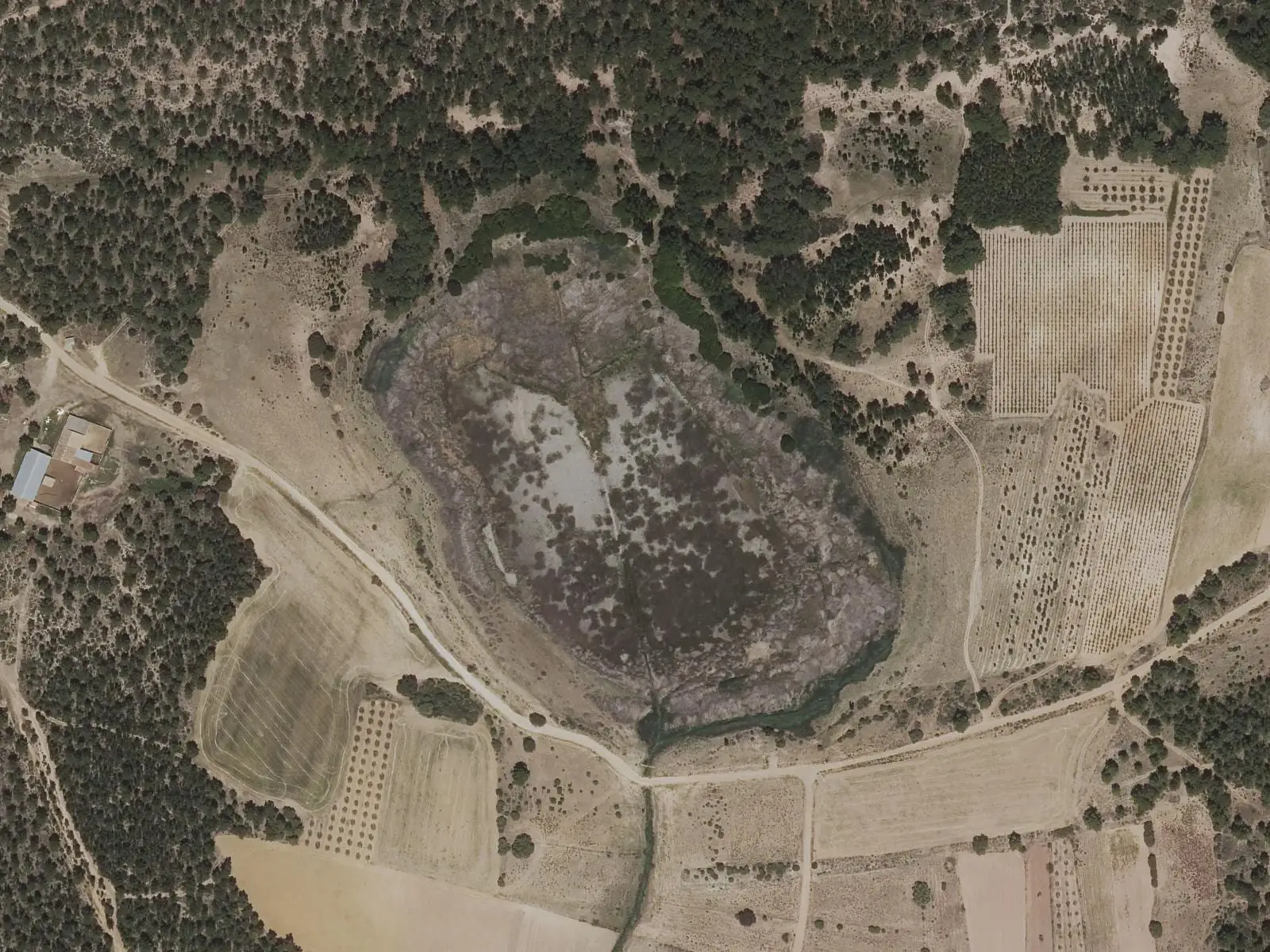
Laguna de Talayuelas is endorheic and shallow, its level rising and falling with the seasons. It has been a micro-reserve since 2003. Little grebes, mallards and coots use it throughout the year, and grey herons and shovelers in winter; Iberian ribbed newts have healthy populations here.
What trades and memory tell
Talayuelas was mining country. There are copper-working licences from 1566 and 1586 and, in the 19th century, «Pozo Vulcano» (Vulcan Shaft), registered in 1841, sixteen claims on slag heaps in 1845 and the Sociedad Minera de Santa Filomena, which worked grey copper ores. Remains lie at Cerro de las Minas y Collado del Arenal and Pozo Vulcano. On the hills, Iberian lookout settlements such as La Mogorrita and Cerro Gabaldón have been identified through surface finds, without excavation; the full catalogue is in the Cerro Viejo entry.
Every 2 February, at Candlemas, the women festival stewards spend the day together in the church making the torta de turroncillos offered to the Virgin. They share the cost of ingredients, and it is a time when older women pass on memories and knowledge.
In 2021 Talayuelas’s pine forests were among the places where the Go-Resinlab project tested a new resin-tapping method: shallow drilling instead of traditional cutting and a closed bag rather than an open pot. It was a trial; no results were published.
Radio also has its dates. On 24 December 2018, at 10:50, Radio Talayuelas went on air on 95.2 FM. On 30 October 2020 regular internet broadcasts began from Radio Serranía, the municipal station reporting news from Serranía Baja. The dates come from the history published by the station itself.
The Cañón Rojo
Among the pines, near Casillas de Ranera, the ground suddenly opens into an almost round hollow with reddish and orange walls: the Cañón Rojo, locally called the bullring because of its shape, not because there were bulls. It is sandstone, not limestone: not a collapsed sinkhole but soft rock eaten into gullies and channels by the Regajo stream and wind, still eroding; pines grow inside. It cannot be seen from afar: it appears at the edge. The surrounding forest is maritime pine, and in 2022 pines still bore resin-tapping scars and hanging pots. Nearby is Fuente de Pie Mulo, where villagers fetch water. The edge is unstable: keep away.
Routes
The lake’s interpretive trail is circular, 2.3 km long and almost flat, with a bird hide.
Plan your visit
The lake takes an hour to walk around. The archaeological sites and mines are not casual walks: view slag heaps and mine entrances without entering or disturbing them.
Before you travel
The lake is a protected wetland: observe it from the trail and hide without disturbing birds. Confirm the hide’s condition and the Candlemas date with the town hall.
Combine with
Graja de Campalbo and Garaballa are less than 9 km away in a straight line, and Landete less than 10 km.
Frequently asked questions
What is Laguna de Talayuelas?
A shallow lake of endorheic origin, fed by groundwater and rain, with underwater stonewort beds and surrounding maritime-pine woods. It has been a natural micro-reserve since 2003 and forms part of Natura 2000, according to Tierra Galana. An easy 2.3 km circular trail goes around it.
What is the torta de turroncillos?
The cake made by the women festival stewards during the weekend before Candlemas to offer to the Virgin. They prepare it together, paying for the ingredients themselves, in an occasion for passing knowledge between generations.
Were there mines in Talayuelas?
Yes. There are copper-mine records from 1566 and 1586 at Cerro de las Minas, the 1841 iron file for «Pozo Vulcano» (Vulcan Shaft), and a Sociedad Minera de Santa Filomena working grey copper ores in the 19th century. The 1924 Mining Statistics mention intensive Roman exploitation of the copper-bearing area, without specifying mines or dates.
Carry on from here
The rivers, zones, eras, places and official routes that the atlas links with Talayuelas.
Lands and landscapes
From here, follow the memory of the land
These readings connect Talayuelas with the stories, the work and the villages around it.
Places in the municipality and around it
Official routes
Near Talayuelas

Fuente del Royo picnic area
Huerta del Marquesado
Prao de San Roque picnic area
Huerta del MarquesadoPaisaje Ilustrado of Huerta del Marquesado
Huerta del MarquesadoSee 5 more

Fuente de la Ardilla picnic area
Valdemeca
Las Hoyas
La CiervaPaisaje Ilustrado of Valdemeca
Valdemeca
Valdemeca Visitor Reception Centre
Valdemeca
Centenar viewpoint
ValdemecaPopulation of Talayuelas, 1842–2021
Talayuelas reached 1,648 inhabitants in 1950. The 2021 census counted 852, 48 % fewer.
Location
● Reference point · ● Villages · ● Places · ━ Routes nearby
Location sketch. The map with paths and names loads as you scroll to it.
Approximate position: village centre.
Reference villages: Graja de Campalbo · Garaballa · Landete · Santa Cruz de Moya.
Open the full map and its historical layers →Where the data on this page come from
- Location
- IGN: Nomenclátor Geográfico Básico de España, capital de municipio (CC BY 4.0) source consulted, 9 October 2026
«Source consulted»: the primary source has been read. «Reference located»: the source has been identified but not yet read. «Open question»: the figure needs confirmation.