Castle · Cañada del Hoyo
Cañada del Hoyo castle
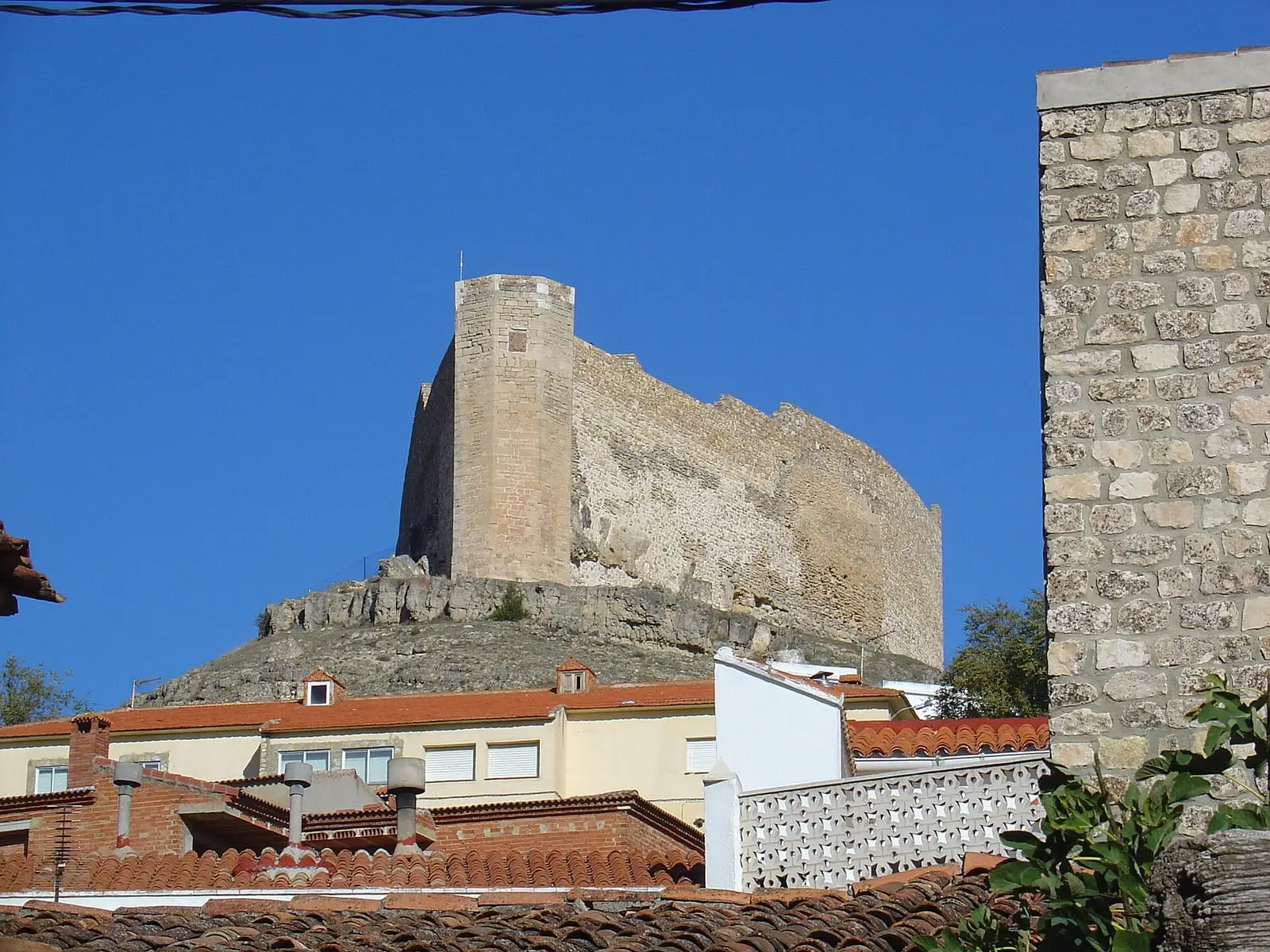
Cañada del Hoyo castle, or Buen Suceso castle, stands on the Hurtado de Mendoza hill. It began as a watchtower to detect approaching enemies and became a castle after Alfonso VIII's definitive conquest of Cuenca, as part of the defensive line between Castile and Valencia. It retains walls, a keep and an octagonal tower. It is privately owned.
- Municipality
- Cañada del Hoyo
- Castle
- Buen Suceso
- Hurtado de Mendoza
- Cañada del Hoyo
- Frontier
A watchtower on the frontier
The castle stands on Cerro del Buen Suceso, also called the Hurtado de Mendoza hill, above Cañada del Hoyo. It began as a watchtower to see who approached the village, becoming a castle after Alfonso VIII conquered Cuenca. It formed part of a defensive line between Castile and Valencia.
What remains
It is shaped like a prow. It retains the walls, keep and an octagonal tower entered from the courtyard. The Marquis of Cañete and later the Marquis of Villena altered it.
Plan your visit
Before you travel
It is privately owned: view it from outside.
Combine with
The lakes of Cañada del Hoyo nearby and PR-CU 88, a short-distance trail starting at the castle.
Frequently asked questions
What survives?
The walls, keep and an octagonal tower entered from the courtyard. The castle is shaped like a ship's prow.
Can it be visited?
It is privately owned, according to Descubre Cuenca; consult the town hall before approaching.
Carry on from here
Lands and landscapes
From here, follow the memory of the land
These readings connect Cañada del Hoyo castle with the stories, the work and the villages around it.
Where it is
Where the data on this page come from
- Name
- Diputación Provincial de Cuenca source consulted, 4 October 2026
- Turismo de Castilla-La Mancha source consulted, 4 October 2026
- Municipality (INE code)
- Diputación Provincial de Cuenca source consulted, 4 October 2026
«Source consulted»: the primary source has been read. «Reference located»: the source has been identified but not yet read. «Open question»: the figure needs confirmation.