Heritage · Moya
Moya historic ensemble
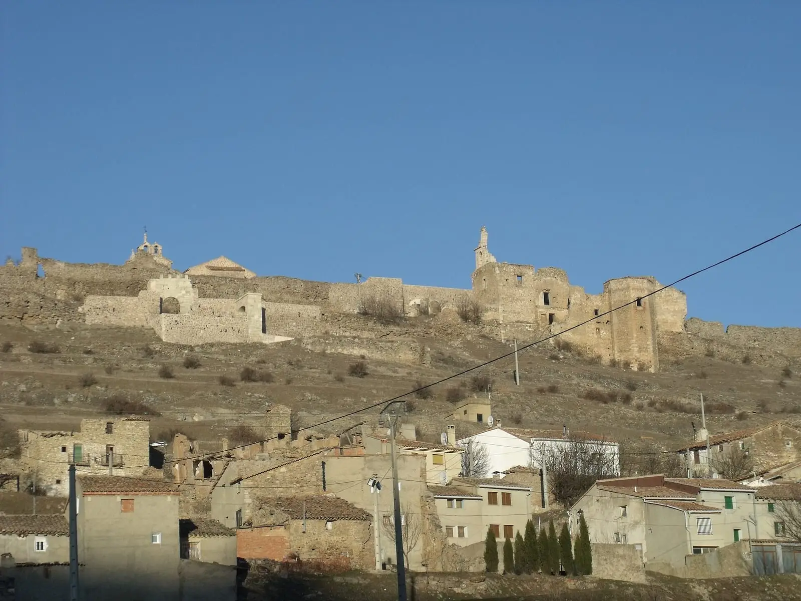
Moya's historic ensemble is an abandoned medieval town on a 1,149 m hill, designated a historic-artistic ensemble in 1982. It covers 59.7 hectares and retains five walled enclosures, eight gates, the castle, the coracha protecting the water supply and ruined churches, convent and hospitals. It headed the marquisate of Moya and emptied during the 19th and 20th centuries.
- Municipality
- Moya
- Moya
- Historic ensemble
- Town walls
- Marquisate of Moya
- Inland customs post
- Deserted settlement
Five enclosures and eight gates
On Moya’s hill, at 1,149 m, are remains from the Middle Bronze Age, around 1500 BC, and Roman coins minted at Bílbilis. The town was conquered in 1183, passed to the Order of Santiago in 1215, came under direct Crown jurisdiction in 1319 and became a marquisate in 1480, with its first lords, Andrés de Cabrera and Beatriz de Bobadilla. Its position between Castile, Aragón and Valencia made it an inland customs post: the lezda, a duty on goods passing between kingdoms, was collected at Torre de San Roque.
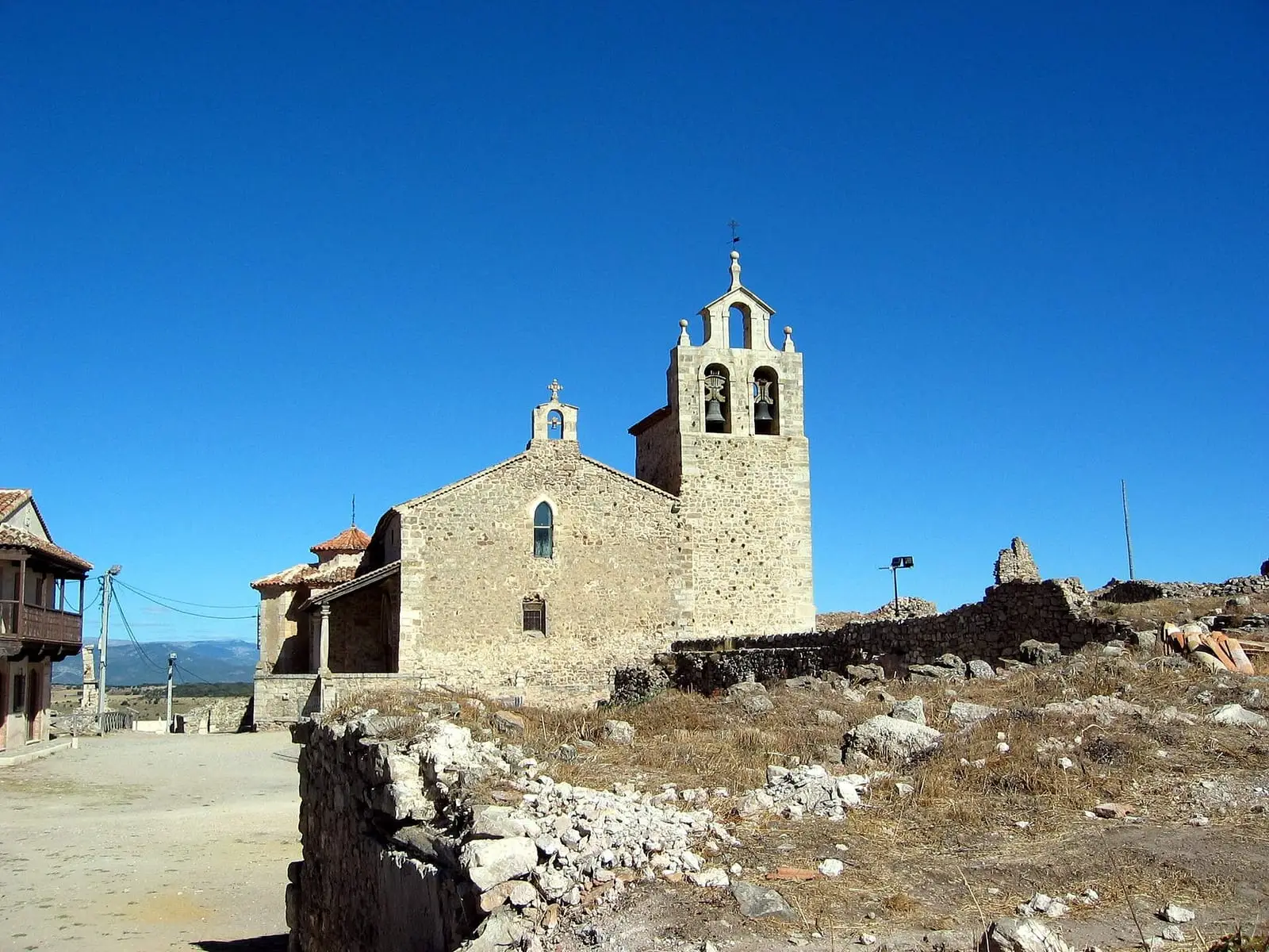
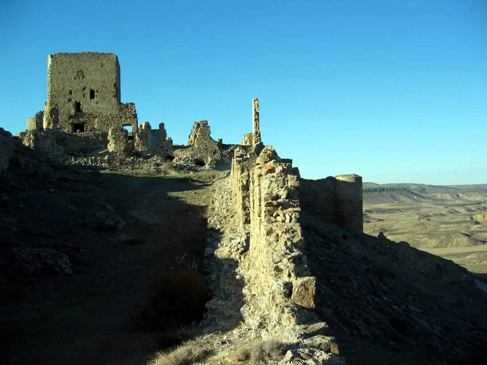
The town had five walled enclosures and eight gates. In the first two, around the main square, stood the communal grain store, the 16th-century Concepcionistas convent and six churches, including Santa María, La Trinidad and San Miguel, now a cemetery. There was a Hospital for the Poor and a Captives’ Hospital of the Order of Santiago. Most churches survive only as remains: half the bell gable of San Bartolomé, Gothic jambs of San Miguel, the bulk of the Concepcionistas convent and what remains of La Trinidad. The convent church, from the 16th and 17th centuries, was consolidated in 2005 but remained roofless until a new roof opened on 10 September 2021: outside it retains the old silhouette, while inside curved timber sheets evoke, without copying, lost vaults, arches and dome. It was intended as an auditorium and venue for exhibitions and courses. The castle closes the southern end, and the coracha, a wall protecting access to water, with Torre del Agua, protected the spring.
How it emptied
Moya declined from the 18th century. A centre of resistance to the French in 1808, it lost its 36 dependent villages through confiscation sales and new administration; Cabrera attacked and destroyed it in 1835, and residents moved down to nearby neighbourhoods until the mid-20th century. It became a historic-artistic ensemble in 1982. Sections of wall are now being restored.
Plan your visit
Before you travel
Access is free. There are cobbled streets and ruined walls: do not climb them.
Combine with
Tejeda monastery in Garaballa and Cañete, once its dependent village.


Frequently asked questions
Why was it abandoned?
It declined from the 18th century; administrative reforms and confiscation sales separated the 36 villages under its jurisdiction, Carlists attacked in 1835, and residents gradually moved to nearby neighbourhoods well into the 20th century.
What protection does it have?
It was declared a historic-artistic ensemble by Royal Decree 2726/1982 of 3 September (BOE of 2 November 1982), and is a Bien de Interés Cultural, Spain's highest heritage listing.
Carry on from here
Lands and landscapes
From here, follow the memory of the land
These readings connect Moya historic ensemble with the stories, the work and the villages around it.
This place through time
Which eras you can read here
A single place can keep traces of several periods. These layers connect what you see with the atlas's stories.
Where it is
Where the data on this page come from
- Name
- Junta de Comunidades de Castilla-La Mancha — Cultura source consulted, 4 October 2026
- Ayuntamiento de Huerta del Marquesado source consulted, 5 October 2026
- Galanita / gestión editorial por verificar source consulted, 5 October 2026
- Luis de Villanueva Domínguez y otros: «La construcción medieval y renacentista en las puertas del conjunto amurallado de Moya (Cuenca). Materiales históricos y técnicas constructivas» (2001) source consulted
- «Ruinas de la antigua villa medieval de Moya» source consulted
- Chamocho Cantudo, Miguel Ángel: «Los fueros del Reino de Toledo y Castilla la Nueva» (2017) source consulted
- García Casar, María Fuencisla: «El tratamiento de los judíos en los fueros de la familia Cuenca-Teruel» (1985) source consulted
- España. Ministerio de Cultura: «Real Decreto 2726/1982, de 3 de septiembre, por el que se declara conjunto histórico-artístico la villa de Moya (Cuenca)» (1982) source consulted
- Municipality (INE code)
- Junta de Comunidades de Castilla-La Mancha — Cultura source consulted, 4 October 2026
- Ayuntamiento de Huerta del Marquesado source consulted, 5 October 2026
- Galanita / gestión editorial por verificar source consulted, 5 October 2026
- Luis de Villanueva Domínguez y otros: «La construcción medieval y renacentista en las puertas del conjunto amurallado de Moya (Cuenca). Materiales históricos y técnicas constructivas» (2001) source consulted
- «Ruinas de la antigua villa medieval de Moya» source consulted
- Chamocho Cantudo, Miguel Ángel: «Los fueros del Reino de Toledo y Castilla la Nueva» (2017) source consulted
- García Casar, María Fuencisla: «El tratamiento de los judíos en los fueros de la familia Cuenca-Teruel» (1985) source consulted
- España. Ministerio de Cultura: «Real Decreto 2726/1982, de 3 de septiembre, por el que se declara conjunto histórico-artístico la villa de Moya (Cuenca)» (1982) source consulted
«Source consulted»: the primary source has been read. «Reference located»: the source has been identified but not yet read. «Open question»: the figure needs confirmation.