Torca · Mira
Cueva Santa del Cabriel
Cueva Santa del Cabriel in Mira lies at about 860 m near Fuencaliente, the hamlet submerged by Contreras reservoir. It was an Iberian sanctuary between the 5th or 4th and 2nd centuries BC, with 122 recorded goblet-shaped vessels, and a Christian hermitage from the 14th century. It has not been excavated.
- Municipality
- Mira
- Iberian sanctuary
- Cave
- Solstice
- Mira
- Hermitage
A cave in the ravine
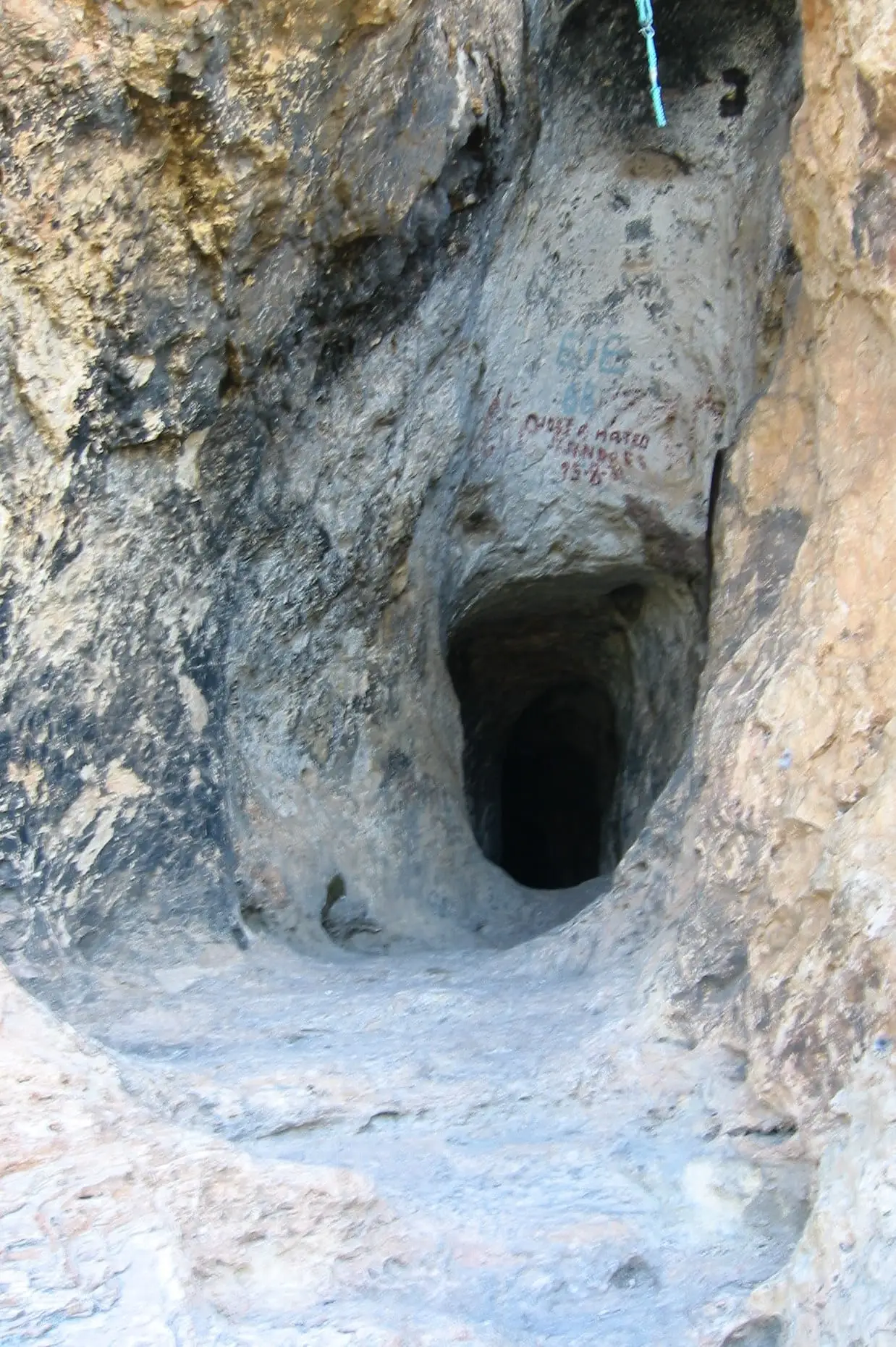
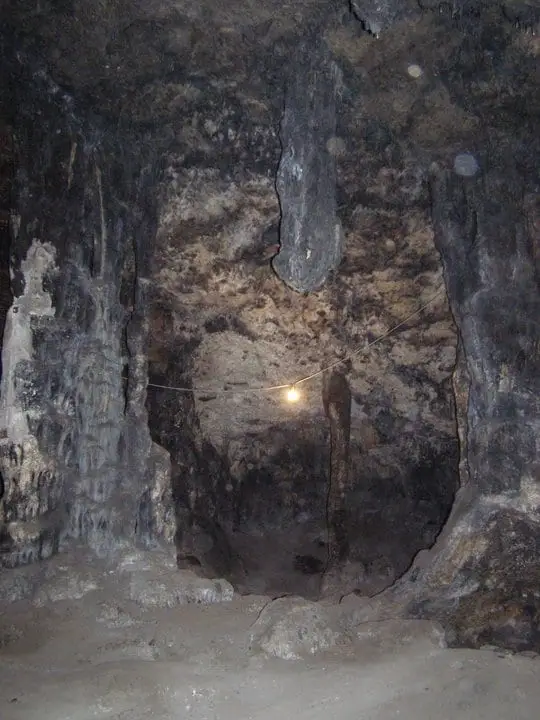
Cueva Santa del Cabriel, also called Fuencaliente or Mira cave, opens at about 860 metres in the ravine of the same name, within Mira. An entrance 1.60 metres high leads to a passage about 11 metres long, widened in the late 18th century, and a chamber about 30 metres wide and 10 high. Galleries lie below, yielding almost everything known about it.
An Iberian sanctuary
Between the late 5th and 2nd centuries BC it was an Iberian sanctuary. 122 goblet-shaped vessels, 89 plates and 25 pots were left there. Earlier, between the Copper and Bronze Ages, it may have served for burial: a copper axe appeared inside a stalagmite column. The cave lies near the Pajazo ford, a main Cabriel crossing on a route between the Requena-Utiel plateau and Castile.
It has never been excavated. Knowledge comes from privately collected objects, a school collection and looting with explosives in the 1970s.
The solstice sun
The entrance passage, about 12 metres long, faces sunset at the summer solstice, when light reaches the chamber’s north wall. Whether the Iberians sought this is unknown.
The hermitage and pilgrimage
Around the 14th century the cave became a hermitage of the Virgin. In the mid-19th it had two rooms for the hermit and pilgrims and two altars, one among stalactites and another to San Marcos. In the early 20th century people from Fuenterrobles came on pilgrimage with decorated carts, heard Mass in the cave, sang the mayos, May songs, and ate outdoors; the pilgrimage continues in May.
Beside the cave stood Fuencaliente. Contreras reservoir has covered it since 1975.
Plan your visit
Before you travel
Both archaeological site and hermitage: collect nothing, do not enter with fire or touch the rock. Ask Mira town hall about access and the pilgrimage date.
Combine with
Continue with the village of Mira and Narboneta, a few kilometres away.

Frequently asked questions
Has it been excavated?
No. Its record comes from collected material, collections and looting with explosives in the 1970s.
What is its astronomical feature?
A 2019 study notes that its roughly 12 m entrance passage points towards sunset at the summer solstice. This is a proposed use, not proven.
Carry on from here
Rivers and basins
Following the water from Cueva Santa del Cabriel
Follow these watercourses to where they meet, to their villages and to the memories of their basin.
Lands and landscapes
From here, follow the memory of the land
These readings connect Cueva Santa del Cabriel with the stories, the work and the villages around it.
This place through time
Which eras you can read here
A single place can keep traces of several periods. These layers connect what you see with the atlas's stories.
Where it is
Where the data on this page come from
- Name
- Machause López, Sonia y otros: «Cuevas rituales ibéricas en el territorio de Kelin (ss. V-III a.C.)» (2018) source consulted
- Moneo, Teresa y otros: «La Cueva Santa del Cabriel (Mira, Cuenca): lugar de culto antiguo y ermita cristiana» (2006) source consulted
- Machause López, Sonia y otros: «Enduring Sacred Places: The Astronomical Orientation of the Iberian Cave-Sanctuary of Cueva Santa del Cabriel in Spain» (2019) source consulted
- Municipality (INE code)
- Machause López, Sonia y otros: «Cuevas rituales ibéricas en el territorio de Kelin (ss. V-III a.C.)» (2018) source consulted
- Moneo, Teresa y otros: «La Cueva Santa del Cabriel (Mira, Cuenca): lugar de culto antiguo y ermita cristiana» (2006) source consulted
- Machause López, Sonia y otros: «Enduring Sacred Places: The Astronomical Orientation of the Iberian Cave-Sanctuary of Cueva Santa del Cabriel in Spain» (2019) source consulted
«Source consulted»: the primary source has been read. «Reference located»: the source has been identified but not yet read. «Open question»: the figure needs confirmation.