Village · Cuenca
Narboneta
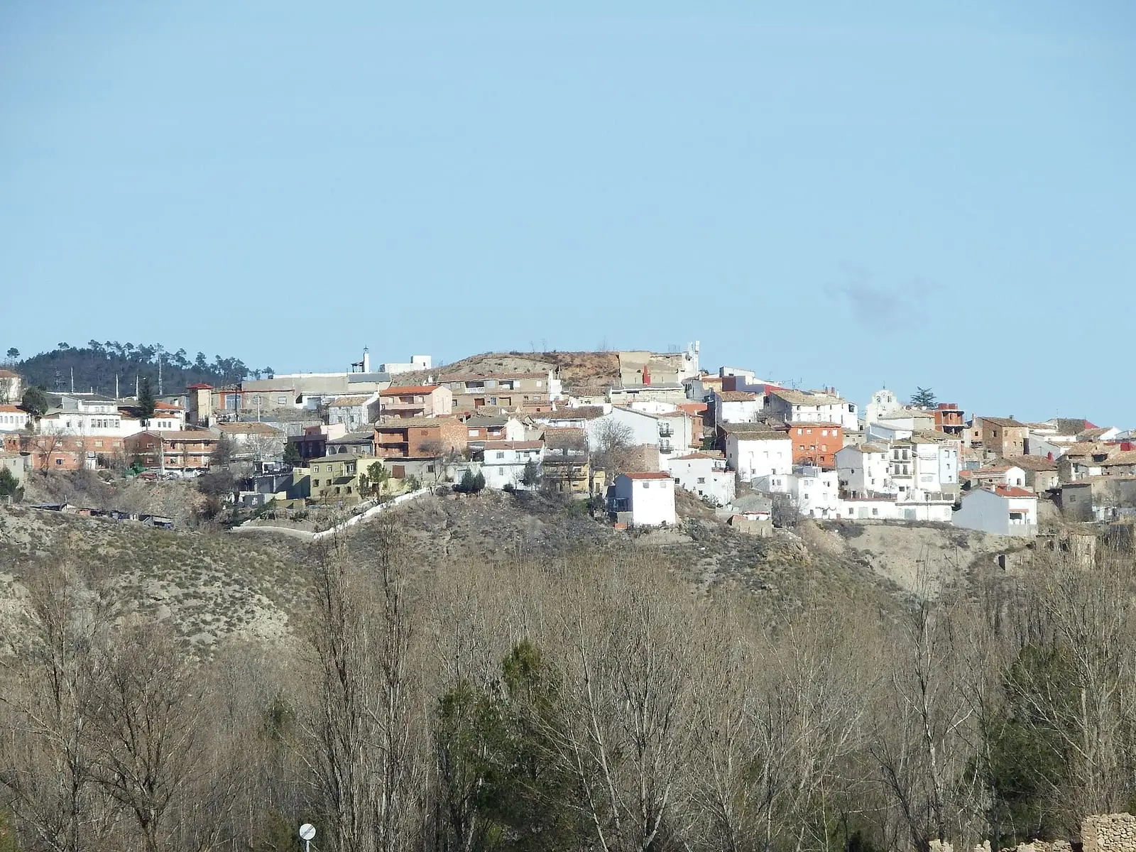
Narboneta is a village in Serranía Baja (lower Serranía), where the mountains open into the Cabriel valley, within the Biosphere Reserve. The INE records it within Mira until the 1930 census. It had 520 inhabitants in 1940 and 42 in 2021: a loss of 92% in eight decades.
On this page 9 sections
Between the mountains and the Cabriel
Narboneta lies in the east of the province, where Serranía Baja (lower Serranía), descends towards the valley of the Cabriel, one of the peninsula’s best-preserved rivers. Its municipality, about 35 km², lies within the Valle del Cabriel Biosphere Reserve: Mediterranean pine woods and scrub on rolling hills, with farmland. The houses follow traditional architecture, adapted to the terrain and climate.
A Gascon fortress
Local history, recorded by Miguel Romero Sáiz, says Alfonso VIII rewarded the Gascon soldiers who helped him conquer Cuenca with land, giving one group the fortress of Narboneta around 1223, although Alfonso VIII had died in 1214; this would explain the French-sounding name. The castle stood on a peak overlooking the valley: a rectangle of roughly dressed stone about 27 by 17 metres, using stone from Cardenete’s quarries, with a cistern beneath the entrance.
In 1473, during struggles for the lordship of Moya, men of a son of governor Alonso Téllez occupied the then half-ruined fortress. Juan Fernández de Heredia, lord of Mora, defending Moya for Princess Isabel, attacked it with cavalry and artillery. The castle was demolished, the village razed and its inhabitants fled to the Mira mountains. Recovery took a long time: in the Ensenada Cadastre of 1752 it had 7 householders and 10 houses, five in ruins; in the Floridablanca census, between 1785 and 1787, 41 inhabitants, including 8 farmers and 3 day labourers.
What trades and memory tell
In the mid-19th century Narboneta ceased to be a municipality and became part of Mira; it regained its town council before 1930. It reached 520 residents in 1940; today there are a few dozen. This is the story of Depopulation.
Narboneta in 1752
On 23 November 1752 the villagers answered the Ensenada Cadastre. Narboneta belonged to the Marquis of Moya, so small it did not even have a village council, and its parish depended on Víllora’s.
- The pastures. The village should have enjoyed the Boalax pasture, but the marquis used it, claiming the settlement was deserted. Its grazing was valued at 400 reales a year, and in return the marquis paid the village’s taxes. The Eusebio, or Fuente del Buitre, pasture yielded 500 reales in grazing income to Moya’s Concepción convent. Villagers grazed their livestock on other patches of uncultivated land.
- Daily wages. There were seven farmers, with no day labourers. A farmer’s day’s work was valued at four reales, including food, with 190 days counted per year; a shepherd’s at two reales.
- The beehives. There were 46, in pine containers, all belonging to one resident. Each yielded three pounds of honey and three ounces of wax a year.
- The mill. The village declared that it had none. One arrived in the late 19th century: the municipal history preserves an 1893 receipt for 13 pesetas in tax.
Plan your visit
Narboneta is a stop on a day through eastern Serranía Baja, with walks along forest tracks.
Before you travel
Bring water and food. Ask the town hall about the paths.
Combine with
Mira, with Cueva Santa del Cabriel, is 4.6 km away in a straight line, and Víllora 9.6 km.
Frequently asked questions
Where is Narboneta?
In eastern Cuenca province, where Serranía Baja meets the Cabriel valley. Its 34.85 km² municipality lies within the Valle del Cabriel Biosphere Reserve.
How many inhabitants does it have?
42 in the 2021 census. Its peak was 520 in 1940, according to the INE.
Carry on from here
The rivers, zones, eras, places and official routes that the atlas links with Narboneta.
Lands and landscapes
From here, follow the memory of the land
These readings connect Narboneta with the stories, the work and the villages around it.
Near Narboneta

Fuente del Royo picnic area
Huerta del Marquesado
Prao de San Roque picnic area
Huerta del Marquesado
Las Hoyas
La CiervaSee 5 more
Paisaje Ilustrado of Huerta del Marquesado
Huerta del Marquesado
Fuente de la Ardilla picnic area
Valdemeca
Beamud viewpoint
Beamud
Fuente de los Pastores picnic area
BeamudPaisaje Ilustrado of Valdemeca
ValdemecaPopulation of Narboneta, 1842–2021
Narboneta reached 520 inhabitants in 1940. The 2021 census counted 42, 92 % fewer. It is the story told in the emptying.
Location
● Reference point · ● Villages · ● Places · ━ Routes nearby
Location sketch. The map with paths and names loads as you scroll to it.
Approximate position: village centre.
Reference villages: Mira · Víllora · Garaballa · Henarejos.
Open the full map and its historical layers →Where the data on this page come from
- Location
- IGN: Nomenclátor Geográfico Básico de España, capital de municipio (CC BY 4.0) source consulted, 9 October 2026
«Source consulted»: the primary source has been read. «Reference located»: the source has been identified but not yet read. «Open question»: the figure needs confirmation.
More about Narboneta, told from the village: the Narboneta Town Council website.