Village · Cuenca
Mira
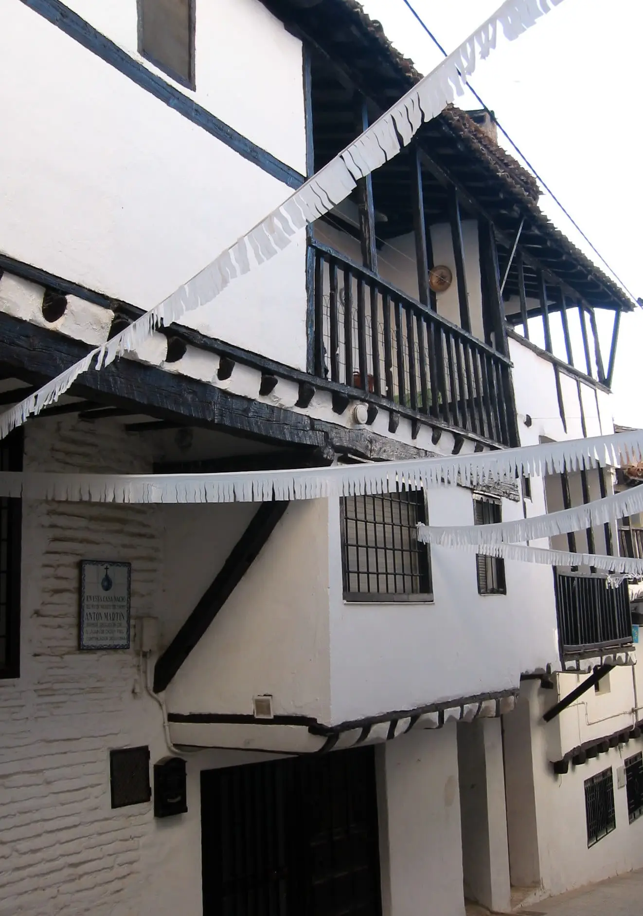
Mira is a town in eastern Cuenca province, in the Valle del Cabriel Biosphere Reserve, with the Cueva Santa del Cabriel: an Iberian sanctuary of the 5th to 2nd centuries BC, aligned with the summer solstice, and later a Christian hermitage. It had 2,605 inhabitants in 1940 and 937 in 2021. The hamlet of Fuencaliente was submerged beneath the Contreras reservoir in 1975.
On this page 11 sections
A town on the Cabriel
Mira lies in the east of Serranía Baja (lower Serranía), on the eastern bank of the Cabriel and within the Valle del Cabriel Biosphere Reserve. It is one of the milder municipalities in the mountains. In the mid-19th century this was broken, stony country living from cereals, sheep, two flour mills, a fulling mill, a pottery and a few sawyers who sold boards.
The Cueva Santa
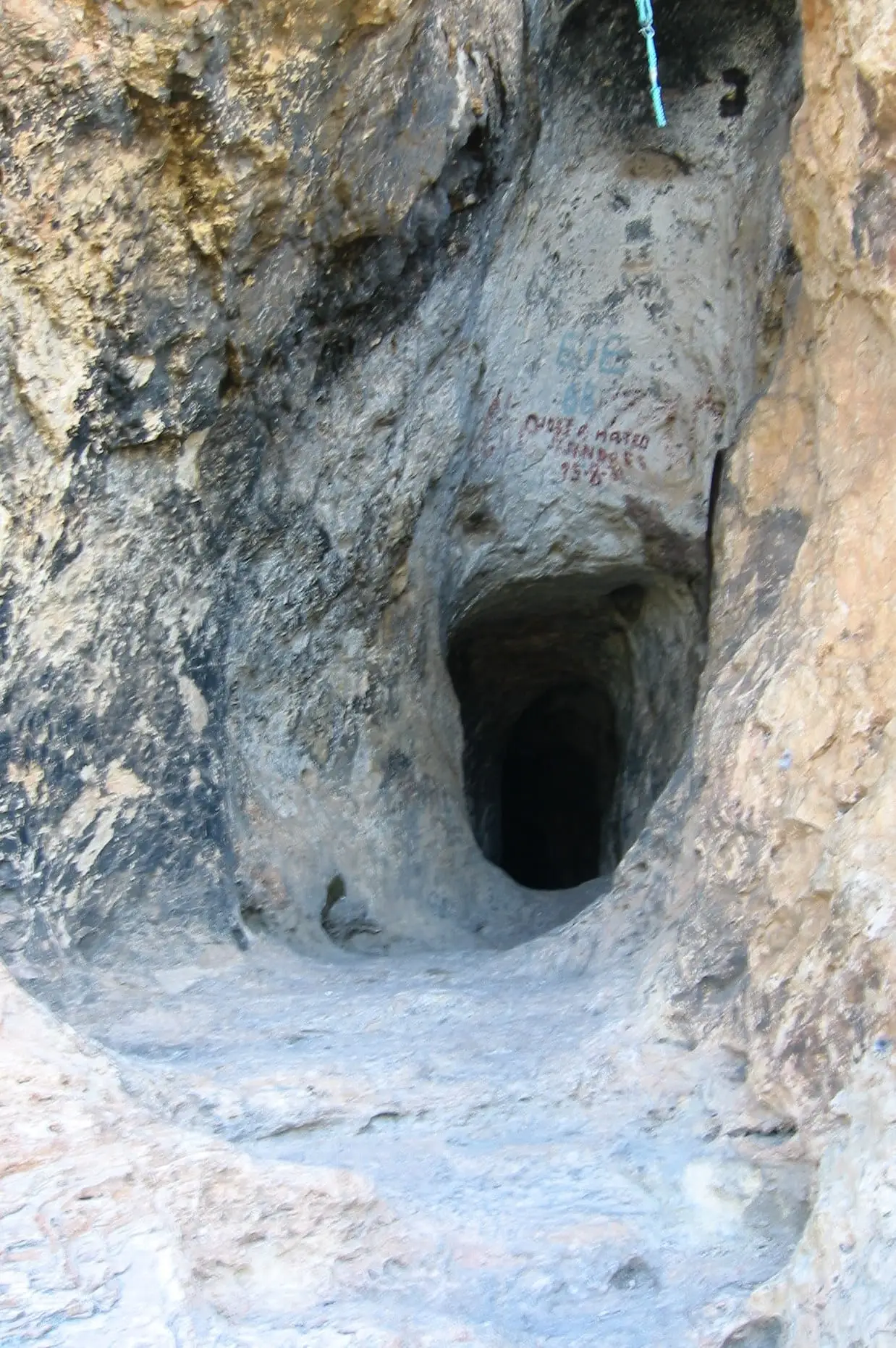
In a ravine at about 860 metres opens the Cueva Santa del Cabriel. It was an Iberian sanctuary between the 5th and 2nd centuries BC, with more than a hundred goblet-shaped vessels offered in its galleries, and a hermitage of the Virgin from the 14th century. Its passage faces sunset at the summer solstice. The pilgrimage continues: in the early 20th century people from Fuenterrobles arrived with decorated carts, Mass in the cave and May songs. The hamlet of Fuencaliente, beside the cave, was submerged beneath the Contreras reservoir in 1975.
What trades and memory tell
In 1753 the town had a cloth fulling mill which it leased annually by auction. Beekeepers took their cork hives to winter in the kingdom of Valencia, brought them back to Mira in spring and then moved them up into the Moya and Cuenca mountains: a seasonal migration of bees, with a six-day journey to Valencia.
The municipality’s hills contain Iberian settlements identified through surface finds, such as Los Castellares, the pottery workshop of Ladera del Molino and El Molón de Mira, gathered in the Cerro Viejo entry. At the Los Villares necropolis, railway works uncovered cremation urns in 1932.
The Mira river gorge
Beside the town, from Fermín’s mill, a short local trail of about two kilometres follows the gorge where the Ojos de Moya river, here already called the Mira, cuts into limestone on its way to the Cabriel. Panels identify the trees: willows, poplars and white poplars beside the water and, higher up, pines, holm oaks and strawberry trees, whose fruit was ripe in November 2022. It ends at the Ánimas viewpoint. There are murals on streets and stairways in the town. This description predates the 2024 flood.
The 2024 flood
On the night of 29–30 October 2024, during the DANA storm, the Ojos de Moya river burst its banks and entered houses on both sides. A local woman died, around fifty people were rescued from rooftops, and hundreds of homes and businesses were damaged. Work was still continuing a year later. The story is told in The Mira flood.
Plan your visit
Start with the town and leave the Cueva Santa for later, allowing time: it is both a hermitage and an archaeological site.
Before you travel
Do not touch anything in the cave or enter with fire. Check access and the pilgrimage date beforehand.
Combine with
Narboneta, which once formed part of Mira’s municipality, is 4.6 km away in a straight line, and Aliaguilla 10 km.
Frequently asked questions
What is Cueva Santa del Cabriel?
A cave at about 860 m altitude, on the middle Cabriel, near the former hamlet of Fuencaliente. It was an Iberian sanctuary, with goblet-shaped and miniature vessels from the 5th to 2nd centuries BC, and a Christian hermitage from the 14th century. It has not been excavated: the finds come from surveys and collections.
What is its astronomical feature?
The access passage, about 12 metres long, is aligned with sunset at the summer solstice, and on that day light partly reaches the north wall of the main gallery, according to a 2019 study.
What happened to Fuencaliente?
The hamlet of Fuencaliente, near the cave and within Mira's municipality, was covered by water when the Contreras reservoir was built in 1975.
Carry on from here
The rivers, zones, eras, places and official routes that the atlas links with Mira.
Rivers and basins
Following the water from Mira
Follow these watercourses to where they meet, to their villages and to the memories of their basin.
Lands and landscapes
From here, follow the memory of the land
These readings connect Mira with the stories, the work and the villages around it.
Traces in the village and around it
Which eras you can read here
A single place can keep traces of several periods. These layers connect what you see with the atlas's stories.
Places in the municipality and around it
Near Mira

Fuente del Royo picnic area
Huerta del Marquesado
Prao de San Roque picnic area
Huerta del Marquesado
Las Hoyas
La CiervaSee 5 more
Paisaje Ilustrado of Huerta del Marquesado
Huerta del Marquesado
Fuente de la Ardilla picnic area
Valdemeca
Beamud viewpoint
BeamudPaisaje Ilustrado of Valdemeca
Valdemeca
Valdemeca Visitor Reception Centre
ValdemecaPopulation of Mira, 1842–2021
Mira reached 2,605 inhabitants in 1940. The 2021 census counted 937, 64 % fewer. It is the story told in the emptying.
Climate in Mira month by month
Averages for the ten years from 2015 to 2024 from the ERA5 reanalysis (Copernicus), for a grid cell with a reference altitude of 861 m. They are model estimates, not measurements from a local station or thirty-year climate normals.
Source: Copernicus ERA5 via Open-Meteo, CC BY 4.0. Retrieved: 2026-10-09.
Location
● Reference point · ● Villages · ● Places · ━ Routes nearby
Location sketch. The map with paths and names loads as you scroll to it.
Approximate position: village centre.
Reference villages: Narboneta · Aliaguilla · Garaballa · Víllora.
Open the full map and its historical layers →Where the data on this page come from
- Location
- IGN: Nomenclátor Geográfico Básico de España, capital de municipio (CC BY 4.0) source consulted, 9 October 2026
«Source consulted»: the primary source has been read. «Reference located»: the source has been identified but not yet read. «Open question»: the figure needs confirmation.
More about Mira, told from the village: the Mira Town Council website.