Route · Tragacete
PR-CU 79: San Blas - San Felipe - Río Cuervo
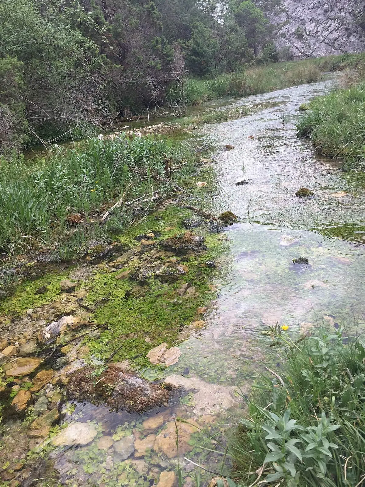
PR-CU 79 is a difficult circular short-distance trail of 22 km with 877 m of elevation gain and over six hours, linking the Júcar and Cuervo sources. It starts at San Blas hostel, follows the Júcar to Estrecho del Infierno and its springs, climbs Cerro San Felipe (1,833 m) and descends to the Cuervo source.
- Code
- PR-CU 79
- Distance
- 22 km
- Elevation gain
- 877 m
- Time
- 4 h
- Layout
- Circular
- Difficulty
- Demanding
Walking time without travel or stops. Difficulty as graded by the official source. «Easy» does not mean accessible.
- PR-CU 79
- Tragacete
- Júcar
- San Felipe
- Cuervo river
Where to start
At San Blas, beside the hostel, just over 3 km from Tragacete.
The route
It links two river sources. It follows the right-hand track along the still-small Júcar to Estrecho del Infierno and the river’s springs, climbing to the Garrafa saddle, where the circuit closes and a shorter option is available. To continue to the Cuervo, it climbs Cerro San Felipe, at 1,833 m, descends through pine forest to Cañada del Perro and follows a narrow, very steep path down to the Cuervo river source car park, beside PR-CU 78.
Difficulty and time
22 km and 877 m of elevation gain, circular, difficult and over 6 hours according to Senderos de Cuenca. The regional government describes the section to the Cuervo as an 11 km linear trail of moderate difficulty: about 4 hours one way and 8 out and back. Return from the Cuervo the same way.
Before you set out
Check the forecast before climbing San Felipe: weather changes quickly above.
Official route · Federación de Deportes de Montaña de Castilla-La Mancha y Diputación de Cuenca (Senderos de Cuenca) (PR-CU 79). Description, track and notices on the official route page (in Spanish). Before you set out, check there for changes or closures.


Frequently asked questions
How far does it go?
To Cerro San Felipe, 1,833 m high, and the Cuervo source.
What precaution is needed?
Assess the weather before climbing San Felipe.
Carry on from here
Lands and landscapes
From here, follow the memory of the land
These readings connect San Blas - San Felipe - Río Cuervo with the stories, the work and the villages around it.
Where it is
● Villages · ● Places · ━ Simplified official route
Location sketch. The map with paths and names loads as you scroll to it.
Reference villages: Tragacete · Huélamo · Vega del Codorno · Valdemeca.
Open the full map and its historical layers →Where the data on this page come from
- Name
- Federación de Deportes de Montaña de Castilla-La Mancha (FDMCM) / Senderos de Cuenca source consulted, 4 October 2026
- FDMCM · Diputación Provincial de Cuenca source consulted, 4 October 2026
- FDMCM / Senderos de Cuenca source consulted, 4 October 2026
- Diputación Provincial de Cuenca y Federación de Deportes de Montaña de Castilla-La Mancha (según fuentes públicas) source consulted, 5 October 2026
- Junta de Comunidades de Castilla-La Mancha — Parque Natural source consulted, 4 October 2026
- Federación de Deportes de Montaña de Castilla-La Mancha source consulted, 5 October 2026
- Municipality (INE code)
- Federación de Deportes de Montaña de Castilla-La Mancha (FDMCM) / Senderos de Cuenca source consulted, 4 October 2026
- FDMCM · Diputación Provincial de Cuenca source consulted, 4 October 2026
- Route data
- Federación de Deportes de Montaña de Castilla-La Mancha (FDMCM) / Senderos de Cuenca source consulted, 4 October 2026
- FDMCM · Diputación Provincial de Cuenca source consulted, 4 October 2026
- FDMCM / Senderos de Cuenca source consulted, 4 October 2026
- Diputación Provincial de Cuenca y Federación de Deportes de Montaña de Castilla-La Mancha (según fuentes públicas) source consulted, 5 October 2026
- Junta de Comunidades de Castilla-La Mancha — Parque Natural source consulted, 4 October 2026
- Federación de Deportes de Montaña de Castilla-La Mancha source consulted, 5 October 2026
«Source consulted»: the primary source has been read. «Reference located»: the source has been identified but not yet read. «Open question»: the figure needs confirmation.