Village · Cuenca
Tragacete
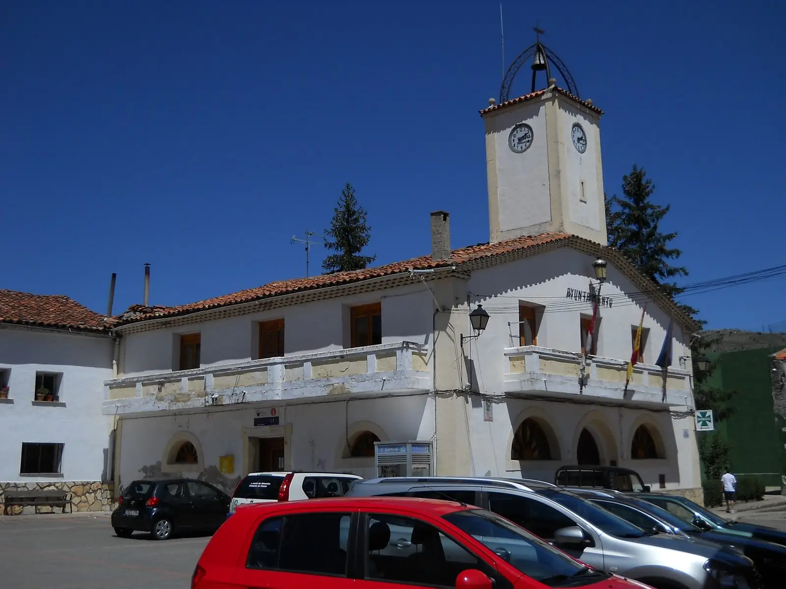
Tragacete is a village in Serranía Alta (upper Serranía), within the Natural Park, in a valley beside the Júcar source and Cerro de San Felipe. It has a visitor reception centre, a bridge of Roman origin over the Júcar and the short Molino de la Chorrera waterfall trail. It reached 1,521 inhabitants in 1910 and had 258 in 2021.
On this page 17 sections
- A village at the birthplace of the Júcar
- Around Tragacete
- Salt, grain store and mills
- San Miguel, San Blas and May songs
- The Casa de Don Casildo
- Two good men
- Gloria Fuertes’s composer
- A village serving others
- Skiing on La Mogorrita
- Routes
- Plan your visit
- From the archive
- Frequently asked questions
- Carry on from here
- Population
- Climate
- Location
A village at the birthplace of the Júcar
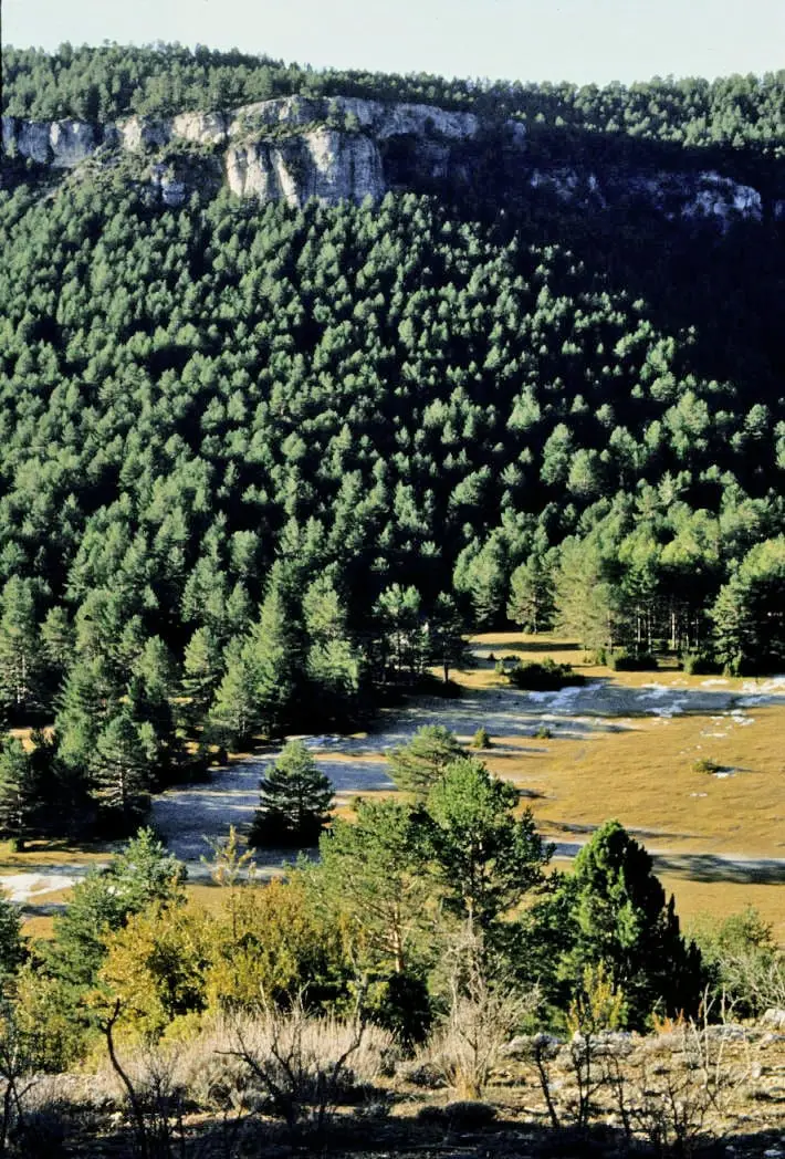
Tragacete occupies a valley in Serranía Alta (upper Serranía), within the Natural Park, surrounded by the mountains’ highest summits. It is country of springs and streams, pine forests and woodland with wild boar, roe deer and red deer. The village began with the resettlement following Alfonso VIII’s conquest of Cuenca in 1177, and belonged to the Land of Cuenca for centuries.
The centre retains vernacular mountain architecture, with a simple main square and planted streets. It was one of the first Serranía villages to live from tourism. Three kilometres away, along the Cuenca road, a bridge of Roman origin crosses the Júcar with a single round arch.
Around Tragacete
- Júcar source, a few kilometres from the village.
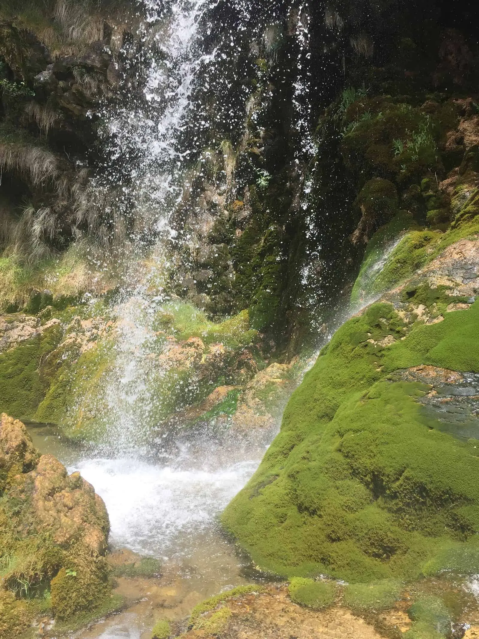
- Molino de la Chorrera waterfall, the Júcar’s first major drop, over tufa; it has a viewpoint.
- Cerro de San Felipe, 1,833 m.
- Cuervo river source, on the other side of San Felipe.
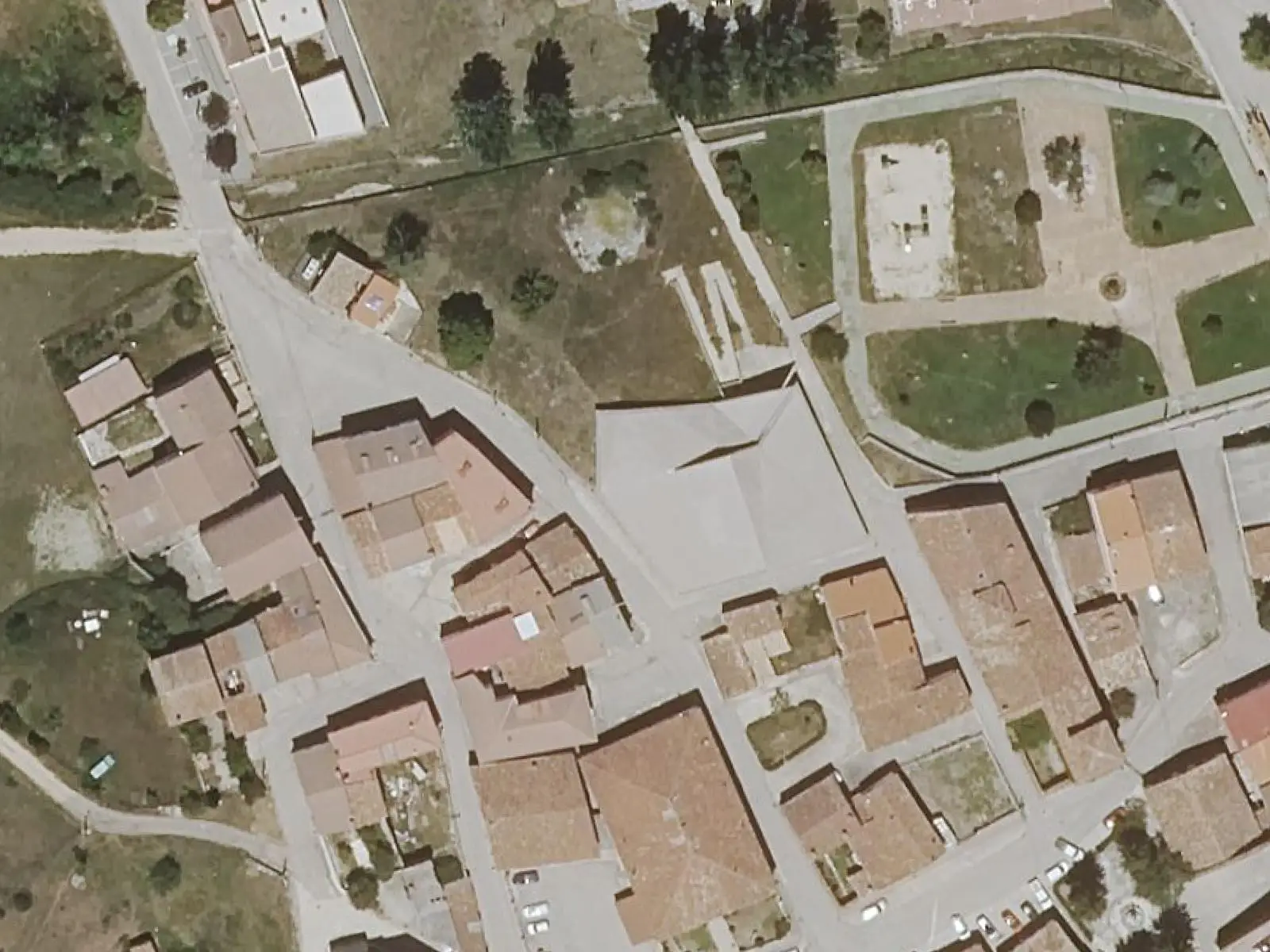
- The Natural Park’s Visitor Reception Centre: a building with a folded roof echoing the terrain, with models, woodland-trade tools and an audiovisual presentation in which a grandfather explains the mountains to his grandson.
- The Ocejón pine, near San Blas hostel: a black pine over three metres in girth and about twenty-five high, spared from felling because of its size.
Salt, grain store and mills
Tragacete had Crown saltworks. On 25 October 1202, Alfonso VIII granted Cuenca’s cathedral chapter a tenth of their income. In 1253, Alfonso X ordered that only salt from Tragacete and Monteagudo be sold in the lands of Huete and Cuenca. In the Ensenada Cadastre of 1752 the village still declared «un salero que pertenece a Su Majestad» (a saltworks belonging to His Majesty). The saltworks were seized in 1870; an 1873 list names Arroyo Salado, Pozo del Río and Poza del Perdón.
There was also a communal wheat store, lending grain in bad years. An account book from 1641 to 1643 names Catalina Moreno as its founder; Masses were already being said for her around 1640.
The woodland brought disputes. On 2 June 1889, Cuenca weekly El Monaguillo published «Una cuestión de deslindes» (a question of boundaries), satirical verses about boundary marking between Cuenca and Tragacete, mocking councillors, keepers and commissions. Cuenca Town Council brought a complaint against a later article in the same newspaper.
Electricity came from the river. Between 1915 and 1920, the owners of the Molino de Abajo and Molino de la Chorrera installed turbines and alternators for their own industries and also lit the village. Both stations became unnecessary when the grid arrived from the hydroelectric plant at Villalba de la Sierra. Downstream stand the Molino del Medio, also called La Toba, and the Molino de los Franceses, said to take its name from a Frenchman who bought it in the 1970s.
San Miguel, San Blas and May songs
The patron saint is San Miguel, and the village preserves a legend about him. One November night, with the village under snow, neighbours sat up together, men plaiting esparto and women embroidering, when they heard howls drawing closer. A pack of wolves was descending towards the houses, followed by another, then another. Everyone went out with sticks, pitchforks and blunderbusses, including some women, with no hope of winning, until the young San Miguel appeared on horseback and, sword in hand, defeated the beasts. María Luisa Vallejo recorded it in her Leyendas conquenses.
At the San Miguel festivities:
- The square. River timber drivers built the barriers with posts, crosspieces and chains.
- The sweets. A vendor from Huélamo set up beside the town hall, selling turrón, alajú and sugar-coated nuts.
- The dancing. People danced in the hall beside the Trinquete, with refreshment-stall rights auctioned and benches against the walls for mothers and young women.
- Los camioneros. Pilar Muñoz places scenes from the episode of Los camioneros filmed here in 1973 in the Avenida bar and Tres Hermanos.
For San Blas, on 3 February, families baked rollos, ring-shaped breads, in the village ovens and took them to Mass for blessing; in 2026 the festival was brought forward to 31 January, with a raffle and competitions in gachas, a flour-based dish, and mus, a card game. For the Cruz de Mayo, fields were blessed: the lower sowings one year and the upper the next, the añá de abajo and añá de arriba, the lower and upper crop divisions. The mayos, May songs, assigned a young man to each young woman; if she disliked her match, the song tells her to go to Mass next day with her apron inside out.
There are newer legends. A princess in love with a priest, whose gaze turned everything to stone, explains the names Cocinilla del Cura, Peña del Fraile and Cueva de la Loca in a story in Tu Comarca. In another, lightning turns a saltworker’s daughter and a timber worker into two joined pines beside the Júcar. These are present-day tales, not old tradition.
The Casa de Don Casildo
On the square stands the Casa de Don Casildo. It takes its name from Julián Casildo de Arribas y Aráuz, a landowner from a local livestock-owning family and parliamentary deputy for the Cañete district from 1879. It has been a farmhouse, municipal school, environmental officers’ office (2007) and social centre, with a library and civil weddings. Women gathered there at weekends to talk and play games, and in the 1980s it had bunks and a kitchen for young Red Cross members. Photographs from around 1970 show beside it a twelve-spout fountain and an arch, now gone, leading to the school plot.
In 1944 the Town Council ordered two bells from Hijos de Constantino Linares of Carabanchel Bajo, weighing 450 and 300 kilos, in G and B. In 1945 it complained twice because they did not swing properly.
Home life, games, school, the barber’s, pig slaughter, war and leaving for domestic service are described in The hearth, the school and the road to Valencia.
Two good men
Prudencio Martínez Martínez, a farmer and Socialist mayor, and his brother-in-law Felipe González Domingo, councillor and UGT leader, were shot in Cuenca after the war: the former on 18 July 1939 and the latter on 21 December. They were accused of the deaths of local Falangists arrested during the war and murdered while being taken to Cuenca, near Uña; the news report says five, testimony in the documentary four. Their families maintain they were uninvolved and that pardons failed to arrive in time.
In August 2019 the Town Council named a street after them. A grandson of Prudencio later initiated the documentary Dos hombres buenos (2023), directed by Jon Cuesta with Ébano Stories, featuring the men’s children and historians such as Paul Preston.
Gloria Fuertes’s composer
Adela Pérez Méndez, pianist and composer who used the name Adela Mascaraque, was born in Tragacete in 1914. She worked with Gloria Fuertes: in 1967 she composed fifteen songs to the poet’s words. She died in 2013.
A village serving others
Tragacete is the small service centre of the high mountains. In 2021 it had a health centre, shop, bank, bars, tourist office, pelota court and a pharmacy also serving Vega del Codorno, Huélamo, Beamud and Valdemeca: the pharmacist went to each village one afternoon and took medicines to older people’s homes. People lived from hospitality, livestock, woodland and building, and a builder complained there were no young people to learn the trade. That year three or four young families had arrived; one from Cataluña through the Hola, Pueblo programme. Vegetable gardens are flood- or drip-irrigated, and gardeners of different ages exchange seeds.
The village has also become a place of cultural work:
- Trashumancias. In June 2024, fifteen university students from four countries spent two weeks in the village through this programme of Fundación Los Maestros and La Circular magazine. Work emerging from it included the podcast Tragacete 109, 90 Varas by Miki Delgado and a verbatim play by Amanda Velloso based on villagers’ accounts on a bench in Calle Santísima Trinidad, later performed in Beamud. In 2025 these were joined by Tragacete Resuena by Paz García Blanes and Vellón Deslanado, sculptures of steel, bones and wool.
- A sound walk. In June 2023 Cristina Palmese and José Luis Carles led one to the waterfall.
- Experimental archaeology. In July 2024 Keltiberia sessions on Iron Age metallurgy were announced at the Casa de Cultura.
- Literary competition. The Foundation’s prizes are presented here: in December 2025 almost three hundred novels and 416 short stories were submitted.
Skiing on La Mogorrita
Across the valley where the Júcar rises, facing San Felipe, stands La Mogorrita, credited with 1,865 m, the province’s highest point. Near the Cubillo pass remains the former house of ICONA forestry officers. According to a Serranía guide, a ski slope operated on its flanks in the 1970s and 1980s: about five hundred metres long, fifty wide and a hundred and twenty in vertical drop, with two drag lifts powered by old Land Rover engines. People came from Cuenca, Teruel and Valencia. Nothing of the lifts remains visible; only the treeless clearing in the pine forest. Documents and accounts from those who built and used it are missing.
For more than twenty-five years, every December, the Dolomía mountaineering association climbed up to place a stone Nativity scene on the summit.
Routes
PNSC-S6 is a 0.4 km walk to the foot of the waterfall. PR-CU 79 (short-distance trail), San Blas - San Felipe - Río Cuervo, is 22 km long with 877 m of elevation gain: it follows the Júcar upstream through Estrecho del Infierno, climbs San Felipe and descends to the Cuervo source.
Plan your visit
The visitor centre, waterfall and a walk through the village fit into a morning. PR-CU 79 needs a full day.
Before you travel
Confirm the visitor centre’s opening calendar. There is little space at the waterfall trailhead: leave the car in the village or at the car park 700 m before it. In winter, snow and ice affect the tracks. View tufa from the trail without stepping on it.
Combine with
Continue towards Huélamo, downstream on the Júcar, or Vega del Codorno, which belonged to Tragacete until the 1920s.
From the archive
Frequently asked questions
What can be seen near Tragacete?
The tufa waterfall of Molino de la Chorrera, about 2 km along the forest road climbing to San Blas hostel, the Júcar source, Cerro de San Felipe and, along PR-CU 79, the Cuervo river source.
Where is the visitor centre?
The Natural Park's Visitor Reception Centre is at 2 Travesía de San Felipe, in a two-storey building of 1,310 m². It offers an exhibition with models and ethnographic objects and an audiovisual presentation. Confirm opening dates with the regional government.
Why did the population fall so much between 1920 and 1930?
Because the municipality shrank in those years: Vega del Codorno separated from Tragacete, according to INE notes. The census population fell from 1,373 to 990.
Carry on from here
The rivers, zones, eras, places and official routes that the atlas links with Tragacete.
Rivers and basins
Following the water from Tragacete
Follow these watercourses to where they meet, to their villages and to the memories of their basin.
Lands and landscapes
From here, follow the memory of the land
These readings connect Tragacete with the stories, the work and the villages around it.
Places in the municipality and around it
Official routes
Near Tragacete
El Hosquillo
Cuenca
Huélamo castle
Huélamo
Alto de la Vega picnic area
CuencaSee 5 more
Peña del Reloj viewpoint
Los Lagunillos picnic area
Cuenca
Fuente de la Tía Perra picnic area
Cuenca
Balcón de Pilatos viewpoint
Molino de Juan Romero picnic area
CuencaPopulation of Tragacete, 1842–2021
Tragacete reached 1,521 inhabitants in 1910. The 2021 census counted 258, 83 % fewer. It is the story told in the emptying.
Climate in Tragacete month by month
Averages for the ten years from 2015 to 2024 from the ERA5 reanalysis (Copernicus), for a grid cell with a reference altitude of 1287 m. They are model estimates, not measurements from a local station or thirty-year climate normals.
Source: Copernicus ERA5 via Open-Meteo, CC BY 4.0. Retrieved: 2026-10-09.
Location
● Reference point · ● Villages · ● Places · ━ Routes nearby
Location sketch. The map with paths and names loads as you scroll to it.
Approximate position: village centre.
Reference villages: Huélamo · Vega del Codorno · Las Majadas · Valdemeca.
Open the full map and its historical layers →Where the data on this page come from
- Name
- IGN, Equipamiento Geográfico de Referencia Nacional: nombre oficial y código INE source consulted, 5 October 2026
- Turismo de Castilla-La Mancha source consulted, 4 October 2026
- Municipality (INE code)
- IGN, Equipamiento Geográfico de Referencia Nacional: nombre oficial y código INE source consulted, 5 October 2026
- Turismo de Castilla-La Mancha source consulted, 4 October 2026
- Protected areas
- Ley 5/2007, de 8 de marzo, de Declaración del Parque Natural de la Serranía de Cuenca (DOCM) reference located, 5 October 2026
- Junta de Castilla-La Mancha, Educación Ambiental: ficha técnica de la exposición «Serranía de Cuenca» reference located, 5 October 2026
- Location
- IGN: Nomenclátor Geográfico Básico de España, capital de municipio (CC BY 4.0) source consulted, 9 October 2026
«Source consulted»: the primary source has been read. «Reference located»: the source has been identified but not yet read. «Open question»: the figure needs confirmation.