Route · Cuenca
SL-CU 10: Ruta de las Hoces de Cuenca
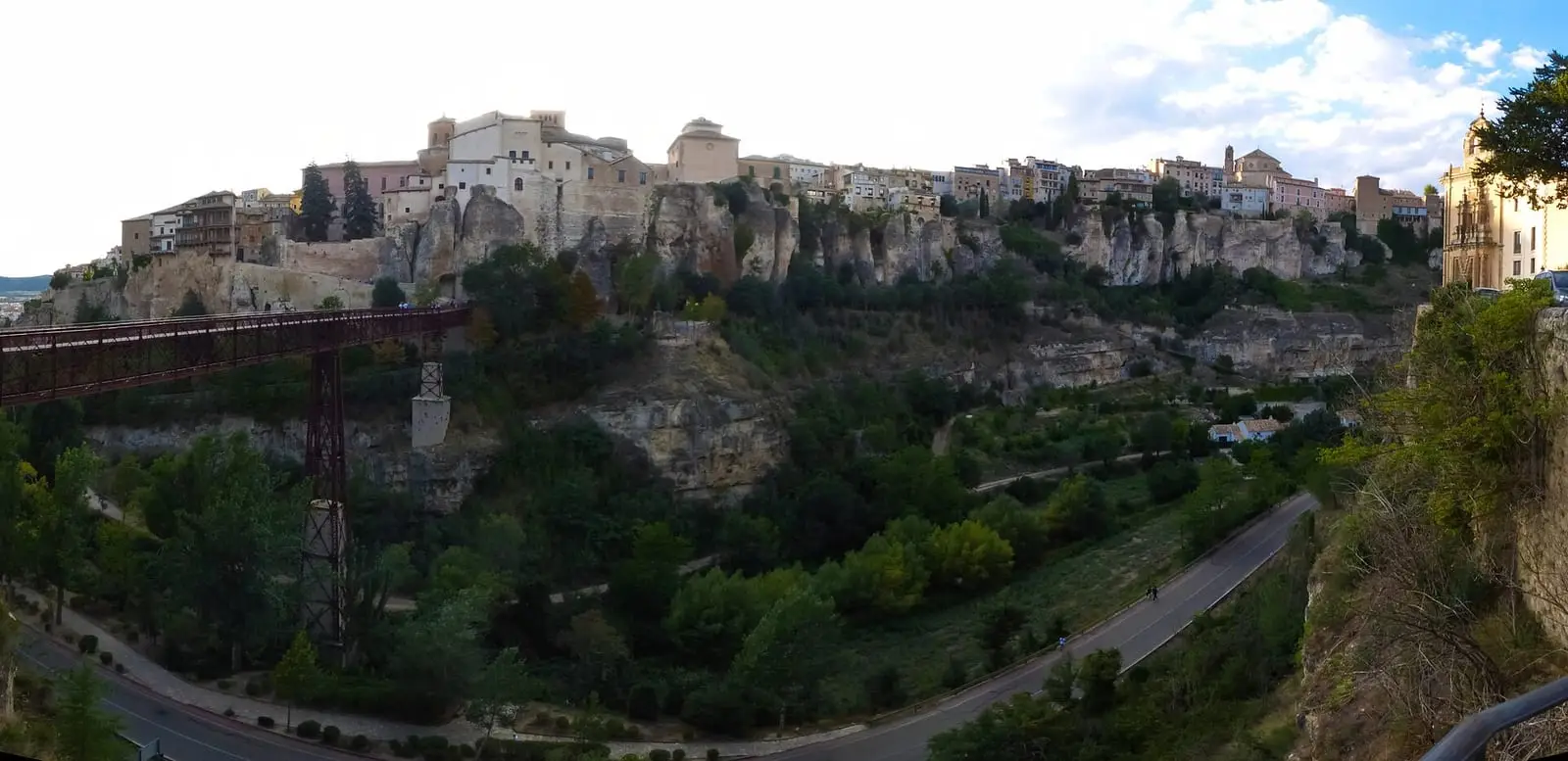
SL-CU 10 is an easy circular local trail of 4 km with 210 m of elevation gain around Cuenca's old town. It combines cobbled streets, Júcar and Huécar riverbanks and natural viewpoints over limestone cliffs. Part of the route is urban and shares sections with vehicles.
- Code
- SL-CU 10
- Distance
- 4 km
- Elevation gain
- 210 m
- Layout
- Circular
- Difficulty
- Easy
Walking time without travel or stops. Difficulty as graded by the official source. «Easy» does not mean accessible.
- SL-CU 10
- Cuenca
- Old town
Where to start
In Cuenca’s old town.
The route
Old Cuenca rises on a rocky spur between the Júcar and Huécar, which meet below at La Junta. The trail circles the centre on footpaths, paths and streets used by Cuenca residents: tree-lined riverbanks, viewpoints over limestone cliffs, cobbled streets and gardens.
Difficulty and time
Circular, 4 km and 210 m of elevation gain. Easy according to Senderos de Cuenca; the federation rates it difficult.
Before you set out
Part runs through the city and shares sections with cars: take care. The provincial capital’s other trail is SL-CU 11.
Official route · Federación de Deportes de Montaña de Castilla-La Mancha y Diputación de Cuenca (Senderos de Cuenca) (SL-CU 10). Description, track and notices on the official route page (in Spanish). Before you set out, check there for changes or closures.


Frequently asked questions
Is it all in the countryside?
No: part runs through an urban setting.
Which rivers does it follow?
The Júcar and Huécar, which meet at La Junta.
Carry on from here
Lands and landscapes
From here, follow the memory of the land
These readings connect Ruta de las Hoces de Cuenca with the stories, the work and the villages around it.
- Serranía MediaZone of the Serranía →
- Complejo Lagunar del río Moscas micro-reserveProtected area in the municipality →
- Cueva de los Morceguillos micro-reserveProtected area in the municipality →
- Nacimiento del río Cuervo Natural MonumentProtected area in the municipality →
- Palancares y Tierra Muerta Natural MonumentProtected area in the municipality →
- Serranía de Cuenca Natural ParkProtected area in the municipality →
- Serranía de Cuenca SAC and SPA (ES4230014)Protected area in the municipality →
Where it is
● Villages · ● Places · ━ Simplified official route
Location sketch. The map with paths and names loads as you scroll to it.
Reference villages: Cuenca · Palomera · Mariana · Buenache de la Sierra.
Open the full map and its historical layers →Where the data on this page come from
- Name
- Federación de Deportes de Montaña de Castilla-La Mancha (FDMCM) / Senderos de Cuenca source consulted, 4 October 2026
- FDMCM · Diputación Provincial de Cuenca source consulted, 4 October 2026
- Federación de Deportes de Montaña de Castilla-La Mancha source consulted, 5 October 2026
- Municipality (INE code)
- Federación de Deportes de Montaña de Castilla-La Mancha (FDMCM) / Senderos de Cuenca source consulted, 4 October 2026
- FDMCM · Diputación Provincial de Cuenca source consulted, 4 October 2026
- Route data
- Federación de Deportes de Montaña de Castilla-La Mancha (FDMCM) / Senderos de Cuenca source consulted, 4 October 2026
- FDMCM · Diputación Provincial de Cuenca source consulted, 4 October 2026
- Federación de Deportes de Montaña de Castilla-La Mancha source consulted, 5 October 2026
«Source consulted»: the primary source has been read. «Reference located»: the source has been identified but not yet read. «Open question»: the figure needs confirmation.