Micro-reserve
Complejo Lagunar del río Moscas micro-reserve
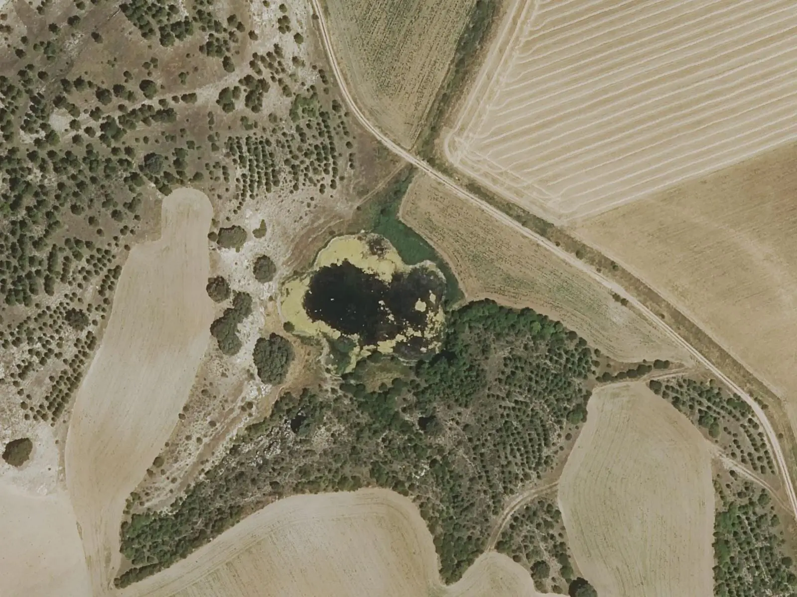
The River Moscas lake complex in Fuentes comprises eleven dolines opened in gypsum by groundwater, nine holding water permanently: the lakes of Mohorte and Las Zomas to the north, and to the south the Ojos de la Corva, Laguna Negra and Laguna de los Cedazos. It has been a micro-reserve since 2010, covering 125.7 hectares, and its most recent doline opened in 2009.
- Designation
- Micro-reserve
- Legal basis
- Decreto 46/2010, de 4 de mayo
- Area
- 125.7 ha
- Municipalities
- 2
- Lakes
- Dolines
- Fuentes
- River Moscas
- Micro-reserve
- Gypsum
Lakes formed by subsidence
Fuentes lives up to its name, meaning springs: it has many, including the source of the River Moscas. That water running underground dissolves gypsum, and the ground subsides into dolines, called torcas in Cuenca. There are eleven, and nine hold water all year: to the north, Mohorte and Las Zomas; to the south, the five Ojos de la Corva, Laguna Negra and Laguna de los Cedazos, the largest. In such soft ground the process is rapid: the most recent doline, in the Ojos de la Corva, opened in 2009.
Life in the water
Algae and water-crowfoots grow on the bottom; on the shore, reeds, bulrushes, rushes and saw-sedge beds, a protected plant community. The Júcar nase, a threatened fish now rare in the basin, lives here. Grey herons and marsh harriers can be seen, moorhens and little grebes heard, and the otter hunts in Los Cedazos.
Four protected pieces
Decree 46/2010 of 4 May made the lakes a micro-reserve of 125.7 hectares in four areas that do not touch: the Mohorte lakes (7.78 ha), in the dependent village of Mohorte in the municipality of Cuenca; Las Zomas (9.05 ha); Los Cedazos, Laguna Negra and others (80.10 ha), between Fuentes and Arcas del Villar; and the Ojo de la Corva lakes (28.77 ha). Agriculture dominates the surroundings, and the lakes are the refuge of a unique ecosystem, with very distinctive aquatic vegetation.
Plan your visit
Before you travel
An interpretive trail follows the lakes. Do not enter the water or tread on the shores.
Combine with
The Fuentes Interpretation Centre, with the dinosaurs of Lo Hueco.
Frequently asked questions
How do these lakes form?
Water circulating underground dissolves the gypsum and the ground subsides into dolines, known here as torcas. In soft materials such as gypsum and marl this happens quickly: the last doline opened in 2009.
What protection does it have?
It is the Complejo Lagunar del río Moscas micro-reserve, designated by Decree 46/2010 of 4 May, with 125.7 hectares in Fuentes, Arcas del Villar and Cuenca, divided into four separate areas.
Carry on from here
Lands and landscapes
From here, follow the memory of the land
These readings connect Complejo Lagunar del río Moscas micro-reserve with the stories, the work and the villages around it.
Which municipalities it covers
Where the data on this page come from
- Name
- Junta de Castilla-La Mancha, Red de Áreas Protegidas: Microrreserva Complejo Lagunar del río Moscas (ficha) source consulted, 14 October 2026
- Decreto 46/2010, de 04/05/2010, por el que se declara la microrreserva Complejo lagunar del Río Moscas (DOCM) source consulted, 14 October 2026
- Designation and legal basis
- Junta de Castilla-La Mancha, Red de Áreas Protegidas: Microrreserva Complejo Lagunar del río Moscas (ficha) source consulted, 14 October 2026
- Decreto 46/2010, de 04/05/2010, por el que se declara la microrreserva Complejo lagunar del Río Moscas (DOCM) source consulted, 14 October 2026
«Source consulted»: the primary source has been read. «Reference located»: the source has been identified but not yet read. «Open question»: the figure needs confirmation.