Route · Lagunaseca
SL-CU 5: Torcas de Lagunaseca
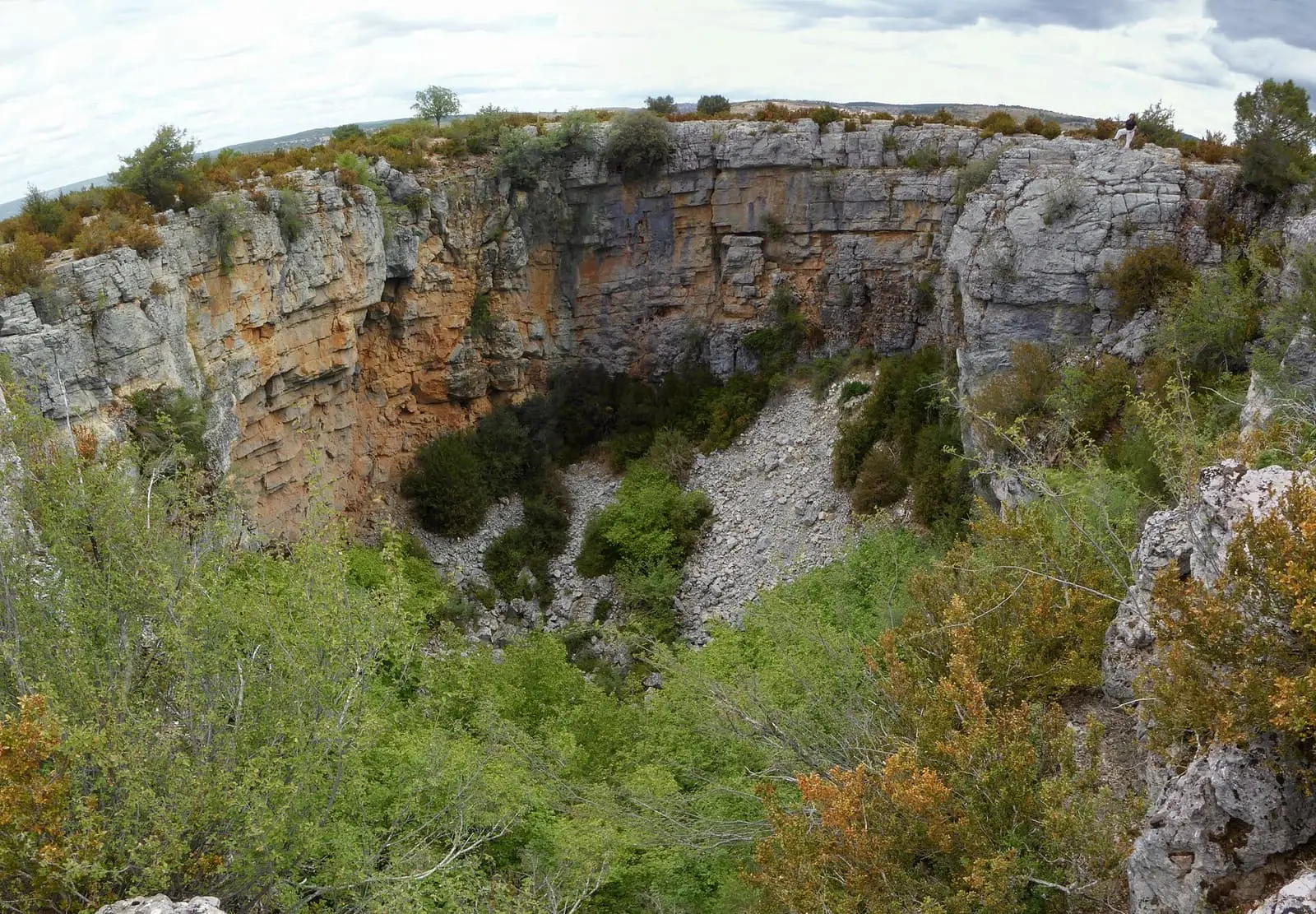
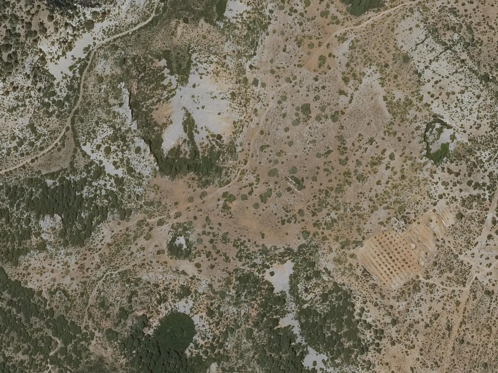
SL-CU 5, Torcas de Lagunaseca, is an easy circular local trail of 4 km and 90 m of elevation gain, taking 1 h 15 min. It starts at the Natural Monument car park at km 4.2 on the CUV-9031, beside Lagunaseca's Mirador Astronómico, climbs to the top of the torcal, a karst landscape, and circles Torca Larga, Torca de las Cabras and Torca de Miguel Orea.
- Code
- SL-CU 5
- Distance
- 4 km
- Elevation gain
- 90 m
- Layout
- Circular
- Difficulty
- Easy
Walking time without travel or stops. Difficulty as graded by the official source. «Easy» does not mean accessible.
- SL-CU 5
- Torcas de Lagunaseca
- Lagunaseca
- Karst
- Easy walk
Where to start
At the Torcas de Lagunaseca Natural Monument car park, at km 4.2 on the CUV-9031, also the location of Lagunaseca’s Mirador Astronómico.
The route
Walk anticlockwise. The track heads towards El Hoyazo and Boca de la Hoz, shared for a stretch with PR-CU 2, a short-distance trail, and GR 66, a long-distance trail; a narrow path then climbs to the top of the torcal, a karst landscape. Through dense pine forest it skirts Torca Larga, reaches Torca de las Cabras and, along a faint path, Torca de Miguel Orea, before returning to the car park. More about the torcas, collapse sinkholes, in their entry.
IGME explains that ice breaking the rock and snow helped shape this karst and fill the slopes with debris.
Difficulty and time
Circular, 4 km and 90 m of elevation gain, between 1,298 and 1,361 m. Easy, 1 h 15 min. Suitable at any time of year.
Before you set out
The torcas are depressions with loose-rock edges: keep away from the rim. At night, the astronomical viewpoint is beside the route.
Official route · Federación de Deportes de Montaña de Castilla-La Mancha y Diputación de Cuenca (Senderos de Cuenca) (SL-CU 5). Description, track and notices on the official route page (in Spanish). Before you set out, check there for changes or closures.
Frequently asked questions
Which direction should it be walked?
The official entry recommends anticlockwise, continuing straight on at the first junction towards El Hoyazo and Boca de la Hoz.
Carry on from here
Lands and landscapes
From here, follow the memory of the land
These readings connect Torcas de Lagunaseca with the stories, the work and the villages around it.
Where it is
● Villages · ● Places · ━ Simplified official route
Location sketch. The map with paths and names loads as you scroll to it.
Reference villages: Lagunaseca · Masegosa · Santa María del Val · Cueva del Hierro.
Open the full map and its historical layers →Where the data on this page come from
- Name
- FDMCM · Diputación Provincial de Cuenca source consulted, 4 October 2026
- FDMCM / Diputación Provincial de Cuenca; promotor JCCM source consulted, 4 October 2026
- Federación de Deportes de Montaña de Castilla-La Mancha source consulted, 5 October 2026
- Municipality (INE code)
- FDMCM · Diputación Provincial de Cuenca source consulted, 4 October 2026
- FDMCM / Diputación Provincial de Cuenca; promotor JCCM source consulted, 4 October 2026
- Route data
- FDMCM · Diputación Provincial de Cuenca source consulted, 4 October 2026
- FDMCM / Diputación Provincial de Cuenca; promotor JCCM source consulted, 4 October 2026
- Federación de Deportes de Montaña de Castilla-La Mancha source consulted, 5 October 2026
«Source consulted»: the primary source has been read. «Reference located»: the source has been identified but not yet read. «Open question»: the figure needs confirmation.