Natural Monument
Torcas de la Lagunaseca Natural Monument
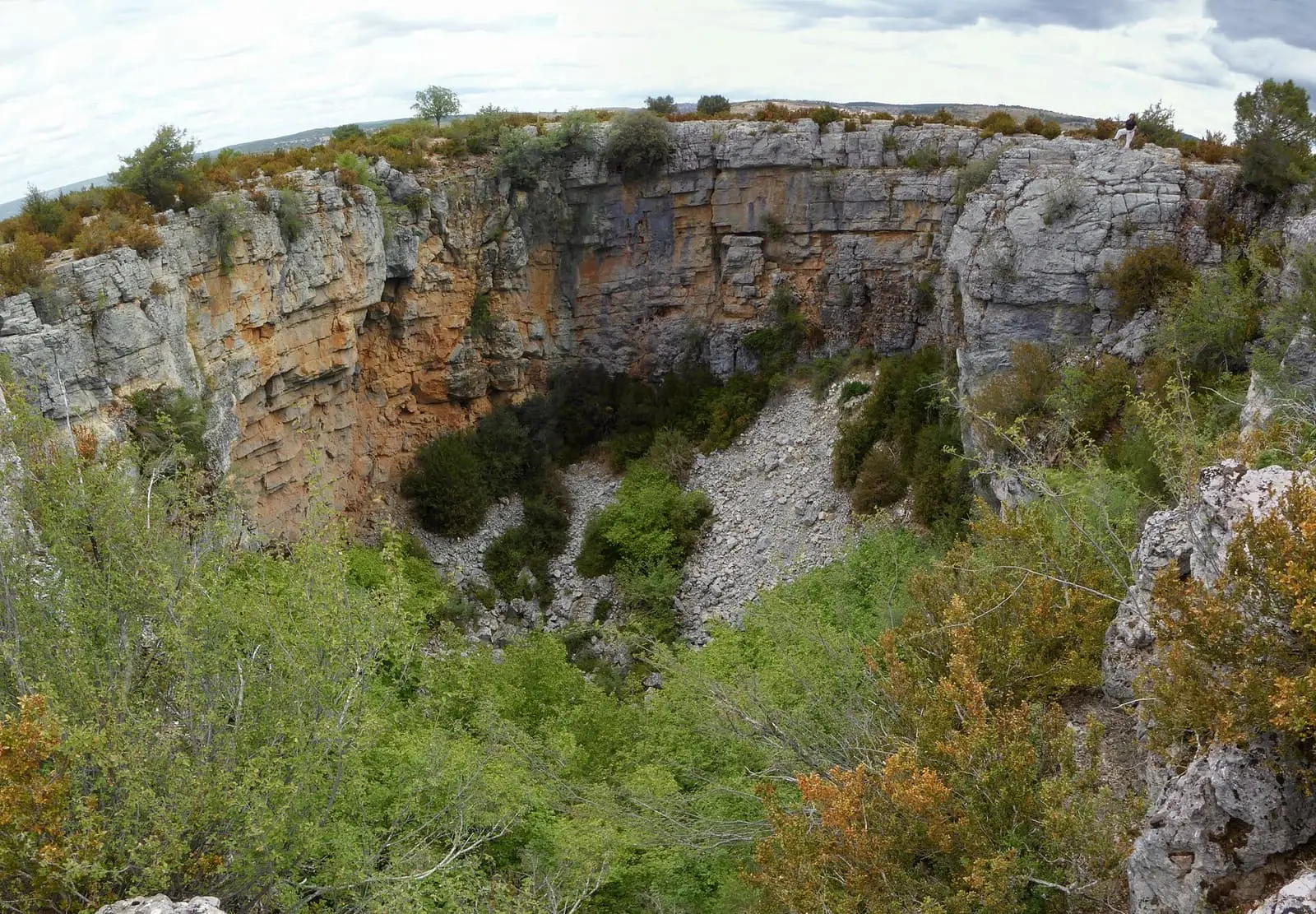
The Torcas de la Lagunaseca are a Natural Monument of 188.42 hectares in the municipality of Lagunaseca, designated by Decree 310/2003. They bring together torcas, dolines, uvalas and poljes in limestones deposited about 200 million years ago, among juniper woods, box thickets and black pines.
- Designation
- Natural Monument
- Legal basis
- Decreto 310/2003, de 2 de diciembre
- Area
- 188.42 ha
- Municipalities
- 1
- Natural Monument
- Torcas
- Dolines
- Polje
- Lagunaseca
Karst on a large scale
The torcas, collapse sinkholes, are in Lagunaseca: well-formed dolines, uvalas and poljes, opened along cracks in the ground. The rock was deposited about 200 million years ago; ice breaking it and water dissolving it have done the rest.
Plants and animals
Box, spiny broom, thyme, sage and lavender grow on the plateau, with scattered Spanish junipers and black pine. On the walls are rock plants such as té de risca; at the bottom of the dolines, hazels, maples and St Lucie cherries. Red-billed choughs, booted eagles and nightjars fly here, and wildcats, stone martens, badgers, red deer, roe deer and wild boar roam.
Plan your visit
The SL-CU 5 local trail follows the torcas over 4 km.
Before you travel
The edges are cliffs: keep away.
Combine with
The torcas have their own entry, and Muela Pinilla is next door.
Frequently asked questions
What is there at the Torcas de la Lagunaseca?
Closed depressions, torcas, dolines, uvalas and poljes, and smaller forms such as grooved karren. Their importance lies in their size and their use as a model for interpreting the area's geomorphological evolution.
When was it designated?
By Decree 310/2003 of 2 December.
Carry on from here
Lands and landscapes
From here, follow the memory of the land
These readings connect Torcas de la Lagunaseca Natural Monument with the stories, the work and the villages around it.
Which municipalities it covers
Where the data on this page come from
- Name
- Junta de Castilla-La Mancha, Red de Áreas Protegidas: Monumento Natural Torcas de la Lagunaseca (ficha) source consulted, 5 October 2026
- Designation and legal basis
- Junta de Castilla-La Mancha, Red de Áreas Protegidas: Monumento Natural Torcas de la Lagunaseca (ficha) source consulted, 5 October 2026
«Source consulted»: the primary source has been read. «Reference located»: the source has been identified but not yet read. «Open question»: the figure needs confirmation.