Village · Cuenca
Henarejos
Henarejos is a village at the eastern end of the province of Cuenca, in the old Land of Moya and within the Valle del Cabriel Biosphere Reserve, with three Levantine rock art shelters, including Los Oculados, dated by radiocarbon. It had 1,396 inhabitants in 1950 and 137 in 2021.
On this page 9 sections
A village of the Land of Moya
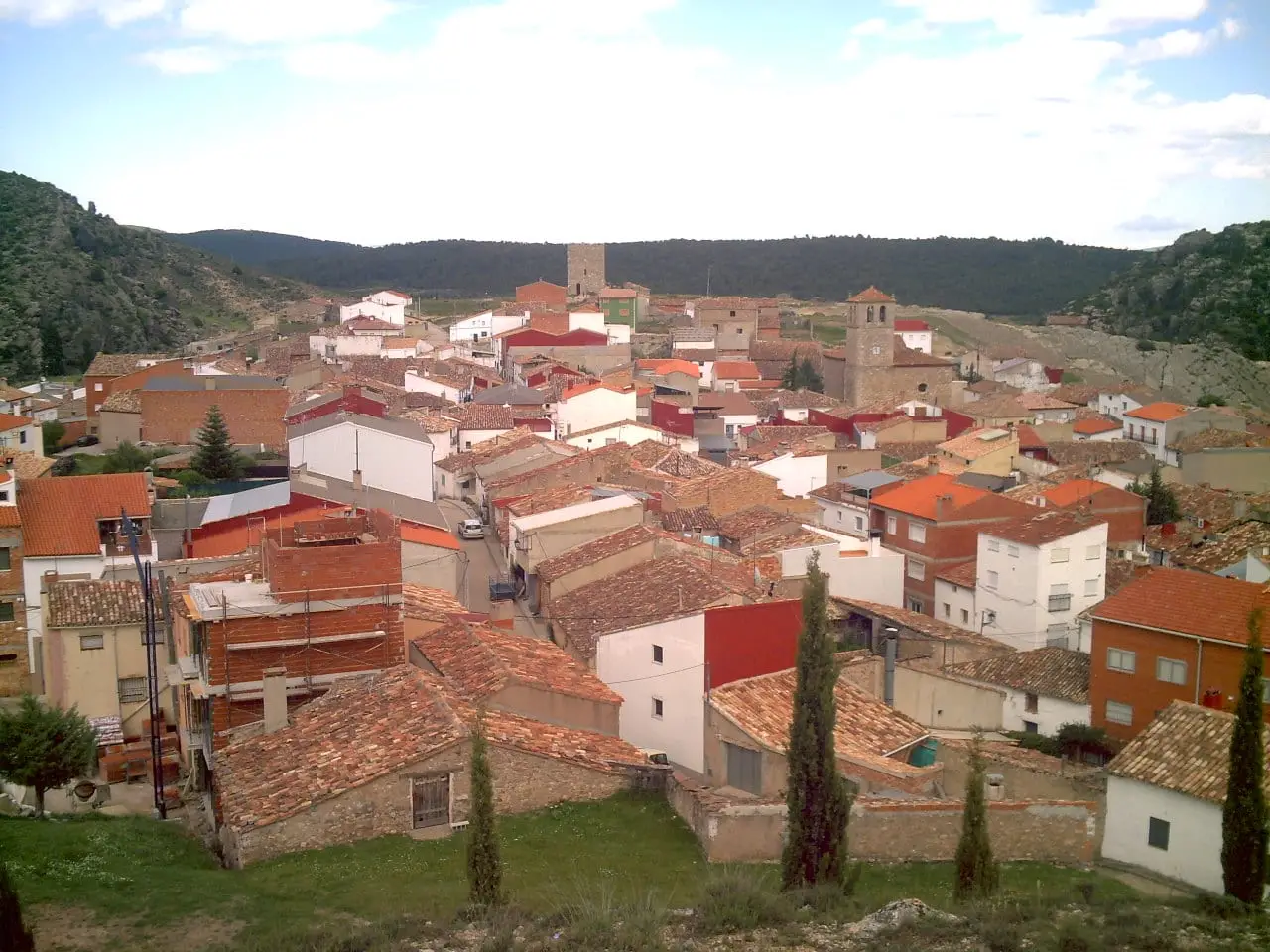
Henarejos lies at the eastern end of the province, in the Serranía Baja (lower Serranía), within the Valle del Cabriel Biosphere Reserve. It was part of the old Land of Moya. The terrain is rolling pine forest and ravines, with stone houses and narrow streets following the ground.
Paintings in the shelters
The municipality’s ravines hold rock paintings, protected as a Bien de Interés Cultural (Spain’s highest heritage listing).
- Abrigo del Tío Modesto, with Levantine art and a panel of superimposed prehistoric phases. A signposted route starts in the village.
- Abrigo de los Oculados, named for its large-eyed idols. In 2012 the mineral crust covering three figures was dated, and the dates fit the expected period for this kind of idol.
- Others grouped as Henarejos rock art shelters.
The mining valley
Henarejos lived from coal. Mines began working with simple methods in the mid-19th century, and in 1860 the Sociedad Carbonera de Cuenca was formed in Madrid, dreaming of a railway from Aranjuez; in 1868 a company to lay track to the mines was even approved. It never happened. Meanwhile coal travelled by pack animal to La Roda station, 85 kilometres away, and later by carts and lorries to Enguídanos station once the Utiel-Cuenca railway opened. Its peak came in the first two decades of the 20th century, when coal fuelled locomotives, and the post-war years, when the country needed domestic coal.
Then three neighbourhoods grew in the Valle de las Minas, De Abajo, De Arriba and Nuevo, with over 300 permanent residents, mainly young families from nearby villages but also Andalusians and Asturians. There was a school, company shop, oven, bars, washhouse and Guardia Civil barracks. Almost the whole village lived from mining. With oil, from the 1960s coal ceased to pay, the installation was precarious and nobody modernised it: in 1966 the mines closed.
Another version, from a 2023 radio excursion, changes some dates and figures: it puts the start of bituminous coal for steam engines in the late 19th century, speaks of over seven hundred inhabitants in the settlement, says it emptied in the early 1990s and adds new work in 2013 and 2014, denounced by SOS Patrimonio Conquense for destroying part of what remained. It also repeats that Romans extracted silver from the valley, without citing evidence. The versions may concern different things (mine closure, people remaining, later work), but documentation is missing. Today the valley mixes black and grey spoil heaps with red sandstone, maritime pines and coal-washing ponds; the ruins and galleries are not visited.
In 1988 a Henarejos woman told lecturer Pilar Gómez Couso Pedro el valiente, the tale of a woodcutters’ son leaving to discover the world. Her recording forms part of the Universidad de Castilla-La Mancha corpus of children’s popular literature, and the author remembered it for the richness of its characters and episodes.
Plan your visit
Walk through the village and ask the town council how to reach the shelters.
Before you travel
View the paintings without touching or wetting the rock, using flash or stepping on the shelter floor: any contact damages them.
Combine with
Fuentelespino de Moya is 6.3 km away as the crow flies and San Martín de Boniches 7.9. The paintings of Villar del Humo complete the day.
Frequently asked questions
What rock art is there in Henarejos?
The Abrigo del Tío Modesto, with Levantine paintings and superimposed prehistoric phases, and the Abrigo de los Oculados, with eye idols. There are other shelters in the municipality too.
Has the Abrigo de los Oculados been dated?
Yes. A 2012 article presents two AMS radiocarbon dates on calcium oxalate associated with three eye-idol pictographs; the abstract says the ages agree with the expected archaeological chronology.
Are they protected?
As rock paintings they are Bien de Interés Cultural under article 40.2 of Law 16/1985. This is general protection by operation of law, not an individual designation for each shelter.
Carry on from here
The rivers, zones, eras, places and official routes that the atlas links with Henarejos.
Lands and landscapes
From here, follow the memory of the land
These readings connect Henarejos with the stories, the work and the villages around it.
Traces in the village and around it
Which eras you can read here
A single place can keep traces of several periods. These layers connect what you see with the atlas's stories.
Places in the municipality and around it
Near Henarejos

Fuente del Royo picnic area
Huerta del Marquesado
Prao de San Roque picnic area
Huerta del MarquesadoPaisaje Ilustrado of Huerta del Marquesado
Huerta del MarquesadoSee 5 more

Las Hoyas
La Cierva
Fuente de la Ardilla picnic area
ValdemecaPaisaje Ilustrado of Valdemeca
Valdemeca
Valdemeca Visitor Reception Centre
Valdemeca
Beamud viewpoint
BeamudPopulation of Henarejos, 1842–2021
Henarejos reached 1,396 inhabitants in 1950. The 2021 census counted 137, 90 % fewer. It is the story told in the emptying.
Climate in Henarejos month by month
Averages for the ten years from 2015 to 2024 from the ERA5 reanalysis (Copernicus), for a grid cell with a reference altitude of 1077 m. They are model estimates, not measurements from a local station or thirty-year climate normals.
Source: Copernicus ERA5 via Open-Meteo, CC BY 4.0. Retrieved: 2026-10-09.
Location
● Reference point · ● Villages · ● Places
Location sketch. The map with paths and names loads as you scroll to it.
Approximate position: village centre.
Reference villages: Fuentelespino de Moya · San Martín de Boniches · Garaballa · Landete.
Open the full map and its historical layers →Where the data on this page come from
- Location
- IGN: Nomenclátor Geográfico Básico de España, capital de municipio (CC BY 4.0) source consulted, 9 October 2026
- Municipality (INE code)
- Turismo de Castilla-La Mancha source consulted, 4 October 2026
- Name
- Turismo de Castilla-La Mancha source consulted, 4 October 2026
«Source consulted»: the primary source has been read. «Reference located»: the source has been identified but not yet read. «Open question»: the figure needs confirmation.
More about Henarejos, told from the village: Henarejos Town Council website.