Village · Cuenca
Fuentelespino de Moya
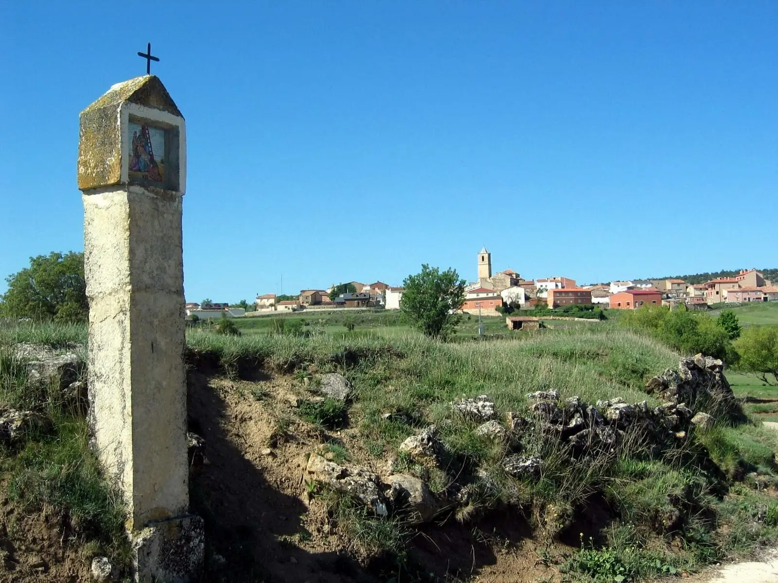
Fuentelespino de Moya is a village in the Serranía Baja (lower Serranía) of Cuenca, in the old lordship of Moya and within the Valle del Cabriel Biosphere Reserve. Its municipality contains El Toril, a small walled Iron Age settlement with two ditches. It had 854 inhabitants in 1910 and 102 in 2021.
On this page 11 sections
A village of Moya’s lands
Fuentelespino de Moya lies in the Serranía Baja, in the old Land of Moya, as its name says, within the Valle del Cabriel Biosphere Reserve. It is a village of cold plateau.
What trades and memory tell
Within the municipality is El Toril, a small fortified Later Iron Age settlement with a walled enclosure of about 1,500 m². Two parallel ditches close the easiest side to attack, the first cut in rock, between 3 and 6 metres wide. There are also Bronze Age and Islamic remains. It is known from surface evidence and has not been excavated.
The tower of three stonemasons
The church tower was begun on 1 April 1892 with a budget of 70,000 reales and 1,000 pesetas in hand, collected by the 180 households. It took four years to finish. The first stonemason, Manuel Boch, who had built Casas Altas’ tower, raised it to the church eaves and died suddenly in Narboneta. The second, Vicente Villaplana from Landete, raised it to the last cornice and died of pneumonia, almost suddenly, in Landete. The third, Dionisio Villanueva from Henarejos, put on the roof and died shortly after finishing it. Stone came from municipal quarries such as Los Barrancos or La Porteruela; lime from kilns such as Corral del Moreno; timber from the village pine forests.
At the end priest and mayor clashed over the top: the mayor wanted a worthy spire; the priest wanted to finish quickly because villagers were tired of compulsory unpaid work on it. He had the scaffolding dismantled on his own authority and its wood lit celebration bonfires. The tower was left with a pyramidal zinc top that does not quite fit the stone and was inaugurated on 14 September 1896, during the Santísimo Cristo del Amparo festivities.
Ánimas and Holy Innocents
Until the Civil War the village had three brotherhoods: the Santísimo, holding a procession inside the church every third Sunday of the month; the Third Order of St Francis; and the Benditas Ánimas, souls in purgatory, collecting door to door, holding a public auction in the square and a novena for the dead around All Saints’ Day. War swept them away. Early this century the village revived its oldest, most distinctive tradition, the Santos Inocentes, Holy Innocents festival, with its animeros, collectors for the souls, wearing pointed hoods, and in 2024 some still collected for the souls in purgatory. A legend places an enchanted princess in Fuente de los Villares, like the one at Salvacañete. Some still work with willow: baskets for saffron flowers, mushroom gathering or distributing blessed bread at charitable feasts for Santa Quiteria, San Bernabé, San Antonio or San Roque, and two villagers have assembled old-tool collections, one in old straw barns at La Erilla.
The shepherds’ Virgin
According to tradition, the Virgen de la Fuen María appeared in a cave to two shepherds from Fuentelespino. Hence the two villages share the Whit Monday pilgrimage: the image leaves the church of Landete, and at the sanctuary’s entrance arch Fuentelespino villagers receive it to carry it up.
Plan your visit
The village takes a short time to see.
Before you travel
El Toril is in the hills without prepared access: do not touch anything.
Combine with
Henarejos, with its rock paintings, is 6.3 km away as the crow flies, and Landete about 9.
Frequently asked questions
What is El Toril?
A small Later Iron Age hillfort with a walled enclosure of about 1,500 m² and two parallel ditches on the most accessible side. According to Lorrio, there are also materials from the Middle Bronze Age and Islamic period.
How many people live in Fuentelespino de Moya?
102 in the 2021 census. The peak was 854 in 1910, according to the INE.
Carry on from here
The rivers, zones, eras, places and official routes that the atlas links with Fuentelespino de Moya.
Lands and landscapes
From here, follow the memory of the land
These readings connect Fuentelespino de Moya with the stories, the work and the villages around it.
Near Fuentelespino de Moya

Fuente del Royo picnic area
Huerta del Marquesado
Prao de San Roque picnic area
Huerta del MarquesadoPaisaje Ilustrado of Huerta del Marquesado
Huerta del MarquesadoSee 5 more

Las Hoyas
La Cierva
Fuente de la Ardilla picnic area
ValdemecaPaisaje Ilustrado of Valdemeca
Valdemeca
Valdemeca Visitor Reception Centre
Valdemeca
Centenar viewpoint
ValdemecaPopulation of Fuentelespino de Moya, 1842–2021
Fuentelespino de Moya reached 854 inhabitants in 1910. The 2021 census counted 102, 88 % fewer. It is the story told in the emptying.
Climate in Fuentelespino de Moya month by month
Averages for the ten years from 2015 to 2024 from the ERA5 reanalysis (Copernicus), for a grid cell with a reference altitude of 1102 m. They are model estimates, not measurements from a local station or thirty-year climate normals.
Source: Copernicus ERA5 via Open-Meteo, CC BY 4.0. Retrieved: 2026-10-09.
Location
● Reference point · ● Villages · ● Places
Location sketch. The map with paths and names loads as you scroll to it.
Approximate position: village centre.
Reference villages: Henarejos · Campillos-Paravientos · Landete · San Martín de Boniches.
Open the full map and its historical layers →Where the data on this page come from
- Location
- IGN: Nomenclátor Geográfico Básico de España, capital de municipio (CC BY 4.0) source consulted, 9 October 2026
«Source consulted»: the primary source has been read. «Reference located»: the source has been identified but not yet read. «Open question»: the figure needs confirmation.