Village · Cuenca
Garaballa
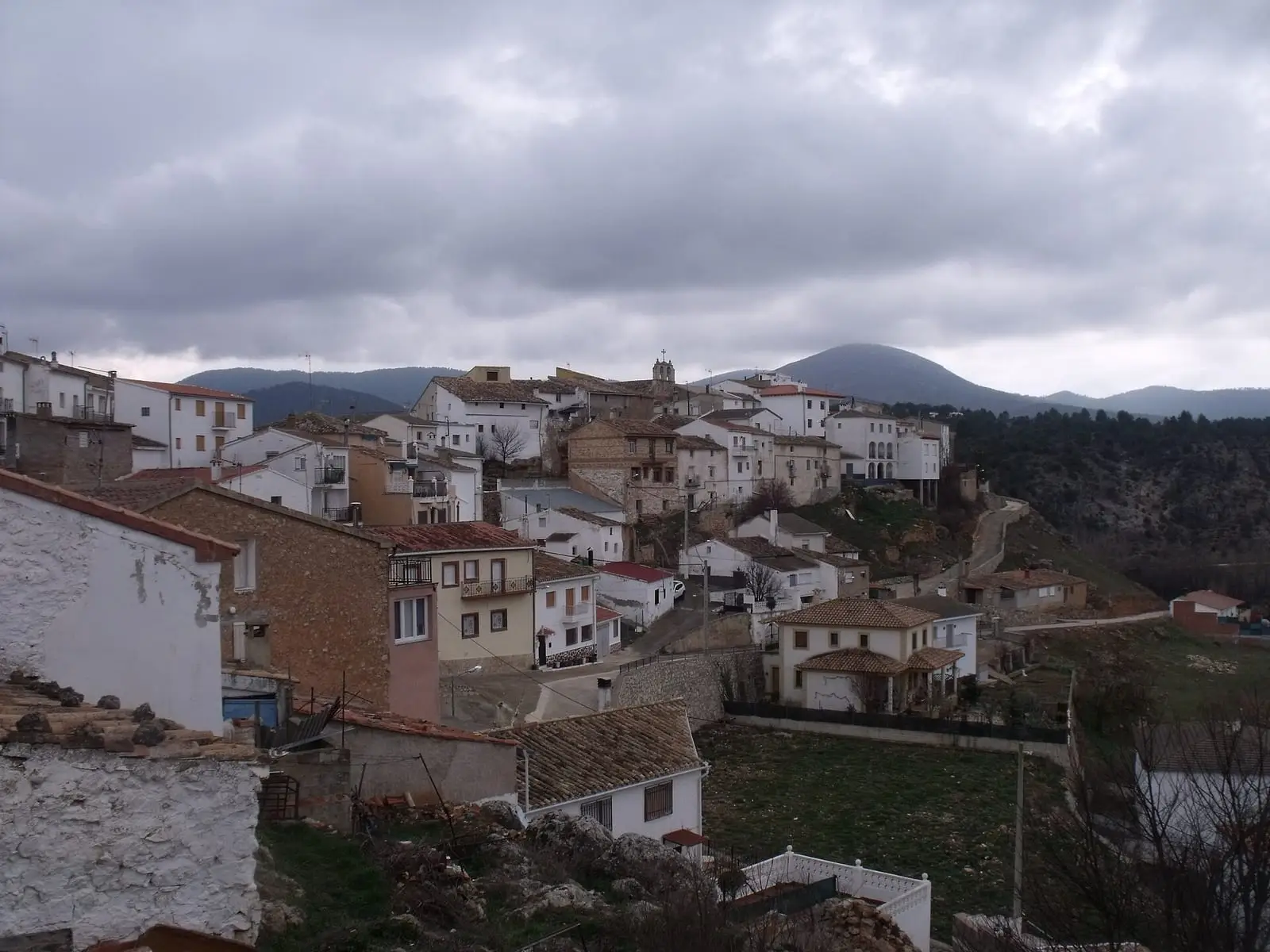
Garaballa is a village in the Serranía Baja (lower Serranía) of Cuenca, in the Valle del Cabriel Biosphere Reserve, with a mining past documented at Santa Filomena's silver-bearing grey-copper mine and several Iberian hillside settlements. It had 830 inhabitants in 1940 and 65 in 2021.
On this page 9 sections
A large municipality in the east
Garaballa lies in the Serranía Baja, on the province’s eastern edge, within the Valle del Cabriel Biosphere Reserve. Its municipality, about 72 km², borders Narboneta, Talayuelas, Mira, Aliaguilla, Henarejos and Landete.
Tejeda: a yew, a caiman and a paper mill
Garaballa municipality contains the valley of Tejeda la Vieja, where, according to tradition, the Virgin appeared to a shepherd, Juan, in a yew. Yews gave it its name: «el llamarse Tejeda es por los tejos que allí cerca estaban» (it is called Tejeda for the yews that stood nearby), wrote Friar Ponce de León in 1663. Even then only three remained at the cave’s foot, and devotees took branches as relics; in 1995 one remained, clinging to the castle rocks above a river bend. The valley still shows the Arab castle ruins, the Cueva Santa, the first place of worship, and the site of the first convent, where Pedro de Bobadilla, eldest son of the Marquises of Moya, was buried. The image is now in the Tejeda monastery and every seven years goes up to Moya in procession: the Septenario.
The Trinitarian friars of the new convent built a paper mill in the valley, operating from December 1756. It made estraza, estrazilla and florete papers, sold in Castile and Valencia, each sheet showing the Trinitarian Order’s cross against the light, the same cross carved on the cloister vaults. The sale of confiscated property put it up for auction, and its ruins remain.
A stuffed caiman, the «hardacho de Tejeda» (Tejeda lizard), hung in the sanctuary, watched fearfully by children at pilgrimages. According to the tradition recorded by Friar Ponce, a Moya soldier, Juan Montero, brought it from Peru: encountering it in the countryside with only a sword, he fought it for five hours commending himself to the Virgen de Tejeda, killed, skinned and salted it. It disappeared during the Civil War in 1936. Hardacho, the word for lizard in Moya’s lands, comes from Arabic.
What trades and memory tell
In the 19th century, when concessions were liberalised, the Serranía Baja filled with mines and trial pits. Garaballa had the Santa Filomena mine, silver-bearing grey copper belonging to a Cuenca company. In 1867 it had traces of old workings and had been idle for a year.
Small Iberian settlements with hardly any wall remains have been identified by surface survey on the municipality’s slopes: La Veguilla, with slag; Las Ramblas I and II; Peña el Rubial; El Hornillo and Rento de Henares, with flint and metal slag. None has been excavated. The Cerro Viejo entry gathers them with the rest of the basin.
Plan your visit
Garaballa is a stop on a day through the eastern Serranía Baja.
Before you travel
Old mines have shafts and galleries: do not enter. The settlements are in the hills, unprepared for visitors.
Combine with
Talayuelas, with its lake and mines, is 8.8 km away as the crow flies, and Aliaguilla 9.3.
Frequently asked questions
What is the Santa Filomena mine?
A silver-bearing grey-copper mine described by the Estadística Minera of 1867 as belonging to a Cuenca-based company in the Garaballa and Talayuelas mining district, with undated traces of old workings and operations halted the previous year.
What ancient remains are there in Garaballa?
Several Iberian hillside or hilltop settlements recorded by Esther Marín Rubio's survey: La Veguilla, Las Ramblas I and II, Peña el Rubial, El Hornillo and Rento de Henares.
Carry on from here
The rivers, zones, eras, places and official routes that the atlas links with Garaballa.
Lands and landscapes
From here, follow the memory of the land
These readings connect Garaballa with the stories, the work and the villages around it.
Traces in the village and around it
Which eras you can read here
A single place can keep traces of several periods. These layers connect what you see with the atlas's stories.
Places in the municipality and around it
Near Garaballa

Fuente del Royo picnic area
Huerta del Marquesado
Prao de San Roque picnic area
Huerta del MarquesadoPaisaje Ilustrado of Huerta del Marquesado
Huerta del MarquesadoSee 5 more

Las Hoyas
La Cierva
Fuente de la Ardilla picnic area
ValdemecaPaisaje Ilustrado of Valdemeca
Valdemeca
Valdemeca Visitor Reception Centre
Valdemeca
Beamud viewpoint
BeamudPopulation of Garaballa, 1842–2021
Garaballa reached 830 inhabitants in 1940. The 2021 census counted 65, 92 % fewer. It is the story told in the emptying.
Climate in Garaballa month by month
Averages for the ten years from 2015 to 2024 from the ERA5 reanalysis (Copernicus), for a grid cell with a reference altitude of 941 m. They are model estimates, not measurements from a local station or thirty-year climate normals.
Source: Copernicus ERA5 via Open-Meteo, CC BY 4.0. Retrieved: 2026-10-09.
Location
● Reference point · ● Villages · ● Places · ━ Routes nearby
Location sketch. The map with paths and names loads as you scroll to it.
Approximate position: village centre.
Reference villages: Talayuelas · Aliaguilla · Landete · Henarejos.
Open the full map and its historical layers →Where the data on this page come from
- Location
- IGN: Nomenclátor Geográfico Básico de España, capital de municipio (CC BY 4.0) source consulted, 9 October 2026
«Source consulted»: the primary source has been read. «Reference located»: the source has been identified but not yet read. «Open question»: the figure needs confirmation.