Village · Cuenca
San Martín de Boniches
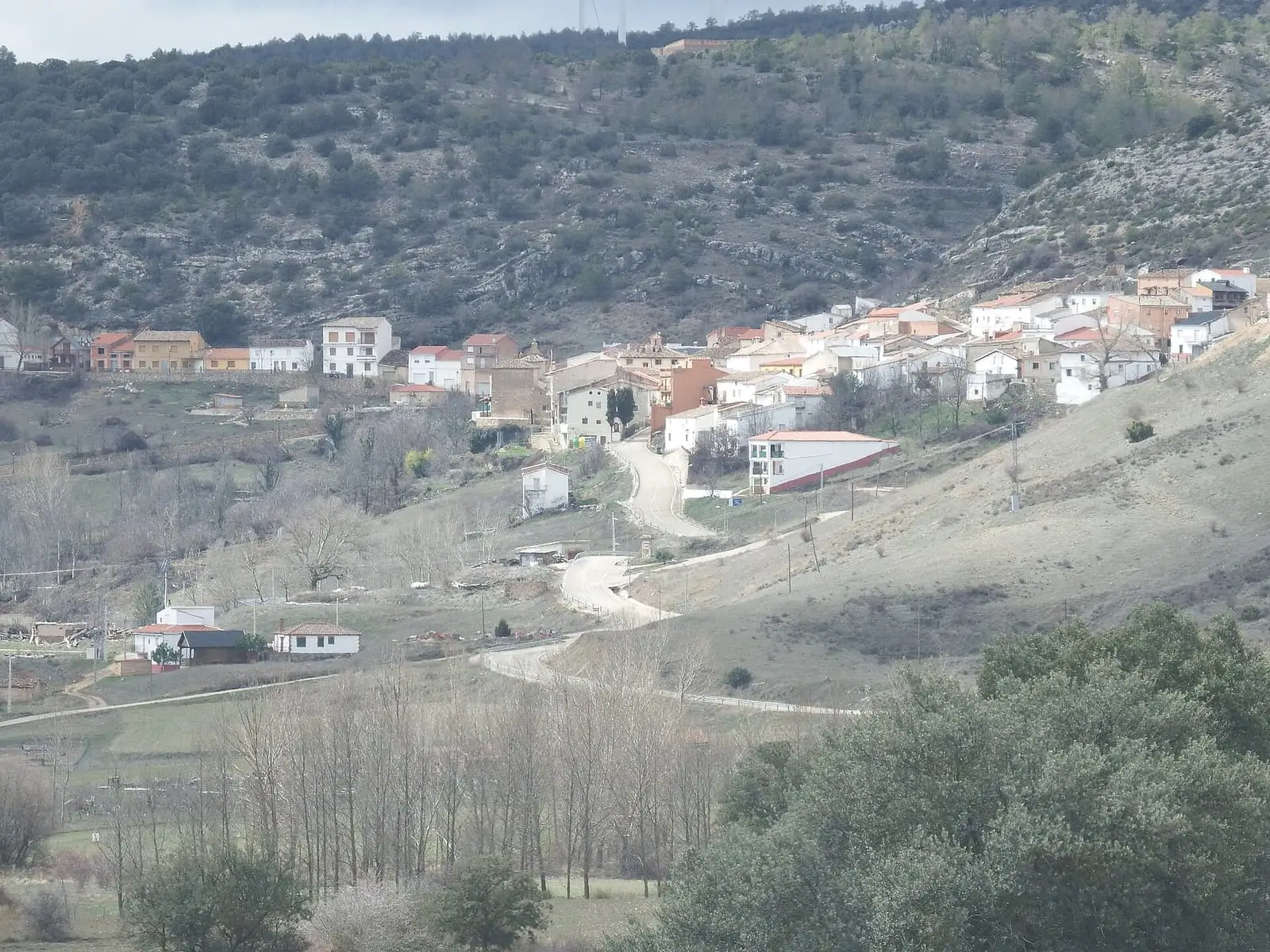
San Martín de Boniches is a village in Serranía Baja (lower Serranía), in the Valle del Cabriel Biosphere Reserve, less than 5 km from Villar del Humo. Its residents recall a life of farming, livestock and resin. In September 1946 it was seized by the guerrilla «Capitán» (Captain). It had 540 inhabitants in 1940 and 45 in 2021.
On this page 10 sections
A village in Serranía Baja
San Martín de Boniches lies in Serranía Baja (lower Serranía), within the Valle del Cabriel Biosphere Reserve, very close to Villar del Humo.
What trades and memory tell
In a Vestal Etnografía interview, villagers recall a life of farming, livestock and resin, and describe how streets and work changed as the village emptied. More than three hundred people left between 1960 and 1970.
On 19 September 1946 the guerrilla group of «Capitán» (Captain) seized the village: it gathered officials and villagers, held a rally, distributed propaganda and took goods and a shotgun. Nine days later, following a tip-off, the Civil Guard attacked its Cabeza del Royo camp. Miguel Pérez Lloria, «Peluquilla» (Little Wig), died and a warrant officer was wounded. The story is told in The guerrilla in the Serranía.
From grain to bread
San Martín had two mills on the river: the upper mill, at La Masegosa, already recorded in the Ensenada Cadastre and milling until the early 1970s, and the lower mill, which closed in 1960. A channel carried water to a pond, and emptying it drove the stones; gardeners downstream waited for that moment to irrigate with the outflow. Millers collected wheat from houses with pack animals and charged the maquila, a milling payment: one kilo of wheat per almud. Around the square, beside the washhouse, there were at least three bread ovens in the first half of the 20th century. Women brought dough made at home, and the baker, man or woman, baked it and took the poya, a piece of dough, as payment. Bread was baked for about fifteen days and kept wrapped in cloths. In 2024 villagers waited for the bread van in that same square.
The woodland supplied maritime-pine resin, sent to the factories of Garaballa and El Cañizar, and charcoal from heather roots and holm oak, sold in Víllora and Utiel. At the municipality’s southern tip, about two hours away on foot, was La Manglana, a hamlet of livestock-keeping families with some farming, deserted in the 1970s.
Resin workers in Algeria
In the early 20th century several families from San Martín de Boniches went to Algeria to tap pines for resin: El Liberal mentioned them in 1912, and some of their children were born in Bossuet, in Oran province. Almost all returned. Behind this lay the forests: the village had six communal pine woods and lost them in litigation with the House of Moya; a Supreme Court ruling, dated by El Sol accounts sometimes to 1912 and sometimes to 1919, awarded the hundred hectares to the marquises. The owner was then the former empress Eugenia de Montijo. Villagers went to Madrid to ask her to return three of the six estates; the administrator sent the request to London, and the empress died without replying. It is told alongside other woodland disputes in The common woodland.
In November 1924 the case reached the Madrid press. There was no harvest, a storm had carried away the potatoes, and the village received an offer of work in Algeria: according to El Sol, of 115 householders, 80 families were to leave. Rodolfo Llopis wrote that the village was leaving because it was being driven out by «el hambre» (hunger) and «la injusticia social» (social injustice). Local researcher Elena Ruiz Pérez, author of San Martín de Boniches: historia, costumbres y testimonios, has brought the material together.
The guerrillas’ woodland
The municipality, deeply cut and wooded, with places such as La Manglana, El Royo, La Rebollosa, El Molatón and El Bercoloso, sheltered the Agrupación Guerrillera de Levante y Aragón. After Cabeza del Royo, the guerrillas moved south within the municipality, to the now-ruined houses of La Manglana, joined by landless shepherds and resin tappers who knew the woods. Between 1947 and 1949 they blew up railway tracks in Cardenete, Monteagudo and Salinas del Manzano. In the Cabeza Mediana cave, village researchers say, the names of three women guerrillas remained carved; one was from Mohorte and called herself «Celia» (her adopted name).
The guerrillas ate what their local supporters, almost all relatives, passed to them: one house cooked for them, and someone carried provisions into the woods. In autumn 1949, after a Civil Guard corporal’s death and a guerrilla’s arrest, searches for contacts began, and a dozen villagers took to the hills. Civil governor Gabriel Juliá Andreu came in person to ask the families to surrender. A week later, on 7 November, five of those villagers died at Cerro Moreno, in Santa Cruz de Moya. On 29 April 1950, at La Rebollosa, «Felipe» (his guerrilla name) killed two guards and was wounded; he died in the Carboneras barracks. In 1951 the Civil Guard post opened in the village to end the guerrilla campaign was closed.
Ethnographer Eduardo Bollo of Vestal Etnografía, who worked with two villagers on the village study, attributes the 1946 seizure to «Paisano» (Countryman) and notes that other texts say «Capitán» (Captain): both versions are retained. Among the memories he recorded is one of the economy then: a wheat field harvested beside the river, the sheaves counted and, on returning days later to take them to the threshing floor, eleven missing. No one saw who took them.
Plan your visit
The village takes little time to explore and can be combined with Villar del Humo.
Before you travel
The Cabeza del Royo camp cannot be visited: there is no marked access.
Combine with
Villar del Humo, with its rock paintings, is 4.9 km away in a straight line, and Henarejos 7.9 km.
Frequently asked questions
How did San Martín de Boniches make its living?
According to its residents' testimony, from farming, livestock and resin extraction. This is oral memory, not a census of trades.
What happened in September 1946?
The University of Castilla-La Mancha's Memoria Democrática attributes the seizure of the village on 19 September 1946 to the group of «Capitán» (Captain): it gathered officials and villagers, held a rally and spread propaganda. On the 28th the Civil Guard attacked its Cabeza del Royo camp; Miguel Pérez Lloria, «Peluquilla» (Little Wig), died and warrant officer Federico Alastuy Lanas was wounded.
How many inhabitants does San Martín de Boniches have?
45 in the 2021 census. Its peak was 540 in 1940, according to the INE.
Carry on from here
The rivers, zones, eras, places and official routes that the atlas links with San Martín de Boniches.
Lands and landscapes
From here, follow the memory of the land
These readings connect San Martín de Boniches with the stories, the work and the villages around it.
War and guerrilla · memory of the land
The war in the village's memory
On 19 September 1946 the guerrilla group of «Capitán» took the village, gathered the residents and held a rally. Nine days later the Guardia Civil attacked their camp at Cabeza del Royo, and Miguel Pérez Lloria, «Peluquilla», was killed.
Source: Memoria Democrática de Castilla-La Mancha (UCLM).
Read the story of the guerrilla →Near San Martín de Boniches

Fuente del Royo picnic area
Huerta del Marquesado
Prao de San Roque picnic area
Huerta del Marquesado
Las Hoyas
La CiervaSee 5 more
Paisaje Ilustrado of Huerta del Marquesado
Huerta del Marquesado
Fuente de la Ardilla picnic area
Valdemeca
Beamud viewpoint
Beamud
Fuente de los Pastores picnic area
BeamudPaisaje Ilustrado of Valdemeca
ValdemecaPopulation of San Martín de Boniches, 1842–2021
San Martín de Boniches reached 540 inhabitants in 1940. The 2021 census counted 45, 92 % fewer. It is the story told in the emptying.
Location
● Reference point · ● Villages · ● Places · ━ Routes nearby
Location sketch. The map with paths and names loads as you scroll to it.
Approximate position: village centre.
Reference villages: Villar del Humo · Henarejos · Fuentelespino de Moya · Campillos-Paravientos.
Open the full map and its historical layers →Where the data on this page come from
- Location
- IGN: Nomenclátor Geográfico Básico de España, capital de municipio (CC BY 4.0) source consulted, 9 October 2026
«Source consulted»: the primary source has been read. «Reference located»: the source has been identified but not yet read. «Open question»: the figure needs confirmation.