Village · Cuenca
Monteagudo de las Salinas
Monteagudo de las Salinas is a village in Serranía Media (middle Serranía), at around 1,000 m, with a medieval castle above its houses and a specific link to Santiago pilgrimage: in spring 1624 Francisco Patiño, María de Francis and Sebastián de la Huerta left here for Santiago, and tradition places the start of the Camino de la Lana here. It had 640 inhabitants in 1940 and 122 in 2021.
On this page 9 sections
A village on high ground
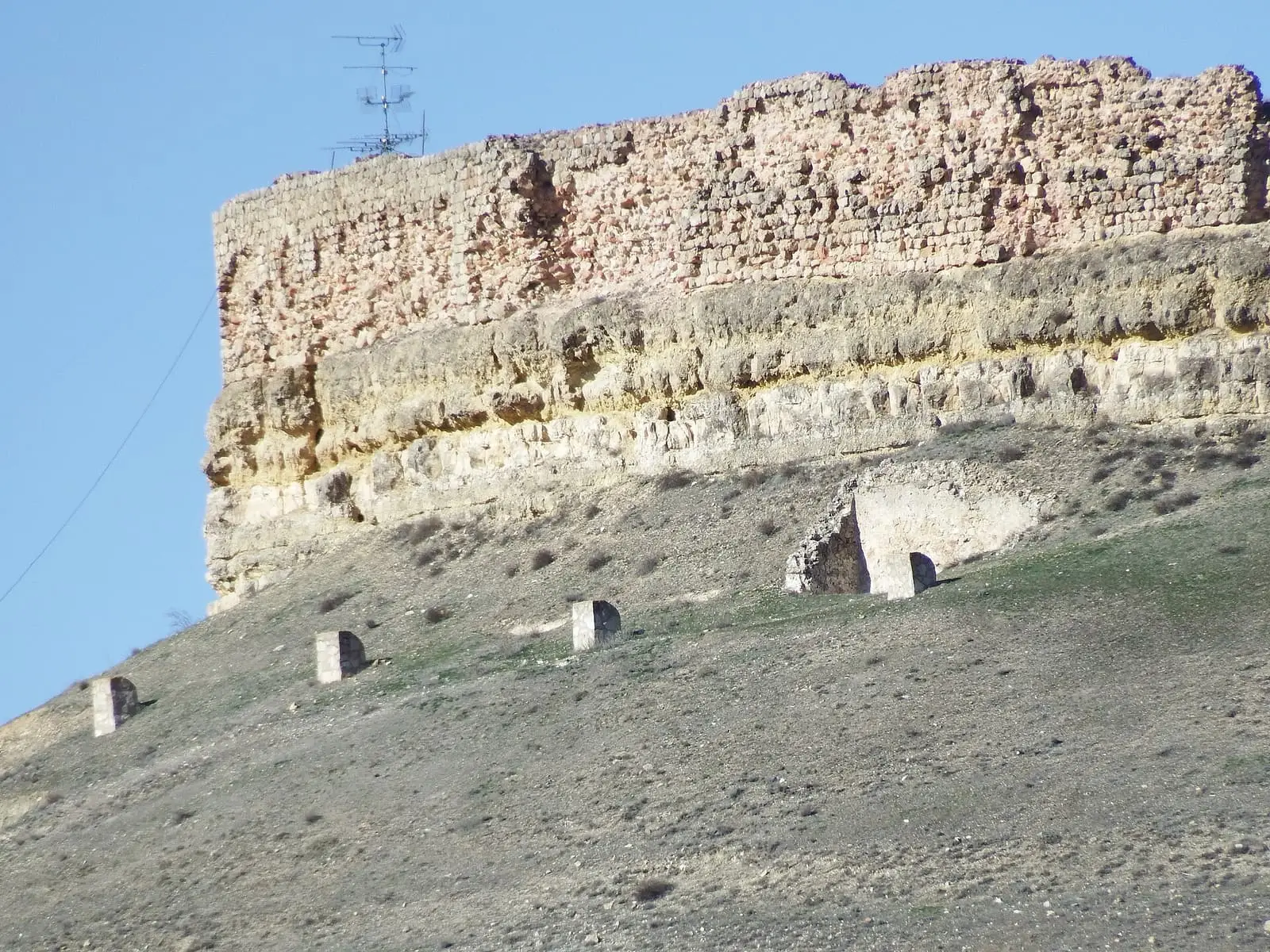
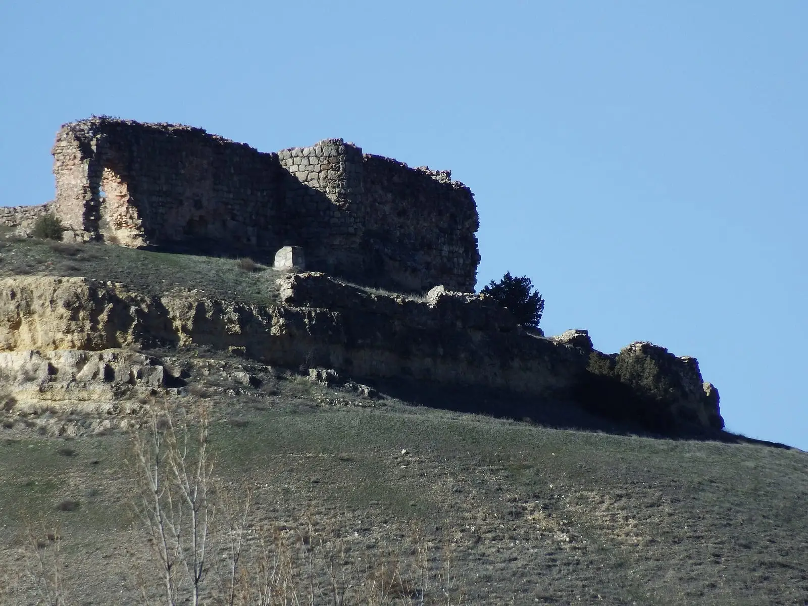
Monteagudo de las Salinas lies in Serranía Media (middle Serranía), at around 1,000 metres. Its stone houses climb towards the castle, a medieval fortress that formed part of the territory’s defences after the conquest of Cuenca and overlooks the surrounding land. The municipality mixes Mediterranean woodland, pine forest and farmland. The second part of its name recalls the salt extracted here. Until 1916 the village was called simply Monteagudo.
What trades and memory tell
In spring 1624, Francisco Patiño, María de Francis and Sebastián de la Huerta left Monteagudo for Santiago de Compostela to fulfil a vow. Their route is unknown, but because of them the Camino de la Lana to Santiago starts here. It continues to Burgos, joining the Camino Francés, along the old route by which wool from the Alcarria and cloth from Cuenca travelled to the Medina fairs and the Burgos merchants’ consulate.
The municipality’s boundaries changed several times: in the 19th century it included Yémeda, and in the 1980s it was joined to Almodóvar de Monte Rey.
The king’s salt
Monteagudo’s saltworks used brine from wells and belonged to the Crown. In 1253, Alfonso X recalled in a lead-sealed charter that only salt from Monteagudo and Tragacete could be sold in the lands of Huete and Cuenca, and that anyone bringing in Beteta salt risked arrest and seizure of everything they carried. Part of the income passed to the Church: in 1297 Bishop Gonzalo Díaz Palomeque granted the cathedral chapter 500 maravedís from it, and in 1339 Alfonso XI ordered the master of Calatrava to pay the bishop and chapter 1,200 maravedís annually. In 1384 the royal court ruled on the chapter’s case against Abraham Buhardo, a Jew from Cuenca leasing the royal saltworks of Fuentelmanzano and Monteagudo, because he had failed to deliver the salt owed for six years. In the Ensenada Cadastre of 1752 the village still declared brine saltworks «que pertenecen a Su Majestad» (belonging to His Majesty). Salt throughout the mountains is covered in The salt of the Serranía.
The saltworks’ remains lie about two kilometres from the village: almost a hundred evaporation pans, channels (without iron, to prevent rust, according to the account), a small building at the spring mouth and a rectangular store with a timber roof dated to the 17th and 18th centuries. In 2021 water still ran through some channels. The path up to the castle had then been repaired, with a railing and benches, and the courtyard cistern protected by a grille.
Plan your visit
Allow a morning to explore the village, climbing through the old centre to the castle. If you are walking the Camino de la Lana, this is its starting point.
Before you travel
Ask the town hall whether the castle can be entered. Bring warm clothing: at this altitude it turns cool even in summer.
Combine with
Arguisuelas is 7.5 km away in a straight line and Reíllo 11.5 km.
Frequently asked questions
Why is it called de las Salinas?
The place name recalls its connection with salt production. Until the municipal naming reform of 1916 it was called simply Monteagudo.
How is it connected with the Camino de la Lana?
Traditionally the Camino de la Lana began here and ended in Burgos, joining the Camino Francés. The choice is linked to the 1624 pilgrimage of Francisco Patiño, María de Francis and Sebastián de la Huerta, who left Monteagudo to fulfil a vow.
How many inhabitants does it have?
122 in the 2021 census. Its peak was 640 in 1940, according to the INE.
Carry on from here
The rivers, zones, eras, places and official routes that the atlas links with Monteagudo de las Salinas.
Lands and landscapes
From here, follow the memory of the land
These readings connect Monteagudo de las Salinas with the stories, the work and the villages around it.
Places in the municipality and around it
Near Monteagudo de las Salinas

Las Hoyas
La Cierva
Fuente del Royo picnic area
Huerta del Marquesado
Prao de San Roque picnic area
Huerta del MarquesadoSee 5 more
Paisaje Ilustrado of Huerta del Marquesado
Huerta del Marquesado
Beamud viewpoint
Beamud
Fuente de los Pastores picnic area
Beamud
Fuente de la Ardilla picnic area
Valdemeca
Fuente del Arenazo picnic area
CuencaPopulation of Monteagudo de las Salinas, 1842–2021
Monteagudo de las Salinas reached 640 inhabitants in 1940. The 2021 census counted 122, 81 % fewer. It is the story told in the emptying.
Climate in Monteagudo de las Salinas month by month
Averages for the ten years from 2015 to 2024 from the ERA5 reanalysis (Copernicus), for a grid cell with a reference altitude of 1011 m. They are model estimates, not measurements from a local station or thirty-year climate normals.
Source: Copernicus ERA5 via Open-Meteo, CC BY 4.0. Retrieved: 2026-10-09.
Location
● Reference point · ● Villages · ● Places
Location sketch. The map with paths and names loads as you scroll to it.
Approximate position: village centre.
Reference villages: Arguisuelas · Reíllo · Carboneras de Guadazaón · Yémeda.
Open the full map and its historical layers →Where the data on this page come from
- Location
- IGN: Nomenclátor Geográfico Básico de España, capital de municipio (CC BY 4.0) source consulted, 9 October 2026
«Source consulted»: the primary source has been read. «Reference located»: the source has been identified but not yet read. «Open question»: the figure needs confirmation.