Village · Cuenca
Reíllo
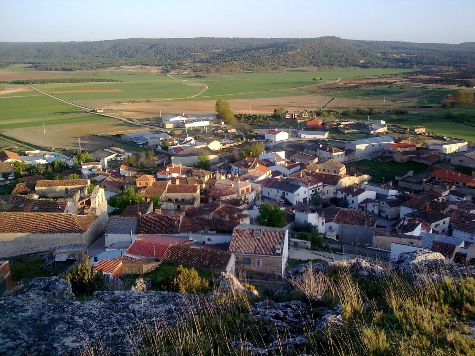
Reíllo is a village in Serranía Baja (lower Serranía), on lands once belonging to the lordship of Moya. It has a parish archive inventoried by the Ministry of Culture, a coat of arms with a castle and fleurs-de-lis examined by the Royal Academy of History in 2022, and stick dances at its festivals. It had 650 inhabitants in 1920 and 111 in 2021.
On this page 9 sections
A village of the Moya lands
Reíllo lies in Serranía Baja (lower Serranía), near Carboneras de Guadazaón, and belonged to the lordship of Moya. According to one hypothesis, the natural route from the Júcar to the Cabriel passed through its municipality, as through Pajarón, Cañete and Moya, bringing pottery and fashions from eastern Spain to the mountains. The parish is Nuestra Señora de la Concepción.
What trades and memory tell
Festivities follow the year: Candlemas, San Blas and Carnival, with paloteos, a stick dance accompanied by verses.
The coat of arms proposed by the town council, reported on by the Royal Academy of History in June 2022, is green, with a silver castle for the Dehesa de la Torre and three gold fleurs-de-lis for the former dependence on Moya.
A pledge from 1688
On the second Sunday in May, the village goes in procession with its image to Carboneras de Guadazaón. This is Domingo de Procesiones, Processions Sunday, dating from 1688, when Carboneras, Arguisuelas, Reíllo, Pajarón and Pajaroncillo signed deeds pledging forever to honour the Santa Hijuela, a relic entrusted by the Marchioness of Moya to the Dominicans of Carboneras convent, and to attend its procession with their saints. The mayors renewed the deeds around 2023, and La Cierva and Villar del Humo have since joined.
The lord who wrote La Mosquea
José de Villaviciosa (1589–1658), lord of Reillo, wrote La Mosquea in his youth, a mock epic about the war between flies and ants, printed in Cuenca in 1615, twenty years before Lope de Vega’s La Gatomaquia, with which it is often compared. It was reprinted in Madrid in 1732 and 1777. Among the insect battles, the poem celebrates the Moscas river, which rises nearby in Fuentes.
Plan your visit
Reíllo takes little time to see, as a stop on a day through Serranía Baja.
Before you travel
Ask the town hall when the church opens.
Combine with
Carboneras de Guadazaón is 5.2 km away in a straight line and Cañada del Hoyo, with its lakes, 7.6 km.
Frequently asked questions
What are Reíllo's paloteos?
A traditional dance accompanied by verses, forming part of the village festivals. López Requena's study, published by Cuenca Provincial Council in 1989, describes it alongside Candlemas, San Blas and Carnival.
What does Reíllo's coat of arms show?
According to the Royal Academy of History's report of 3 June 2022 on the municipal proposal, a green field with a silver castle and three gold fleurs-de-lis. The castle refers to the Dehesa de la Torre and the fleurs-de-lis to its historical dependence on Moya.
How many inhabitants does Reíllo have?
111 in the 2021 census. Its peak was 650 in 1920, according to the INE.
Carry on from here
The rivers, zones, eras, places and official routes that the atlas links with Reíllo.
Lands and landscapes
From here, follow the memory of the land
These readings connect Reíllo with the stories, the work and the villages around it.
Near Reíllo

Las Hoyas
La Cierva
Fuente del Royo picnic area
Huerta del Marquesado
Prao de San Roque picnic area
Huerta del MarquesadoSee 5 more
Paisaje Ilustrado of Huerta del Marquesado
Huerta del Marquesado
Beamud viewpoint
Beamud
Fuente de los Pastores picnic area
Beamud
Fuente de la Ardilla picnic area
Valdemeca
Fuente del Arenazo picnic area
CuencaPopulation of Reíllo, 1842–2021
Reíllo reached 650 inhabitants in 1920. The 2021 census counted 111, 83 % fewer. It is the story told in the emptying.
Location
● Reference point · ● Villages · ● Places · ━ Routes nearby
Location sketch. The map with paths and names loads as you scroll to it.
Approximate position: village centre.
Reference villages: Carboneras de Guadazaón · Cañada del Hoyo · Arguisuelas · Pajarón.
Open the full map and its historical layers →Where the data on this page come from
- Location
- IGN: Nomenclátor Geográfico Básico de España, capital de municipio (CC BY 4.0) source consulted, 9 October 2026
«Source consulted»: the primary source has been read. «Reference located»: the source has been identified but not yet read. «Open question»: the figure needs confirmation.