Español

Heritage · Sotorribas

Church of La Asunción, Sotos

The church of La Asunción in Sotos, in the municipality of Sotorribas, dates from the 13th century: a single nave with early Gothic elements, a semicircular apse and a slender square tower with two Albornoz coats of arms. The north wall retains the remains of a round-arched Romanesque doorway with figured capitals, one of the few in the area.
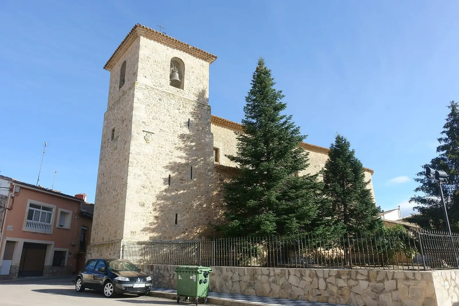
Church of La Asunción in Sotos
The church of La Asunción, in Sotos. Photo: «Iglesia de Nuestra Señora de la Asunción, Sotos», Rodelar (2020) · CC BY-SA 4.0
Municipality
Sotorribas
  • Romanesque
  • Campichuelo
  • Sotos
  • Sotorribas
  • Albornoz

Sotos is one of the villages of Sotorribas, 17 km from Cuenca, at the foot of the Sierra de Bascuñana. Its church dates from the 13th century: a rectangular nave with early Gothic elements, a semicircular apse with round-arched lights and a two-stage square tower with two Albornoz coats of arms. A landscaped forecourt stands in front.

Enter from the south, but look at the north wall: the remains of the old Romanesque doorway survive, with a round arch and figured capitals, something rare in the area’s Romanesque churches.

Plan your visit

It forms part of the Campichuelo Romanesque route. To see inside, ask in the village. Nearby: San Juan in Ribatajada and La Asunción in Torrecilla.

Frequently asked questions

What is distinctive about it?

The remains of its Romanesque doorway in the north wall, with a round arch and figured capitals, one of the few surviving examples in the area.

Carry on from here

Lands and landscapes

From here, follow the memory of the land

These readings connect Church of La Asunción, Sotos with the stories, the work and the villages around it.

Where it is

Location of Church of La Asunción, Sotos Abia de la ObispalíaAlbalate de las NoguerasAlbendeaArandilla del ArroyoArcos de la SierraChillarón de CuencaArrancacepasBascuñana de San PedroBuciegasBuenache de la SierraCanalejas del ArroyoCañamaresCañaverasCañizaresCastejónCastillejo-SierraCastillo-AlbaráñezLa CiervaCuencaFresneda de la SierraLa FronteraFuertescusaGascueñaHuélamoHueteLagunasecaLas MajadasMarianaOlmeda de la CuestaOlmedilla de ElizPalomeraLa PeralejaPineda de GigüelaPortillaPoyatosPriegoSan Pedro PalmichesSanta María del ValTorralbaTorrejoncillo del ReyTragaceteUñaValdeolivasVega del CodornoVillaconejos de TrabaqueVillalba de la SierraVillanueva de GuadamejudVillar de Domingo GarcíaVillar del InfantadoVillarejo de la PeñuelaVillas de la VentosaZarzuelaFuentenava de JábagaLos ValdecolmenasSotorribasVillar y Velasco PNSC-S2: Los CallejonesPR-CU 104: Sendero de la dehesa de los OlmosPR-CU 114: Sendero del Cucurucho y la HocecillaPR-CU 115: Sendero de la DehesaPR-CU 22: Ruta de El Calahorrano y el cerro de la CuevaPR-CU 23: Ruta del Covacho y El CallejónPR-CU 24: Ruta del cerro Calera y Los VallejosPR-CU 26: Ruta de la fuente de la HerreríaPR-CU 27: Ruta del Pado de NavelíarPR-CU 28: Ruta de las Fuentecillas y Los CallejonesPR-CU 30: Ruta del Gollizno y Las CanterasPR-CU 33: Ruta de la Piedra YunquePR-CU 35: Sendero de Los CeñosPR-CU 36: Sendero de la hoz del HuécarPR-CU 41: Sendero de la fuente del GalloPR-CU 42: Ruta del mirador del RodenalPR-CU 43: Ruta de la ribera del Escabas y La CerroyaPR-CU 48: De la Alcarria a la SierraSL-CU 10: Ruta de las Hoces de CuencaSL-CU 11: Ruta de la hoz del Júcar y San JuliánSL-CU 12: Sendero del HocinoSL-CU 13: Sendero del Cañizar Sotorribas
In colour, the municipality. The place does not yet have a verified location, so no point is drawn. Municipal boundaries: © IGN (CC BY 4.0). Route lines: simplified official tracks; source and GPX on each page.
Where the data on this page come from
Name
Municipality (INE code)

«Source consulted»: the primary source has been read. «Reference located»: the source has been identified but not yet read. «Open question»: the figure needs confirmation.