Village · Cuenca
Algarra
Algarra is a village in the Serranía Baja (lower Serranía) of Cuenca, almost on the boundary with Teruel, with a ruined medieval castle above the village and the church of La Asunción. It had 266 inhabitants in 1920 and 24 in 2021. Three Iberian settlements in its municipality have been studied through surface survey.
On this page 10 sections
A stone village on the heights
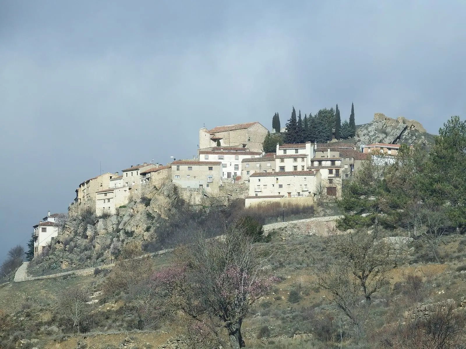
Algarra lies at the eastern end of the province, in the Serranía Baja, almost on the Teruel boundary. It is a mountain village: stone houses and narrow streets following the slope, with pine forests and steep terrain around it. The Turia is nearby, and the mountains of Teruel can be seen from above. Over the village are the remains of the medieval castle, and in its centre the church of La Asunción. Winters are long and cold.
La Peligrosa
The houses cling to a spur of Cerro Santo at about 1,280 metres, shaped like a ship’s keel. Above are the remains of the castle, once called «La Peligrosa» (The Dangerous One); some derive the village’s name from this, though the etymology is unclear. It depended on the marquisate of Moya, hence its other name, «el balcón del Marquesado» (the balcony of the marquisate). Albarracín and Requena coveted its castle; supporters of the Habsburg claimant occupied it in the early 18th century, and in 1873 the Carlist Brigadier Santés, pursued after taking Cuenca, held it for a few days before fleeing towards Chelva.
In 1601 the Inquisition arrested a villager, Miguel Saiz, accused of practising Islam; he was acquitted for lack of evidence. In the post-war years Algarra’s hills were maquis territory.
Ánimas, kaolin and the Virgen de Santerón
In Algarra people ate migas on the night of Ánimas, fried breadcrumbs on the night of the souls in purgatory, and had to make sure some were left: these were used to block the street-door locks so the souls could not enter the house. In the hills remain the settling ponds where kaolin from the old quarry was washed, beside dunes of white sand, and ammonites and belemnites appear in the Barranco del Tamaral.
The municipality contains the hermitage of the Virgen de Santerón, a seated Romanesque carving with the Child on her left knee, beneath a Mudéjar coffered ceiling. Every seven years since 1718, the pilgrimage from Vallanca in the Rincón de Ademuz has come here: people from Castile, Valencia and Aragon at the same celebration, to the sound of the kettledrum and dulzaina, a traditional shawm.
Before the castle: the Iberians
Three unexcavated Iberian-period settlements have been identified through surface survey on the municipality’s hills; the Cerro Viejo entry gathers them with the rest of the basin:
- La Cunázara, on an isolated hill, enclosed by three stretches of wall, perhaps a territorial control post.
- La Borrega, on a hillside.
- Site no. 3, a different hill from the village castle, with medieval remains.
Plan your visit
See Algarra slowly and on foot: the centre and church. The castle is a ruin and the settlements are in the hills, unprepared for visitors.
Before you travel
From November to April frost is almost daily and it may snow. Take warm clothing and ask about road conditions.
Combine with
Casas de Garcimolina is 1.7 km away as the crow flies and Alcalá de la Vega about 8: the three can be linked in a day.
Frequently asked questions
Where is Algarra?
At the eastern end of the province of Cuenca, in the Serranía Baja and almost on the boundary with Teruel, near the Turia.
What ancient remains are there in Algarra?
Besides the medieval castle in the village, archaeological survey records three Iberian settlements in the municipality: La Cunázara, La Borrega and the hill of site no. 3.
Carry on from here
The rivers, zones, eras, places and official routes that the atlas links with Algarra.
Lands and landscapes
From here, follow the memory of the land
These readings connect Algarra with the stories, the work and the villages around it.
Traces in the village and around it
Which eras you can read here
A single place can keep traces of several periods. These layers connect what you see with the atlas's stories.
Places in the municipality and around it
Near Algarra

Fuente del Royo picnic area
Huerta del Marquesado
Prao de San Roque picnic area
Huerta del MarquesadoPaisaje Ilustrado of Huerta del Marquesado
Huerta del MarquesadoSee 5 more

Fuente de la Ardilla picnic area
Valdemeca
Las Hoyas
La CiervaPaisaje Ilustrado of Valdemeca
Valdemeca
Valdemeca Visitor Reception Centre
Valdemeca
Centenar viewpoint
ValdemecaPopulation of Algarra, 1842–2021
Algarra reached 266 inhabitants in 1920. The 2021 census counted 24, 91 % fewer. It is the story told in the emptying.
Climate in Algarra month by month
Averages for the ten years from 2015 to 2024 from the ERA5 reanalysis (Copernicus), for a grid cell with a reference altitude of 1258 m. They are model estimates, not measurements from a local station or thirty-year climate normals.
Source: Copernicus ERA5 via Open-Meteo, CC BY 4.0. Retrieved: 2026-10-09.
Location
● Reference point · ● Villages · ● Places
Location sketch. The map with paths and names loads as you scroll to it.
Approximate position: village centre.
Reference villages: Casas de Garcimolina · Moya · Alcalá de la Vega · Fuentelespino de Moya.
Open the full map and its historical layers →Where the data on this page come from
- Location
- IGN: Nomenclátor Geográfico Básico de España, capital de municipio (CC BY 4.0) source consulted, 9 October 2026
- Municipality (INE code)
- Turismo de Castilla-La Mancha source consulted, 4 October 2026
- Name
- Turismo de Castilla-La Mancha source consulted, 4 October 2026
«Source consulted»: the primary source has been read. «Reference located»: the source has been identified but not yet read. «Open question»: the figure needs confirmation.
More about Algarra, told from the village: Algarra Town Council website.