Village · Cuenca
Casas de Garcimolina
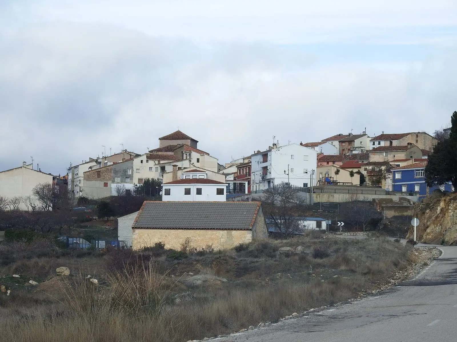
Casas de Garcimolina is a tiny village in the Serranía Baja (lower Serranía) of Cuenca, only 1.7 km from Algarra, with 29 inhabitants in 2021 against 426 in 1920. Its old limestone-slab quarries and Early Cretaceous lake sediments are the subject of a palaeontological campaign begun in 2024, the Proyecto Chikuto.
On this page 10 sections
A very small, very high village
Casas de Garcimolina lies in the Serranía Baja, beside Algarra, at the eastern end of the province. It is a cold village with a large, almost empty municipality.
What trades and memory tell
The municipality’s quarries supplied lajas, flat limestone slabs for houses and pens. Extracting them disturbed layers of an Early Cretaceous lake, revealing fish, plants and a crocodile tooth.
In 2024 the Chikuto project of the Universidad Autónoma de Madrid began studying them, with the Mujeres del Sabinarejo and Las Cunázaras associations, town councils and the Museo de Paleontología de Castilla-La Mancha. It is named after José Luis Ortiz Villar, a collaborator on Cuenca excavations. There was a village exhibition, and the best pieces went to the museum.
García Molina’s house
The village arose during resettlement of Moya’s lands in the early 13th century, when a certain García Molina settled here and his house named the place: in the 18th century it was still called La Casa de Garcimolina. In 1608 a local man, Pedro de Espina, enrolled to study Arts at the University of Oviedo. In the Ensenada Cadastre of 1752 it had 36 households, between 144 and 180 people, and the inquiry was held in Algarra’s rectory, home of its priest, a Trinitarian from Royuela in Aragon. Garcimolina and Algarra also shared timber from the dehesa boyal (common ox pasture) and a single-stone flour mill on their boundary, leased in 1752 by an Ademuz resident for 23 fanegas of wheat and 330 reales a year, shared equally by the two councils. The village has had its own municipal seal since 1847.
The Barranco del Lobo drove road
The Vereda de las Monjas, a narrower drove road 25 Castilian varas, 20.89 metres, wide, crosses the municipality, descending from the mountains towards Moya and the south; its name is attributed to Moya’s Conceptionist nuns, who owned land nearby. Crossing Garcimolina it changes name to the Vereda del Barranco del Lobo. Beside it remain dry-stone shepherds’ shelters named after villagers: Tío Román, Tío Bruno and Tío Bernardino.
Festivities honour San Juan, and villagers have gathered their proverbs, skittles game, May-song lyrics, wind names and a dictionary of local «palabros y jerigonzas» (odd words and jargon) in Garcimolina y sus cosas.
Plan your visit
A short stop together with Algarra. The quarries are unprepared for visitors and nothing is to be collected.
Before you travel
Frost is frequent from autumn to spring. Ask the town council whether the exhibition is open.
Frequently asked questions
What is the Proyecto Chikuto?
A palaeontological campaign begun in 2024 by the CIPb group of the Universidad Autónoma de Madrid around Casas de Garcimolina and Algarra, with local associations, town councils and the Museo de Paleontología de Castilla-La Mancha. Its name honours José Luis Ortiz Villar.
What fossils are there?
Fish, plants and a crocodile tooth have been described in Barremian lake sediments from the Early Cretaceous. Many come from material disturbed by the old quarries.
Carry on from here
The rivers, zones, eras, places and official routes that the atlas links with Casas de Garcimolina.
Lands and landscapes
From here, follow the memory of the land
These readings connect Casas de Garcimolina with the stories, the work and the villages around it.
Traces in the village and around it
Which eras you can read here
A single place can keep traces of several periods. These layers connect what you see with the atlas's stories.
Places in the municipality and around it
Near Casas de Garcimolina

Fuente del Royo picnic area
Huerta del Marquesado
Prao de San Roque picnic area
Huerta del MarquesadoPaisaje Ilustrado of Huerta del Marquesado
Huerta del MarquesadoSee 5 more

Fuente de la Ardilla picnic area
ValdemecaPaisaje Ilustrado of Valdemeca
Valdemeca
Valdemeca Visitor Reception Centre
Valdemeca
Las Hoyas
La Cierva
Centenar viewpoint
ValdemecaPopulation of Casas de Garcimolina, 1842–2021
Casas de Garcimolina reached 426 inhabitants in 1920. The 2021 census counted 29, 93 % fewer. It is the story told in the emptying.
Climate in Casas de Garcimolina month by month
Averages for the ten years from 2015 to 2024 from the ERA5 reanalysis (Copernicus), for a grid cell with a reference altitude of 1164 m. They are model estimates, not measurements from a local station or thirty-year climate normals.
Source: Copernicus ERA5 via Open-Meteo, CC BY 4.0. Retrieved: 2026-10-09.
Location
● Reference point · ● Villages · ● Places
Location sketch. The map with paths and names loads as you scroll to it.
Approximate position: village centre.
Reference villages: Algarra · Moya · Alcalá de la Vega · Fuentelespino de Moya.
Open the full map and its historical layers →Where the data on this page come from
- Location
- IGN: Nomenclátor Geográfico Básico de España, capital de municipio (CC BY 4.0) source consulted, 9 October 2026
«Source consulted»: the primary source has been read. «Reference located»: the source has been identified but not yet read. «Open question»: the figure needs confirmation.
More about Casas de Garcimolina, told from the village: garcimolina.net, the village historical archive.