Village · Cuenca
Alcalá de la Vega
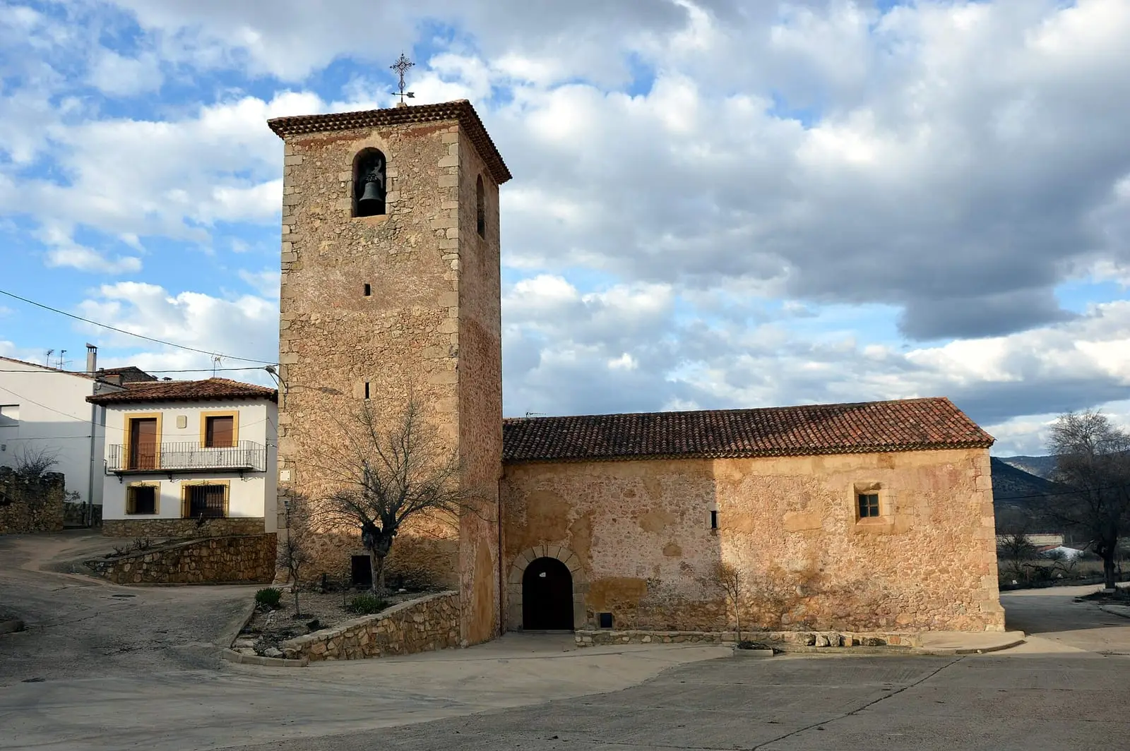
Alcalá de la Vega is a village in the Serranía Baja (lower Serranía) of Cuenca, stepping up above a gorge, with a medieval castle on the hilltop. It had 837 inhabitants in 1940 and 85 in 2021. Since 1975 its municipality has included El Cubillo, formerly a municipality of its own.
On this page 9 sections
A hillside village above the gorge
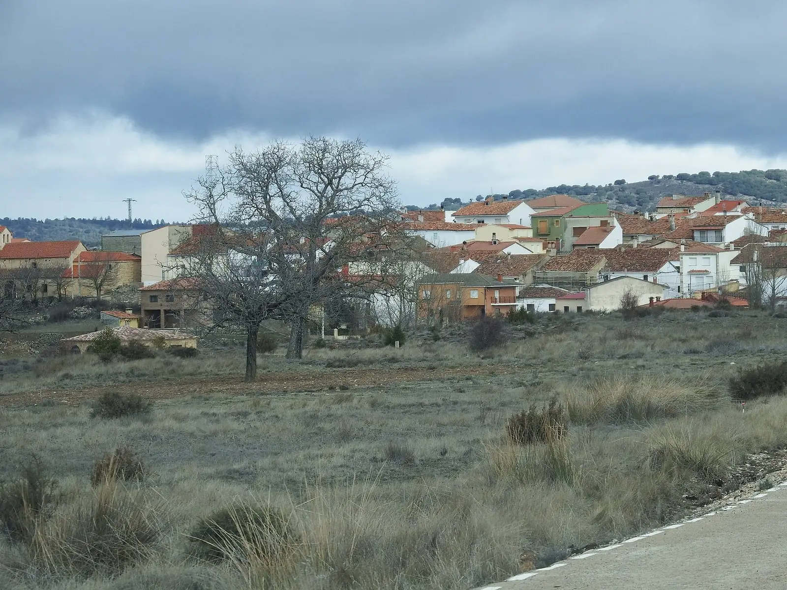
Alcalá de la Vega lies in the Serranía Baja, on the eastern edge of the province. It stands on a slope above the Cabriel gorge, which divides the municipality into two river plains: the streets climb the hillside and, from a distance, the houses look like a staircase of roofs. The cliffs and valley can be seen from the upper streets. Above, on the hill, are the remains of the medieval castle; below, the church and a small stone-built village centre. Winters are those of the mountains.
The castle of the Banu Zennun
At the top, among cliffs, remain the keep, courtyard, walls and cisterns of a castle that Arabic texts call al-Qala or Aqaqla. It was the first fortress of the cora (administrative district) of Santaver, the land of the Banu Zennun, a Berber family that became almost independent of Córdoba in the 9th century. An Arabic chronicle describes a well at the top, descended by one stairway and climbed by another, and doorways cut into the rock. There, in summer 872, Emir Muhammad I met Sulaymán ben Zennun, whom he later made governor of the cora. Visigothic funerary stelae with a Chi-Rho monogram have also been found in the municipality.
It later belonged to the marquisate of Moya, one of its 36 villages. In the 15th-century census it had 109 households, five of them hidalgos (members of the lesser nobility) and three clerics; in 1587 it shared a baptismal font with Algarra.
What trades and memory tell
The patron saint is the Virgen del Remedio, credited with many miracles, and people from surrounding villages such as Campillos-Paravientos make a pilgrimage up to her hermitage in late spring. Village memory retains hemp, grown for many years, the hemp seeds eaten like nougat at Christmas, the pig of San Antón, the gatherings of each year’s conscripts, the communal grain store and the named springs: La Alberca, La Mesta, Los Recueros and Fuente Águeda. The writer Florencio Martínez is from here and has dedicated verses to the «Cabriel dormido» (sleeping Cabriel).
Within the municipality is El Cubillo, a municipality until 1975, when it joined Alcalá de la Vega. Its name remains on the map; its inhabitants left with Depopulation.
Plan your visit
Start in the village centre and take your time climbing to the castle.
Before you travel
The streets are steep and the gorge has cliffs: wear shoes with grip and take care at the edges. The castle is a ruin; ask the town council how to reach it. Frost is frequent in winter.
Combine with
Algarra and Salvacañete are about 8 km away as the crow flies.
Frequently asked questions
What is there to see in Alcalá de la Vega?
The medieval castle on the hill, the village stepping up above the gorge, the parish church and the natural viewpoints in the upper streets. El Cubillo is also within the municipality.
How many people live in Alcalá de la Vega?
85 in the 2021 census. The peak was 837 in 1940, according to the INE.
Carry on from here
The rivers, zones, eras, places and official routes that the atlas links with Alcalá de la Vega.
Lands and landscapes
From here, follow the memory of the land
These readings connect Alcalá de la Vega with the stories, the work and the villages around it.
Places in the municipality and around it
Near Alcalá de la Vega

Fuente del Royo picnic area
Huerta del Marquesado
Prao de San Roque picnic area
Huerta del MarquesadoPaisaje Ilustrado of Huerta del Marquesado
Huerta del MarquesadoSee 5 more

Fuente de la Ardilla picnic area
Valdemeca
Las Hoyas
La CiervaPaisaje Ilustrado of Valdemeca
Valdemeca
Valdemeca Visitor Reception Centre
Valdemeca
Centenar viewpoint
ValdemecaPopulation of Alcalá de la Vega, 1842–2021
Alcalá de la Vega reached 837 inhabitants in 1940. The 2021 census counted 85, 90 % fewer. It is the story told in the emptying.
Climate in Alcalá de la Vega month by month
Averages for the ten years from 2015 to 2024 from the ERA5 reanalysis (Copernicus), for a grid cell with a reference altitude of 1151 m. They are model estimates, not measurements from a local station or thirty-year climate normals.
Source: Copernicus ERA5 via Open-Meteo, CC BY 4.0. Retrieved: 2026-10-09.
Location
● Reference point · ● Villages · ● Places
Location sketch. The map with paths and names loads as you scroll to it.
Approximate position: village centre.
Reference villages: Campillos-Paravientos · Huérguina · Salinas del Manzano · Algarra.
Open the full map and its historical layers →Where the data on this page come from
- Location
- IGN: Nomenclátor Geográfico Básico de España, capital de municipio (CC BY 4.0) source consulted, 9 October 2026
- Municipality (INE code)
- Turismo de Castilla-La Mancha source consulted, 4 October 2026
- Name
- Turismo de Castilla-La Mancha source consulted, 4 October 2026
«Source consulted»: the primary source has been read. «Reference located»: the source has been identified but not yet read. «Open question»: the figure needs confirmation.