Village · Cuenca
Pajarón
Pajarón is a village in Serranía Baja (lower Serranía), covering 52.61 km². It belonged to the territory and marquisate of Moya, one of eastern Castile's most important lordships after the Reconquest. It had 364 inhabitants in 1910 and 77 in 2021, and lies 4.2 km from Pajaroncillo.
On this page 8 sections
A village in the eastern mountains
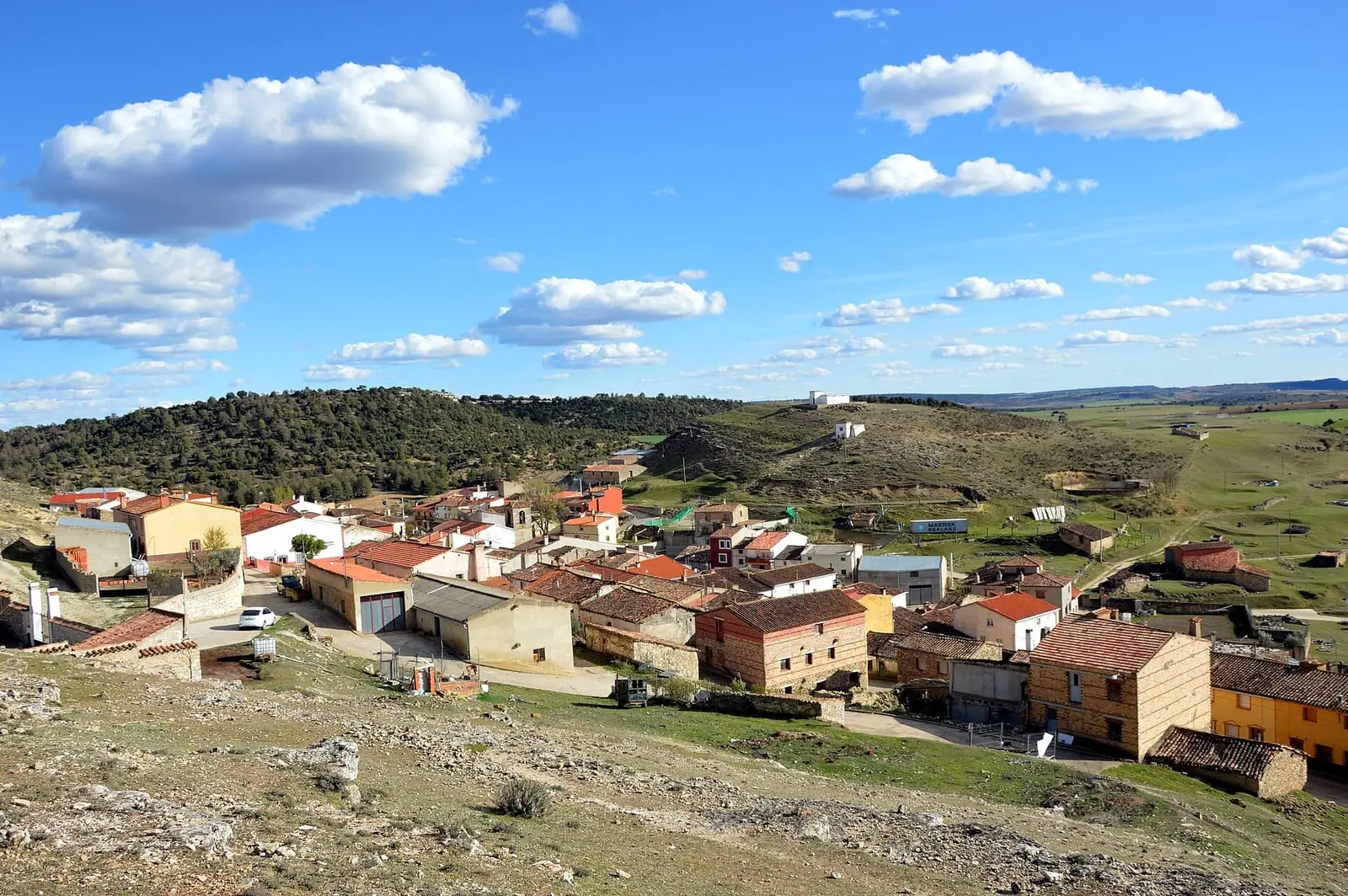
Pajarón lies in Serranía Baja (lower Serranía), where the mountains open towards the Cabriel valley. Its municipality, about 53 km², combines Mediterranean scrub, hills, woodland and farmland, and people lived from farming and livestock. The village is compact, with traditional houses. The landscape stands out most, best in spring and autumn.
What trades and memory tell
Pajarón belonged to the territory and marquisate of Moya. The town that gave it its name, now deserted, is described in Moya.
In 1849 Madoz reported that Pajarón’s Town Council, with a budget of 1,300 reales, was funded by the oven and grazing. A bridle path from Valencia to Madrid passed through the village, in very poor condition like the local roads, and post arrived from Cañete once a week.
A pledge from 1688
On the second Sunday in May, the village goes in procession with its image to Carboneras de Guadazaón. This is Domingo de Procesiones, Processions Sunday, dating from 1688, when Carboneras, Arguisuelas, Reíllo, Pajarón and Pajaroncillo signed deeds pledging forever to honour the Santa Hijuela, a relic entrusted by the Marchioness of Moya to the Dominicans of Carboneras convent, and to attend its procession with their saints. The mayors renewed the deeds around 2023, and La Cierva and Villar del Humo have since joined.
Plan your visit
Pajarón is a village for walking, with countryside around it, on a day through Serranía Baja.
Before you travel
Bring water.
Combine with
Pajaroncillo, with its burial mounds, is 4.2 km away in a straight line, and Carboneras de Guadazaón 6.9 km.
Frequently asked questions
Which lordship did Pajarón belong to?
The territory and marquisate of Moya, described by the Castilla-La Mancha Tourism entry as one of eastern Castile's most important lordships after the Reconquest. This is the main documented historical element in that entry.
How many inhabitants does it have?
77 in the 2021 census. Its peak was 364 in 1910, according to the INE.
Carry on from here
The rivers, zones, eras, places and official routes that the atlas links with Pajarón.
Lands and landscapes
From here, follow the memory of the land
These readings connect Pajarón with the stories, the work and the villages around it.
Near Pajarón

Las Hoyas
La Cierva
Fuente del Royo picnic area
Huerta del Marquesado
Prao de San Roque picnic area
Huerta del MarquesadoSee 5 more
Paisaje Ilustrado of Huerta del Marquesado
Huerta del Marquesado
Fuente de la Ardilla picnic area
Valdemeca
Beamud viewpoint
Beamud
Fuente de los Pastores picnic area
BeamudPaisaje Ilustrado of Valdemeca
ValdemecaPopulation of Pajarón, 1842–2021
Pajarón reached 364 inhabitants in 1910. The 2021 census counted 77, 79 % fewer. It is the story told in the emptying.
Location
● Reference point · ● Villages · ● Places · ━ Routes nearby
Location sketch. The map with paths and names loads as you scroll to it.
Approximate position: village centre.
Reference villages: Pajaroncillo · Carboneras de Guadazaón · Valdemorillo de la Sierra · Reíllo.
Open the full map and its historical layers →Where the data on this page come from
- Location
- IGN: Nomenclátor Geográfico Básico de España, capital de municipio (CC BY 4.0) source consulted, 9 October 2026
«Source consulted»: the primary source has been read. «Reference located»: the source has been identified but not yet read. «Open question»: the figure needs confirmation.