Village · Cuenca
Pajaroncillo
Pajaroncillo is a village in Serranía Baja (lower Serranía), on the Cabriel, with an Iron Age burial-mound field and the Hoyas del Castillo settlement, excavated between 1984 and 1990. Its cemetery contains the grave of 48 Republican soldiers who died at El Cañizar military hospital. It had 577 inhabitants in 1940 and 58 in 2021.
On this page 10 sections
A low-lying village beside the Cabriel
Pajaroncillo lies in Serranía Baja (lower Serranía), on the upper Cabriel. At about 935 metres, it is the lowest settlement in its district, within a municipality of steep, difficult terrain.
Burial mounds and a settlement
Among the pine woods is the burial-mound field, an Iron Age necropolis of stone heaps and cists. Almagro Gorbea excavated it and published his report in 1973; the National Archaeological Museum has a model of mound 82.
Beside it, the Hoyas del Castillo settlement was excavated between 1984 and 1990. It was occupied and abandoned four times, from the end of the Copper Age to Islamic times, and contained three Iberian cremation burials. There were also rock paintings, the Pajaroncillo rock shelters, now almost lost.
What trades and memory tell
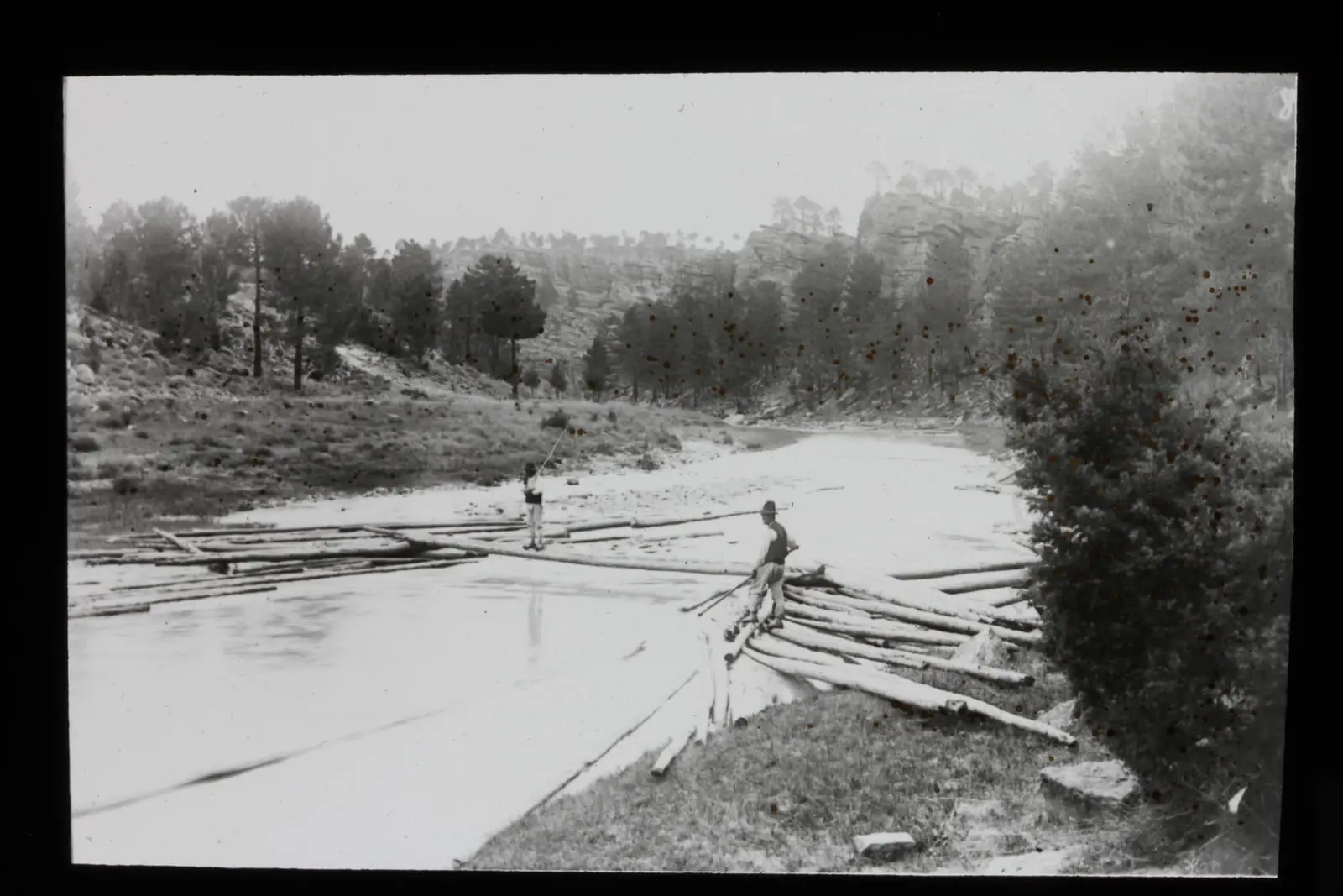
Within the municipality was El Cañizar, with a resin factory opened in 1924 receiving resin from Boniches among other places, and during the Civil War a military hospital for wounded soldiers from the Teruel front. The whole trade is described in Resin, pitch and charcoal. The cemetery contains a grave with 48 Republican soldiers who died there. In 2017, at the families’ request, it was sought using documents, ground-penetrating radar and trial trenches, and two villagers in their nineties helped locate it. Exhumation was impossible without damaging later graves, and in May 2024 a memorial stone with all 48 names was erected: the El Cañizar grave.
The Cristinas weir
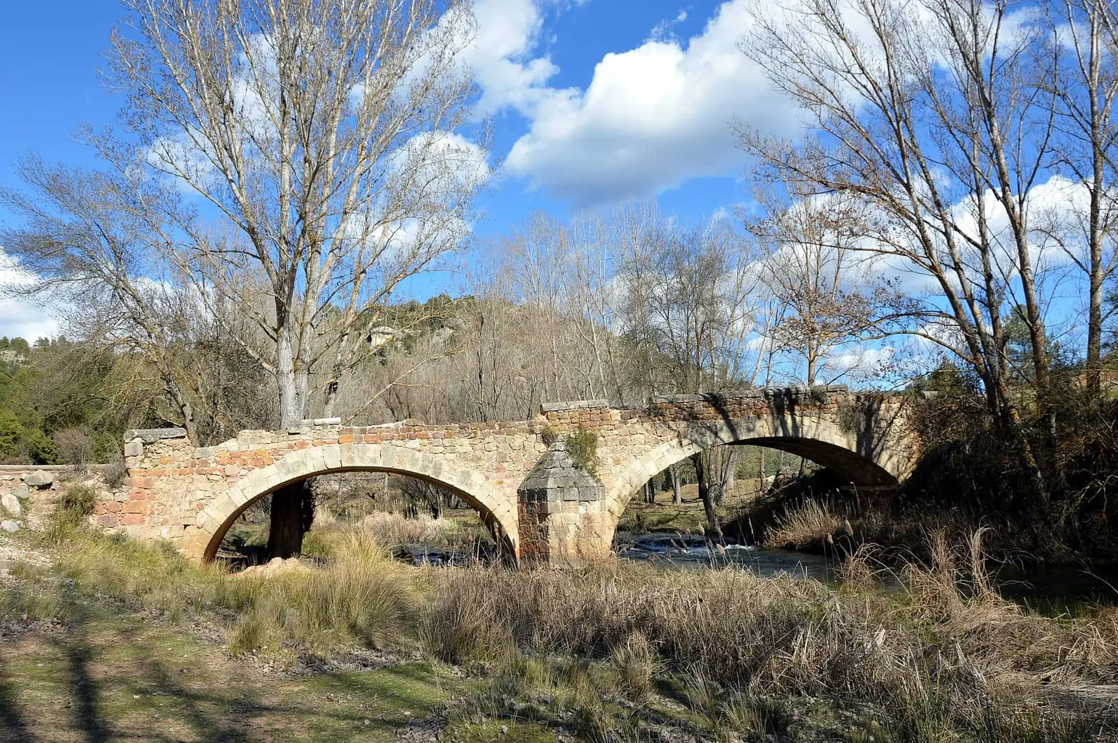
On the Cabriel, within Pajaroncillo’s municipality, stands the Cristinas weir, about two centuries old. It first diverted water to a flour mill and later to a molino de luz, a small hydroelectric mill; according to a villager, it supplied electricity to the houses of El Cañizar and the wartime hospital buildings. The Júcar River Basin Authority records the electricity-generating rights as terminated in January 1997. In 2021 the Authority proposed removing it to restore river continuity, with a favourable environmental report from the regional government; a petition sought to preserve it for the landscape and the pool, where an endangered dragonfly is said to live, and the Authority requested another report. The mayor waited to see the project before giving an opinion. The outcome is not recorded. Beside the weir is a Renaissance bridge, attributed by a popular-history writer to the Dominicans of Santa Cruz convent in Carboneras and, in his 2024 account, restored shortly beforehand; a confirming document is missing.
Plan your visit
Explore the village and Cabriel riverside at an unhurried pace. The burial mounds are an archaeological site: do not move stones or disturb the soil.
Before you travel
Ask the town hall how to reach the archaeological sites. In the cemetery, respect the memorial stone and the families visiting it.
Combine with
Pajarón is 4.2 km away in a straight line and Boniches, with its resin-working history, 10.4 km.
From the archive
Frequently asked questions
What are the Pajaroncillo burial mounds?
An Iron Age burial-mound field among the upper Cabriel pine woods, with stone heaps and cists. Almagro Gorbea published his excavation report in 1973, and the National Archaeological Museum holds a model of mound 82 in the Las Hoyas del Castillo field.
What is the El Cañizar grave?
The mass grave in Pajaroncillo cemetery where 48 Republican soldiers from the Teruel front who died at El Cañizar military hospital, within the municipality, were buried. A memorial stone with their names was inaugurated in 2024.
How many inhabitants does it have?
58 in the 2021 census. Its peak was 577 in 1940, according to the INE.
Carry on from here
The rivers, zones, eras, places and official routes that the atlas links with Pajaroncillo.
Rivers and basins
Following the water from Pajaroncillo
Follow these watercourses to where they meet, to their villages and to the memories of their basin.
Lands and landscapes
From here, follow the memory of the land
These readings connect Pajaroncillo with the stories, the work and the villages around it.
Traces in the village and around it
Which eras you can read here
A single place can keep traces of several periods. These layers connect what you see with the atlas's stories.
War and guerrilla · memory of the land
The war in the village's memory
Between 1938 and 1939 forty-eight Republican soldiers wounded on the Teruel front died in the military hospital of El Cañizar. They were buried together in the village cemetery, and in May 2024 a monolith with their names was put up.
Source: La Gavilla Verde.
Read the story of the grave →Places in the municipality and around it
Near Pajaroncillo

Las Hoyas
La Cierva
Fuente del Royo picnic area
Huerta del Marquesado
Prao de San Roque picnic area
Huerta del MarquesadoSee 5 more
Paisaje Ilustrado of Huerta del Marquesado
Huerta del Marquesado
Fuente de la Ardilla picnic area
Valdemeca
Beamud viewpoint
Beamud
Fuente de los Pastores picnic area
BeamudPaisaje Ilustrado of Valdemeca
ValdemecaPopulation of Pajaroncillo, 1842–2021
Pajaroncillo reached 577 inhabitants in 1940. The 2021 census counted 58, 90 % fewer. It is the story told in the emptying.
Location
● Reference point · ● Villages · ● Places · ━ Routes nearby
Location sketch. The map with paths and names loads as you scroll to it.
Approximate position: village centre.
Reference villages: Pajarón · Carboneras de Guadazaón · Boniches · Valdemorillo de la Sierra.
Open the full map and its historical layers →Where the data on this page come from
- Location
- IGN: Nomenclátor Geográfico Básico de España, capital de municipio (CC BY 4.0) source consulted, 9 October 2026
«Source consulted»: the primary source has been read. «Reference located»: the source has been identified but not yet read. «Open question»: the figure needs confirmation.