Village · Cuenca
Huérguina
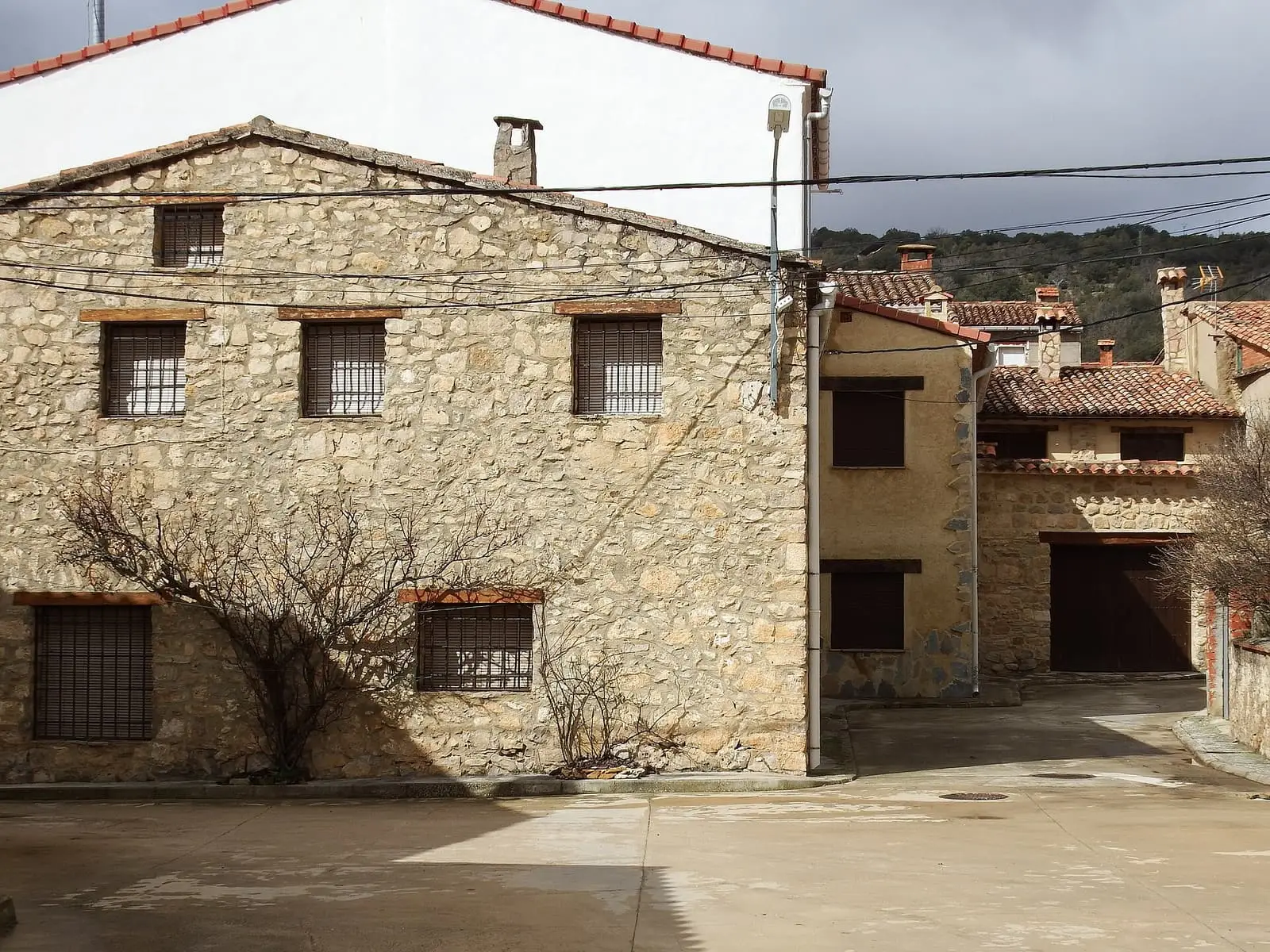
Huérguina is a village in the Serranía Baja (lower Serranía) of Cuenca, 3.5 km from Cañete, from which it separated before 1857, within the Valle del Cabriel Biosphere Reserve. It gives its name to the Calizas de La Huérguina Formation, the Early Cretaceous geological unit containing Las Hoyas. It has 53 inhabitants.
On this page 10 sections
A village born from another
Huérguina lies in the Serranía Baja, 3.5 km from Cañete, within the Valle del Cabriel Biosphere Reserve. It belonged to Cañete until separating as its own municipality in 1843. It is a cold mountain village.
Granary, prison and town hall
Madoz dates the separation to 1843: Huérguina, formerly a neighbourhood of Cañete, gained its own jurisdiction by government order. In 1847 the pósito, the village grain store, served as prison and town hall too. The school had twenty children and the teacher received only what their parents paid.
In 1892, when the State was selling village woods, Dehesa Horguinilla was among those excepted as public land: 107 municipal hectares, almost 64 marked as doubtful or expansion area.
What the stones tell
The village’s name appears in geology books: the Calizas de La Huérguina Formation is the Early Cretaceous layer, about 127 million years old, containing Las Hoyas. Its thinly laminated limestones are the bottom of a freshwater wetland in a subtropical climate. The site itself is in the municipality of La Cierva.
The Judas effigies
At Holy Week Huérguina retains the Judas effigies: straw-filled rag figures shaken about on Easter Sunday and finally burnt. It is a tradition in many Serranía Baja villages, each with its own form: in Salvacañete they fill them with lavender, in Landete hang signs listing village wrongdoings, in Pajaroncillo Judas «se meaba» (wet himself) through a drinking vessel hidden inside, and in Zafrilla they boast of hanging him from the district’s tallest trunk.
Plan your visit
It takes a short time to see, together with Cañete.
Combine with
Cañete is 3.5 km away as the crow flies; Boniches and Salinas del Manzano, 6 and 7.
Frequently asked questions
What is the La Huérguina Formation?
An Early Cretaceous limestone unit, about 129 to 126 million years old, containing fossil wetlands such as Las Hoyas in La Cierva. It is named after the village but extends beyond its municipality.
How many people live in Huérguina?
53 in the 2021 census. The peak was 338 in 1940, according to the INE.
Carry on from here
The rivers, zones, eras, places and official routes that the atlas links with Huérguina.
Lands and landscapes
From here, follow the memory of the land
These readings connect Huérguina with the stories, the work and the villages around it.
Near Huérguina

Fuente del Royo picnic area
Huerta del Marquesado
Prao de San Roque picnic area
Huerta del MarquesadoPaisaje Ilustrado of Huerta del Marquesado
Huerta del MarquesadoSee 5 more

Fuente de la Ardilla picnic area
Valdemeca
Las Hoyas
La CiervaPaisaje Ilustrado of Valdemeca
Valdemeca
Valdemeca Visitor Reception Centre
Valdemeca
Centenar viewpoint
ValdemecaPopulation of Huérguina, 1877–2021
Huérguina reached 338 inhabitants in 1940. The 2021 census counted 53, 84 % fewer. It is the story told in the emptying.
Climate in Huérguina month by month
Averages for the ten years from 2015 to 2024 from the ERA5 reanalysis (Copernicus), for a grid cell with a reference altitude of 1113 m. They are model estimates, not measurements from a local station or thirty-year climate normals.
Source: Copernicus ERA5 via Open-Meteo, CC BY 4.0. Retrieved: 2026-10-09.
Location
● Reference point · ● Villages · ● Places · ━ Routes nearby
Location sketch. The map with paths and names loads as you scroll to it.
Approximate position: village centre.
Reference villages: Cañete · Boniches · Salinas del Manzano · Alcalá de la Vega.
Open the full map and its historical layers →Where the data on this page come from
- Location
- IGN: Nomenclátor Geográfico Básico de España, capital de municipio (CC BY 4.0) source consulted, 9 October 2026
«Source consulted»: the primary source has been read. «Reference located»: the source has been identified but not yet read. «Open question»: the figure needs confirmation.