Village · Cuenca
Boniches
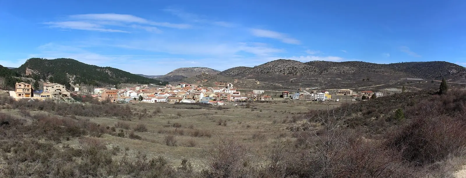
Boniches is a village in the Serranía Baja (lower Serranía) of Cuenca, beside the Cabriel and surrounded by maritime-pine forest. Logs floated down its river until the mid-20th century; it had three mills and five resin-tapping areas with over 150,000 pines. It reached 770 inhabitants in 1940 and has 138 in 2021.
On this page 13 sections
A village of three colours
Boniches lies in the Serranía Baja, beside the Cabriel, in a municipality more than three quarters covered by pine forest. The river has worn away the red sandstone and left three colours: clear water, red rodeno and green maritime pine. The riverbanks have otters, herons, willows, basket willows, poplars and alders. The village shelters from the north wind below the castle hill, which people call «la Picota» (the pillory), and of which almost nothing remains.
Its first written mention dates from 1263. In the late 15th century it passed to the Lordship of Moya and remained there until the 19th century.
What trades and memory tell
Logs floated down the Cabriel from the Middle Ages until the mid-20th century, and Boniches woods supplied timber to the gancheros, river timber drivers. Water drove three mills: La Herrería, Los Llanos and the Molino de la Luz, built to generate electricity: inaugurated in 1915, it began lighting the village in 1916 and received an alternator in 1920. Its channel crossed the river, and the outflow irrigated gardens on the opposite bank. Each house paid for one bulb and had to pay extra for another; the light was so weak that the oil lamp stayed at hand. In the valley, anyone giving up their garden planted a walnut tree in remembrance; today the valley is full of walnut trees.
The woodland belonged to the resin pine. In spring the trunk was stripped and fitted with a metal gutter so it bled into a pot; one resin tapper could work up to 5,000 pines, and resin went to factories in Teruel and, from its opening in 1924, El Cañizar in Pajaroncillo: pots to tins, tins to barrels and then lorries. Gangs of resin tappers also came from Villar del Humo, and villagers remember it as the hardest work. On the slope of La Picota remain the threshing floors and straw barns where threshing took place; the origin of the «castillo de los moros» (Moors’ castle) crowning it is unknown, and the name does not prove it Islamic. The whole trade is told in Resin, pitch and charcoal. In 1958 there were about 1,800 sheep, housed in shelters in the hills that are now ruins. More about that woodland in The hills provide a living.
Boniches beans and salt water
The Cabriel valley gardens grew judías bonicheras, Boniches beans, fine and famous: in Cuenca, if other beans sold for two pesetas, Boniches beans sold for three. The village also has a saltwater spring: for bread, half its water was mixed with half fresh water, and it was used to cure olives and make pickled cucumbers without adding anything else. Three kinds of tea were gathered in the hills, té de río, té de risca and té de monte, the strongest, growing in maritime-pine forest; lavender, which outsiders came to distil in large iron boilers; and mizclos, saffron milkcaps, which brought whole families into the countryside with baskets between October and November to gather them for sale.
There were three mills, the light mill, the forge mill and the lower mill, and each house had its wine vat where grapes were trodden. The main festivities were Pascuas de Mayo, at Pentecost: young men climbed La Picota to sing mayos, May songs, and on Pentecost night sang to the maya, the chosen young woman. Today one day remains, and the festivities have moved to August. In 1940 Boniches had 770 inhabitants; in 2025, 135 registered residents.
On Shrove Tuesday young men went from house to house collecting for the souls in purgatory: potatoes, bacon, fruit and nuts. It is told in Carnival for the ánimas and San Juan night.
In the hills stands the Pino de las Cuatro Garras, a black pine about four metres in girth and twenty-five high, branching so low it seems to have four trunks; its unusual form spared it from felling.
El Traqueadero and La Horadada
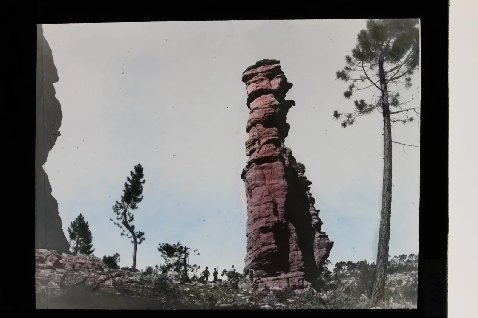
Down the Cabriel, among red sandstone, maritime pine and riverside woodland, is the Traqueadero waterfall (also Traqueaero or Traqueiro): the water divides into three arms and falls, according to guide Fernando Carreras, about five to eight metres. The name may come from the noise, from traquear (to rattle), but this is only a hypothesis. Before it, the path passes the ruins of a mill called El Traqueadero and, further down, La Herrería, converted into rural accommodation. In the other direction, upstream along the River Mayor among old vineyards, some abandoned and others tended, lies La Horadada, Foradada or Obrada: a large natural arch in sandstone and conglomerate, opened by water and wind, overlooking a sea of pines. It is a natural formation, not an inhabited cave.
Around Boniches
- Boniches rock art shelters and the Sima Cabeza de la Fuente, the municipality’s prehistory.
- Castil del Rey.
- The Boniches springs: Del Trillero, Del Cura, De la Canaleja, Del Nacimiento and Del Sastre.
Routes
The PR-CU 66, El Rodenal de Boniches, a short-distance trail, is 15.5 km: it follows the Cabriel valley, climbs through pine forest to Las Cabezas and returns through the Barranco de las Colochas. It is little used; follow the waymarks carefully.
Plan your visit
Walk through the centre and down to the river valley and mills. For the woodland, take the PR-CU 66.
Before you travel
The Barranco de las Colochas is the trail’s roughest stretch: take water and walking footwear. On the riverbank, do not tread on the edges or disturb wildlife.
Combine with
Cañete, Huérguina and Campillos-Paravientos are about 6.5 km away as the crow flies. The Selva Pascuala paintings are in neighbouring Villar del Humo.
From the archive
Frequently asked questions
What is there to see in Boniches?
The hillside centre below the castle hill, vegetable gardens and walnut trees in the river valley, the Cabriel mills, village springs and maritime-pine forest, explored along the PR-CU 66 El Rodenal de Boniches trail.
What connects Boniches with the gancheros?
Timber was transported down the Cabriel from the Middle Ages until almost the mid-20th century: after the thaw, gancheros drove logs towards the Júcar and Levante. Boniches woodland was one of the starting points.
How many people live in Boniches?
138 in the 2021 census. The peak was 770 in 1940, according to the INE.
Carry on from here
The rivers, zones, eras, places and official routes that the atlas links with Boniches.
Rivers and basins
Following the water from Boniches
Follow these watercourses to where they meet, to their villages and to the memories of their basin.
Lands and landscapes
From here, follow the memory of the land
These readings connect Boniches with the stories, the work and the villages around it.
Places in the municipality and around it
Official routes
Near Boniches

Fuente del Royo picnic area
Huerta del Marquesado
Prao de San Roque picnic area
Huerta del MarquesadoPaisaje Ilustrado of Huerta del Marquesado
Huerta del MarquesadoSee 5 more

Las Hoyas
La Cierva
Fuente de la Ardilla picnic area
Valdemeca
Beamud viewpoint
BeamudPaisaje Ilustrado of Valdemeca
Valdemeca
Valdemeca Visitor Reception Centre
ValdemecaPopulation of Boniches, 1842–2021
Boniches reached 770 inhabitants in 1940. The 2021 census counted 138, 82 % fewer. It is the story told in the emptying.
Climate in Boniches month by month
Averages for the ten years from 2015 to 2024 from the ERA5 reanalysis (Copernicus), for a grid cell with a reference altitude of 1034 m. They are model estimates, not measurements from a local station or thirty-year climate normals.
Source: Copernicus ERA5 via Open-Meteo, CC BY 4.0. Retrieved: 2026-10-09.
Location
● Reference point · ● Villages · ● Places · ━ Routes nearby
Location sketch. The map with paths and names loads as you scroll to it.
Approximate position: village centre.
Reference villages: Huérguina · Campillos-Paravientos · Cañete · Alcalá de la Vega.
Open the full map and its historical layers →Where the data on this page come from
- Location
- IGN: Nomenclátor Geográfico Básico de España, capital de municipio (CC BY 4.0) source consulted, 9 October 2026
«Source consulted»: the primary source has been read. «Reference located»: the source has been identified but not yet read. «Open question»: the figure needs confirmation.