Village · Cuenca
Campillos-Sierra
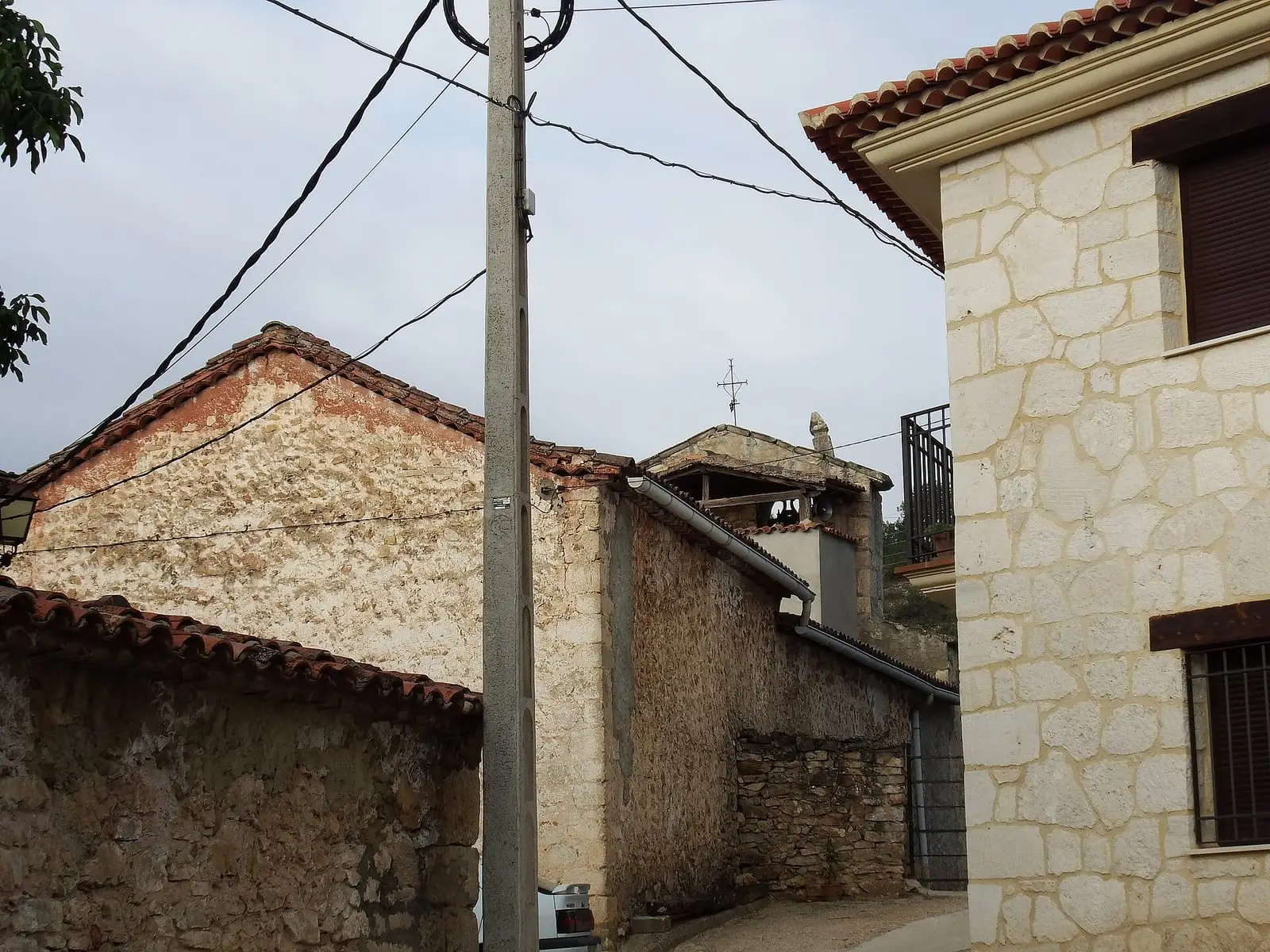
Campillos-Sierra is a village in the Serranía Baja (lower Serranía) of Cuenca, in the Valle del Cabriel Biosphere Reserve, with the parish church of Nuestra Señora de la Asunción and the hermitage of Nuestra Señora del Pilar de Altarejos. It had 476 inhabitants in 1897 and 32 in 2021: it has lost more than 90% of its population.
On this page 10 sections
A small, high village
Campillos-Sierra lies in the Serranía Baja, within the Valle del Cabriel Biosphere Reserve. It is a small, cold village. Its parish church is Nuestra Señora de la Asunción, and its hermitage Nuestra Señora del Pilar de Altarejos, described by villagers on their blog.
What trades and memory tell
Campillos-Sierra reached 476 inhabitants in the late 19th century. Almost half left in the 1960s and today a few dozen remain: Depopulation.
Junipers and an old road
The Dehesa de Campillos-Sierra holds one of Cuenca’s best Spanish-juniper woods, alongside those of Palancares and Tierra Muerta: junipers providing pasture on cold, poor land, always linked to mountain livestock farming. The cart road from Salvacañete to Cuenca passed through the village, and Ernest Hemingway, Martha Gellhorn and Herbert Matthews probably rode along it in September 1937 after spending the night in Salvacañete.
At carnival, wheat, beans, pigs’ trotters, eggs and potatoes were collected from houses for the souls in purgatory and then auctioned in the square. It is told in Carnival for the ánimas and San Juan night.
The municipality has a named juniper, the Sabina Portera.
Coal in Cerro de Enmedio
In March 1854 the mining company La Oriental was founded to extract coal from Cerro de Enmedio de Altarejos, in the municipality of Campillos-Sierra. The mine was registered as La Reparadora.
Plan your visit
It can be seen in half an hour.
Before you travel
Ask the town council when the church and hermitage open. Frost is frequent in winter.
Combine with
Valdemoro-Sierra is about 6 km away as the crow flies and Huerta del Marquesado about 7.
Frequently asked questions
What is there to see in Campillos-Sierra?
The parish church of Nuestra Señora de la Asunción and the hermitage of Nuestra Señora del Pilar de Altarejos, included on the regional tourism website since 2014.
How many people live there?
32 in the 2021 census. The peak was 476 in 1897, according to the INE.
Carry on from here
The rivers, zones, eras, places and official routes that the atlas links with Campillos-Sierra.
Lands and landscapes
From here, follow the memory of the land
These readings connect Campillos-Sierra with the stories, the work and the villages around it.
Near Campillos-Sierra

Fuente del Royo picnic area
Huerta del Marquesado
Prao de San Roque picnic area
Huerta del MarquesadoPaisaje Ilustrado of Huerta del Marquesado
Huerta del MarquesadoSee 5 more

Fuente de la Ardilla picnic area
Valdemeca
Las Hoyas
La CiervaPaisaje Ilustrado of Valdemeca
Valdemeca
Valdemeca Visitor Reception Centre
Valdemeca
Beamud viewpoint
BeamudPopulation of Campillos-Sierra, 1842–2021
Campillos-Sierra reached 476 inhabitants in 1897. The 2021 census counted 32, 93 % fewer. It is the story told in the emptying.
Climate in Campillos-Sierra month by month
Averages for the ten years from 2015 to 2024 from the ERA5 reanalysis (Copernicus), for a grid cell with a reference altitude of 1253 m. They are model estimates, not measurements from a local station or thirty-year climate normals.
Source: Copernicus ERA5 via Open-Meteo, CC BY 4.0. Retrieved: 2026-10-09.
Location
● Reference point · ● Villages · ● Places · ━ Routes nearby
Location sketch. The map with paths and names loads as you scroll to it.
Approximate position: village centre.
Reference villages: Valdemoro-Sierra · Tejadillos · Huerta del Marquesado · Cañete.
Open the full map and its historical layers →Where the data on this page come from
- Location
- IGN: Nomenclátor Geográfico Básico de España, capital de municipio (CC BY 4.0) source consulted, 9 October 2026
«Source consulted»: the primary source has been read. «Reference located»: the source has been identified but not yet read. «Open question»: the figure needs confirmation.