Village · Cuenca
Santa Cruz de Moya
Santa Cruz de Moya is a village in Serranía Baja (lower Serranía), beside the Valencia and Teruel boundaries, known for its links with anti-Franco guerrillas: it has the AGLA Guerrilla Interpretation Centre, with over 200 video interviews, and the Cerro Moreno camp stood nearby. It had 2,321 inhabitants in 1940 and 233 in 2021.
On this page 9 sections
A village at the boundary of three territories
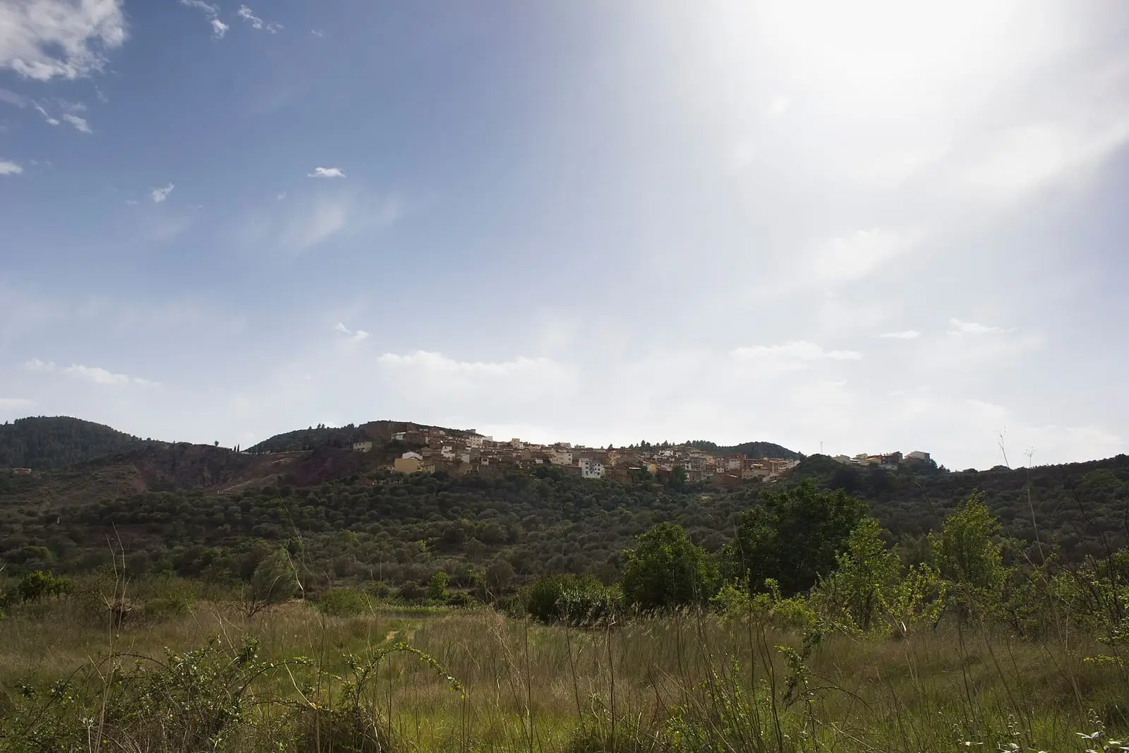
Santa Cruz de Moya lies in the far east of the province, in Serranía Baja (lower Serranía), very close to Valencia and Teruel. Its municipality has villages and rentos, isolated farmsteads in the hills, such as the Orchova valley, a former rento on the boundary between Castile, Aragón and Valencia. It was a large village: it reached 2,321 inhabitants in 1940. Its San Blas festivities in early February are the main festival week.
What trades and memory tell
In the 1940s and 1950s these woods were AGLA guerrilla territory, the Agrupación Guerrillera de Levante y Aragón. In a raid in the area the Civil Guard arrested about fifty contacts: some were killed under the ley de fugas, the pretext of an attempted escape, others tortured, and others took to the hills.
At Cerro Moreno stood a camp of the group. It was attacked at dawn on 7 November 1949, and twelve of the thirteen guerrillas died. Each year, on the Saturday nearest that date, people walk up to the site.
The AGLA Guerrilla Interpretation Centre, run by La Gavilla Verde, preserves documents donated by former guerrillas, over two hundred video interviews and General Enrique Líster’s personal archive. The story is told in The guerrilla in the Serranía.
In winter 2020–2021, larvae of Onychogomphus cazuma, a dragonfly, were found in a stream in the municipality; this was the province’s only known population. Biologist Cecilia Díaz links its survival to open irrigation channels and traditional small irrigated plots, which piping the water would eliminate.
Villages overlooking the Turia
The municipality has three villages: La Olmeda, Las Higueruelas and Las Rinconadas. La Olmeda and Las Rinconadas stand beside the Turia, which briefly enters Cuenca here from the Rincón de Ademuz before leaving again for Valencia, and live from their gardens: tomatoes, pumpkins, bajocas, their word for green beans, and carlota, carrots. The traditional fruit tree is the Esperiega apple, alongside peach, plum and almond trees. Each household made its own wine. La Olmeda has a fountain and washhouse; at Las Rinconadas, approached between poplars and with a feel already closer to eastern Spain than the mountains, water rises from three chasms with their own legends, described by some sources as fresh and by others as so salty that villagers compared it to an arm of the sea and did not drink it; Las Higueruelas retains its small church and washhouse. In the 18th century timber carts from Moya came down to the La Olmeda watering place to launch logs into the river. From La Olmeda, SL-CU 16 (local trail), Ruta de los Molinos, follows a 6 km circuit among olive groves, washhouses and mills.
The oldest villagers remember schools full of children, washing clothes on their knees at La Olmeda’s washhouse or in the river at Las Rinconadas, and rain-fed grain in the rochos, cultivated hillside plots, used down to the last ear. Apples brought the money: in season two or three lorries left daily, and women worked in the stores. Others fetched salt and sold it from carts in the villages for livestock. For things unavailable in the villages people went up to Santa Cruz, and for work they emigrated chiefly to Valencia.
Las Rinconadas has about forty residents during the week, more at weekends, according to one of them. One is a retired teacher who left as a child with his family to make a living in Barcelona and returned to the village on retirement. His father was murdered after the war because of his guerrilla connections, when he was about three: he does not remember him, knows him through what he was told, and this led him to work with La Gavilla Verde in the search for the disappeared. For years he and his partner, also a teacher, spent August in Las Rinconadas doing theatre with children and researching the place’s history. In 2026 he went out with his goats and a donkey towards Orchova, where he tended a garden in her memory.
PR-CU 11 (short-distance trail), the Sendero del Agua, makes a circuit of about fourteen kilometres along the Turia and its ravines: it leaves past a spring with a drinking trough and a fig tree, passes a ruined mill, gypsum kilns and remains of small power stations, climbs to Las Rinconadas, the livestock shelters and La Portera, then descends to La Olmeda, with olive trees thought to be centuries old. According to guide Fernando Carreras, the Turia runs red in floods because of clay carried from Teruel.
Since 2019 the municipality has been the only one in Castilla-La Mancha within the Alto Turia Biosphere Reserve, alongside seven Valencian villages. Before reaching the village, the road bridge across the Turia gorge was once the highest in Spain.
Around Santa Cruz de Moya
- Cerro la Puente, a small Iberian settlement identified through surface finds, part of the catalogue gathered in the Cerro Viejo entry.
- The Senderos de la Memoria, paths restored by the town council and La Gavilla Verde through the guerrillas’ woodland.
Plan your visit
The interpretation centre and village fill a morning. Cerro Moreno needs another, preferably with someone who knows the countryside.
Before you travel
Confirm centre opening times with the town hall or La Gavilla Verde. Guerrilla sites are places of remembrance: visit respectfully and touch nothing.
Combine with
Graja de Campalbo is 6.6 km away in a straight line and Landete 10.9 km.
Frequently asked questions
What is the AGLA Guerrilla Interpretation Centre?
A documentation centre on the anti-Franco guerrilla of the Agrupación Guerrillera de Levante y Aragón. According to Castilla-La Mancha Media, it holds material donated by former guerrillas, over 200 video interviews and General Enrique Líster's personal archive. The La Gavilla Verde association promotes it; its plaque was unveiled on 5 October 2024.
What happened at Cerro Moreno?
According to La Gavilla Verde, at dawn on 7 November 1949 the dictatorship's forces attacked a camp of the group there and killed twelve of the thirteen guerrillas present. The association organises a walk each year on the Saturday nearest that date.
How many inhabitants does Santa Cruz de Moya have?
233 in the 2021 census. Its peak was 2,321 in 1940, according to the INE.
Carry on from here
The rivers, zones, eras, places and official routes that the atlas links with Santa Cruz de Moya.
Lands and landscapes
From here, follow the memory of the land
These readings connect Santa Cruz de Moya with the stories, the work and the villages around it.
War and guerrilla · memory of the land
The war in the village's memory
At dawn on 7 November 1949 the guerrilla camp at Cerro Moreno was attacked, and twelve of the thirteen guerrillas there were killed. Every year people walk up to the site.
Source: La Gavilla Verde.
Read the story of the guerrilla →Places in the municipality and around it
Official routes
Near Santa Cruz de Moya

Fuente del Royo picnic area
Huerta del Marquesado
Prao de San Roque picnic area
Huerta del MarquesadoPaisaje Ilustrado of Huerta del Marquesado
Huerta del MarquesadoSee 5 more

Fuente de la Ardilla picnic area
ValdemecaPaisaje Ilustrado of Valdemeca
Valdemeca
Valdemeca Visitor Reception Centre
Valdemeca
Las Hoyas
La Cierva
Centenar viewpoint
ValdemecaPopulation of Santa Cruz de Moya, 1842–2021
Santa Cruz de Moya reached 2,321 inhabitants in 1940. The 2021 census counted 233, 90 % fewer. It is the story told in the emptying.
Location
● Reference point · ● Villages · ● Places · ━ Routes nearby
Location sketch. The map with paths and names loads as you scroll to it.
Approximate position: village centre.
Reference villages: Graja de Campalbo · Moya · Landete · Talayuelas.
Open the full map and its historical layers →Where the data on this page come from
- Location
- IGN: Nomenclátor Geográfico Básico de España, capital de municipio (CC BY 4.0) source consulted, 9 October 2026
«Source consulted»: the primary source has been read. «Reference located»: the source has been identified but not yet read. «Open question»: the figure needs confirmation.