Castle · Beteta
Rochafrida castle
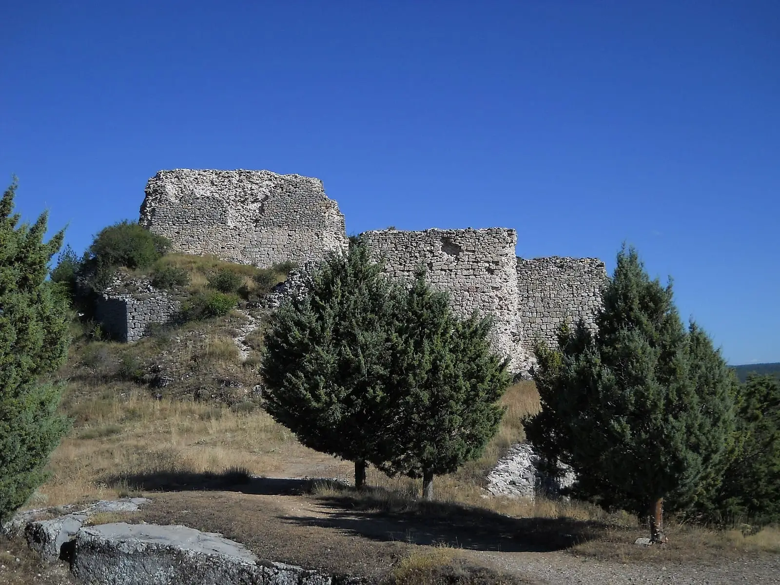
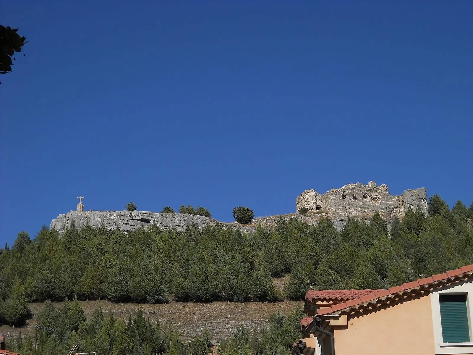
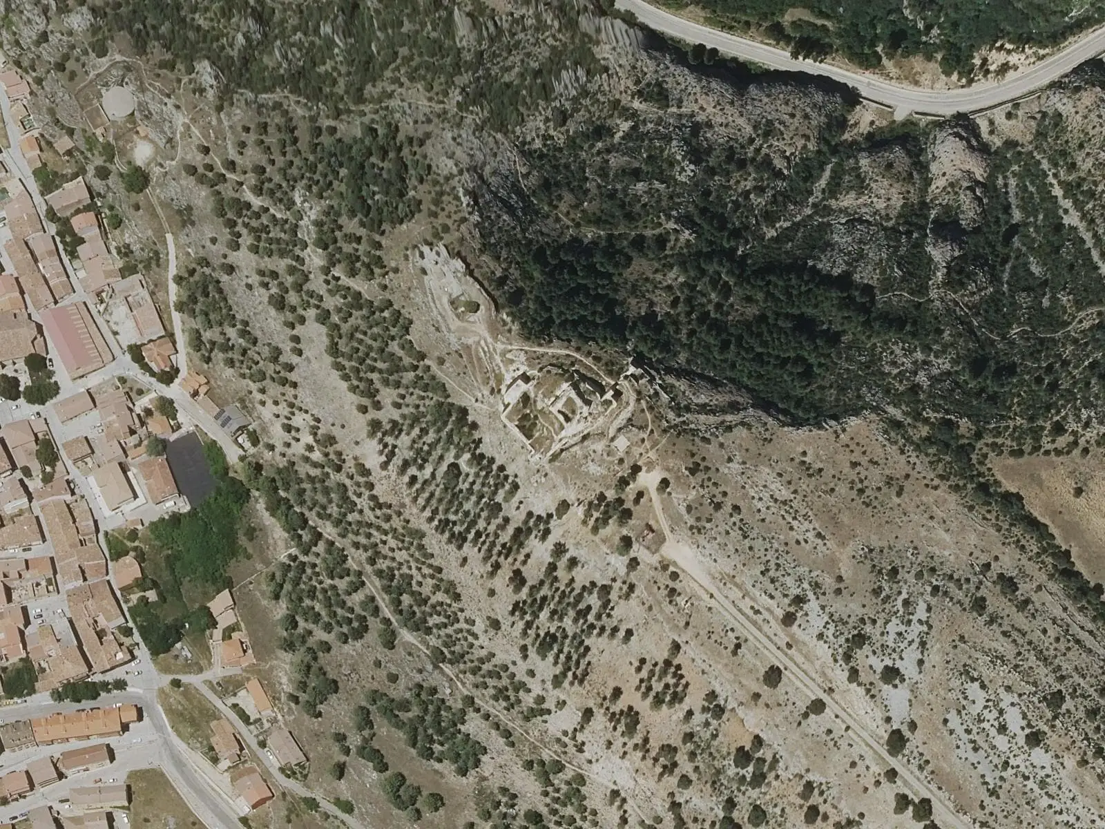
Rochafría or Rochafrida castle overlooks Beteta from a black-rock hill at about 1,300 m. Of Arab origin, it is now a consolidated ruin owned by the Town Council: foundations, wall sections, part of the formerly pentagonal keep, a southern moat and an external cistern survive.
- Municipality
- Beteta
- Castle
- Beteta
- Rochafría
- Arab fortress
On the black hill
The castle overlooks Beteta from a dark-rock hill at about 1,300 metres. Of Arab origin, it is now a consolidated ruin belonging to the Town Council. Foundations, wall sections, part of the formerly pentagonal keep, a southern moat and a cistern outside the enclosure survive. The viewpoint beside it overlooks the whole village.
From the bishop to the Carlists
In 1166 Alfonso VIII gave Beteta to Sigüenza cathedral, and the castle appears in documents around 1172. Already ruined in 1826, it became Cabrera’s stronghold during the First Carlist War: he reinforced its defences and stored ammunition there. An 1848 military sketch shows these alterations.
It was blown up in 1874. Some say by Carlists abandoning Beteta; others by Government troops after taking it, with 400 labourers working two days.
Consolidation
It was consolidated in 2018, and in 2023 the Town Council received a 2% Cultural grant of 849,412 euros to continue consolidation and prepare it for visits.
In January 2025 the mayor explained that the award, 849,412.66 euros, was still provisional and the works project was being drafted, awaiting Heritage approval. The 2% Cultural programme would fund 75% of costs, the Town Council 10%, with the remaining 15% still to find. The aim was to secure remaining walls, especially the north-western one, and the keep, and excavate inside; works were expected in 2025 and 2026. The mayor placed its use as a powder magazine in the Second Carlist War, not the First: this remains to be checked.
Plan your visit
Before you travel
The ruins have changes of level: view them without climbing the walls.
Combine with
Then descend to the Hoz de Beteta, the Guadiela canyon.

Frequently asked questions
What remains?
Foundations, wall sections, part of the pentagonal keep, a moat to the south and an external cistern.
Is it municipally owned?
Yes: it belongs to the Town Council.
Carry on from here
Lands and landscapes
From here, follow the memory of the land
These readings connect Rochafrida castle with the stories, the work and the villages around it.
This place through time
Which eras you can read here
A single place can keep traces of several periods. These layers connect what you see with the atlas's stories.
Where it is
Where the data on this page come from
- Name
- Galanita / gestión editorial por verificar source consulted, 5 October 2026
- Dirección General de Turismo, Comercio y Artesanía: «Castillo de Rochafrida» source consulted
- Ministerio de Educación Nacional: «Decreto de 22 de abril de 1949 sobre protección de los castillos españoles» (1949) source consulted
- Jefatura del Estado: «Ley 16/1985, de 25 de junio, del Patrimonio Histórico Español» (1985) source consulted
- Municipality (INE code)
- Galanita / gestión editorial por verificar source consulted, 5 October 2026
- Dirección General de Turismo, Comercio y Artesanía: «Castillo de Rochafrida» source consulted
- Ministerio de Educación Nacional: «Decreto de 22 de abril de 1949 sobre protección de los castillos españoles» (1949) source consulted
- Jefatura del Estado: «Ley 16/1985, de 25 de junio, del Patrimonio Histórico Español» (1985) source consulted
«Source consulted»: the primary source has been read. «Reference located»: the source has been identified but not yet read. «Open question»: the figure needs confirmation.