Village · Cuenca
Tejadillos
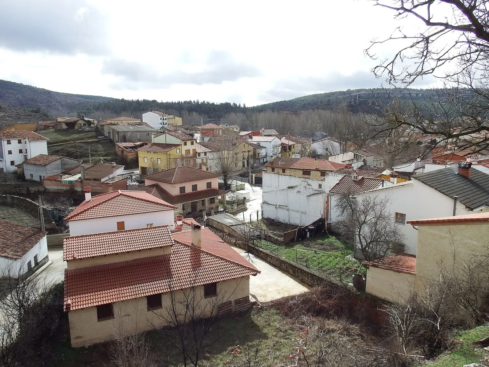
Tejadillos is a village in eastern Serranía Baja (lower Serranía), in the Natural Park and Valle del Cabriel Biosphere Reserve, with rubble-stone houses adapted to the valley and San Pedro festivities around 29 June. It lived from livestock and woodland. It had 687 inhabitants in 1940 and 115 in 2021.
On this page 8 sections
A village in the Cabriel valley
Tejadillos lies in the east of the province, in Serranía Baja (lower Serranía), in a mountain valley crossed by the Cabriel. Its rubble-stone houses follow the terrain. Around it are pine woods, rocks and riverbanks. People lived from livestock and woodland. The church’s dedication is unclear: some sources say San Pedro Apóstol, others the Natividad. The festivities are for San Pedro, around 29 June.
Rue and May songs
In Tejadillos a bunch of rue was hung from the ceiling of children’s rooms to protect them from evil, one of many mountain customs involving this plant, believed to ward off illness, witches and vipers; one local area is called Hoya de la Ruda. The village is also among those still singing the mayos, May songs, like Landete, Talayuelas or Campillos-Paravientos.
The book Etnobotánica en la Serranía de Cuenca (2003) records that asensio, a wormwood, was hung in Tejadillos to protect against a cholera epidemic, and elsewhere placed in pigsties. This is a reported belief, not a remedy. More plant uses appear in Plants with names.
At Carnival, the things collected from houses were taken to the priest’s home and auctioned on the square on carrastoliendas, Shrove Tuesday. The story is told in Carnival of souls and St John’s Night.
A silver mine and two schools
On the hillside towards Peña de Mariestevan was an abandoned mine called de Plata, the silver mine. In 1849 Madoz described it as containing coal and particles resembling iron or copper pyrites.
In 1919 the village requested a boys’ school and conversion of the mixed school to a girls-only school. It had 55 boys and 52 girls of school age, and offered premises, materials and the teacher’s house. The Ministry approved this on 26 November.
Plan your visit
The village takes an hour to see, on a day through eastern Serranía Baja. Forest tracks are suitable for walking or mountain biking.
Before you travel
Ask the town hall when the church opens. Forestry machinery may be working on the forest tracks.
Combine with
Huerta del Marquesado is 5 km away in a straight line, Laguna del Marquesado, with its tufa lake, 5.1 km and Zafrilla 6.1 km.
Frequently asked questions
Where is Tejadillos?
In eastern Cuenca province, in Serranía Baja near the Valencia boundary, in mountainous surroundings crossed by the Cabriel. Its 63.28 km² municipality lies in the Valle del Cabriel Biosphere Reserve.
When are the festivities?
The festivities of San Pedro Apóstol, the patron according to Castilla-La Mancha Tourism, take place around 29 June.
How many inhabitants does it have?
115 in the 2021 census. Its peak was 687 in 1940, according to the INE.
Carry on from here
The rivers, zones, eras, places and official routes that the atlas links with Tejadillos.
Rivers and basins
Following the water from Tejadillos
Follow these watercourses to where they meet, to their villages and to the memories of their basin.
Lands and landscapes
From here, follow the memory of the land
These readings connect Tejadillos with the stories, the work and the villages around it.
Near Tejadillos

Fuente del Royo picnic area
Huerta del Marquesado
Prao de San Roque picnic area
Huerta del MarquesadoPaisaje Ilustrado of Huerta del Marquesado
Huerta del MarquesadoSee 5 more

Fuente de la Ardilla picnic area
ValdemecaPaisaje Ilustrado of Valdemeca
Valdemeca
Valdemeca Visitor Reception Centre
Valdemeca
Centenar viewpoint
Valdemeca
Beamud viewpoint
BeamudPopulation of Tejadillos, 1842–2021
Tejadillos reached 687 inhabitants in 1940. The 2021 census counted 115, 83 % fewer. It is the story told in the emptying.
Location
● Reference point · ● Villages · ● Places · ━ Routes nearby
Location sketch. The map with paths and names loads as you scroll to it.
Approximate position: village centre.
Reference villages: Huerta del Marquesado · Laguna del Marquesado · Zafrilla · Campillos-Sierra.
Open the full map and its historical layers →Where the data on this page come from
- Location
- IGN: Nomenclátor Geográfico Básico de España, capital de municipio (CC BY 4.0) source consulted, 9 October 2026
«Source consulted»: the primary source has been read. «Reference located»: the source has been identified but not yet read. «Open question»: the figure needs confirmation.