Place · Las Majadas
Callejones de Las Majadas
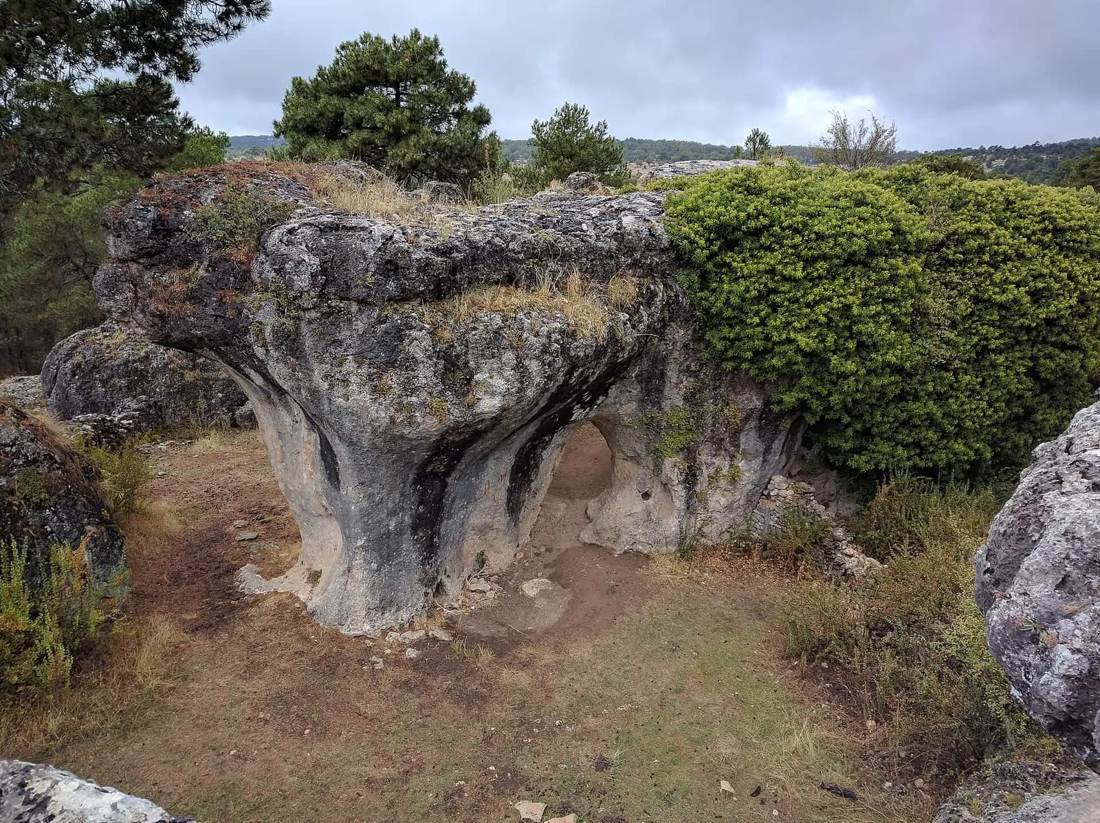
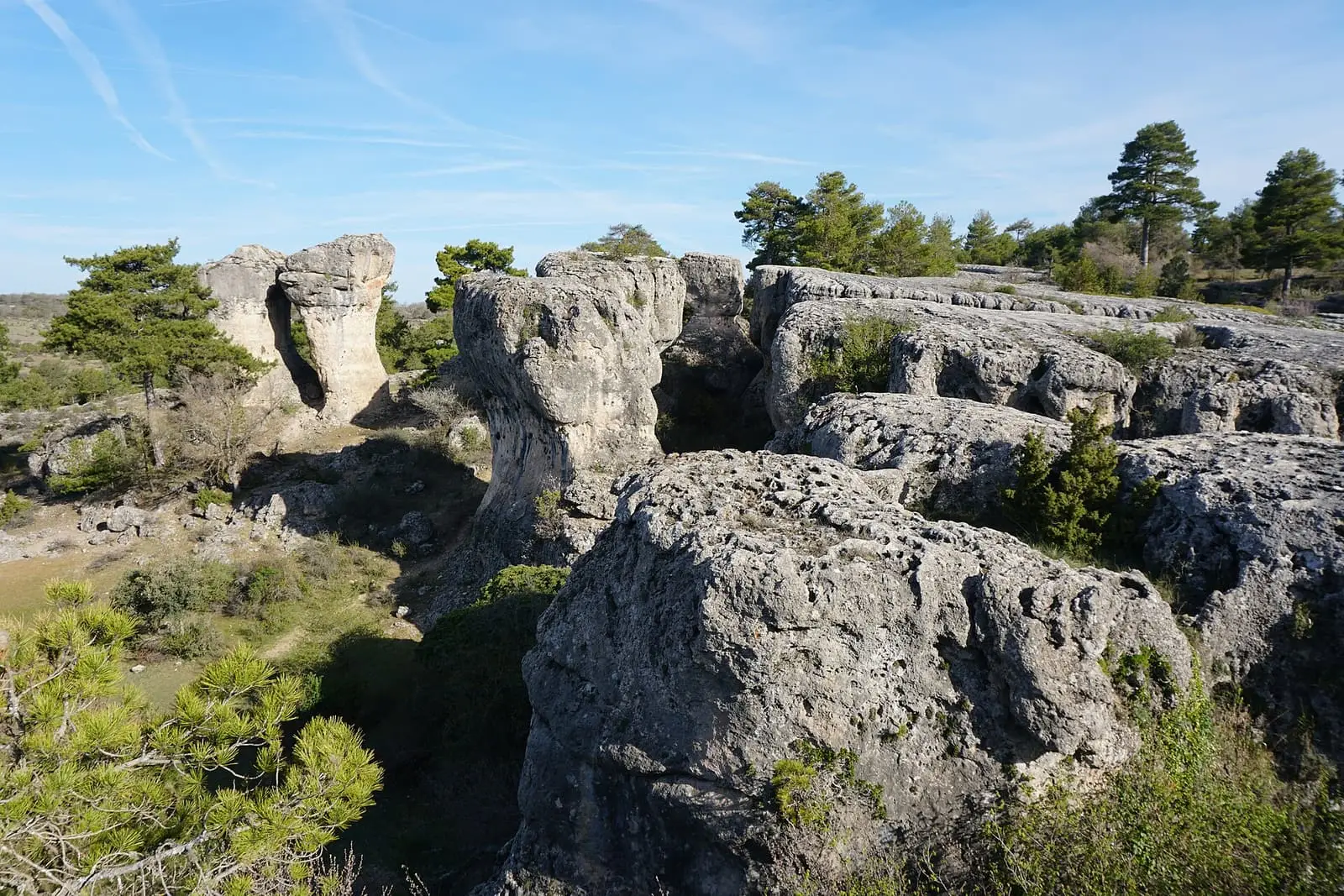
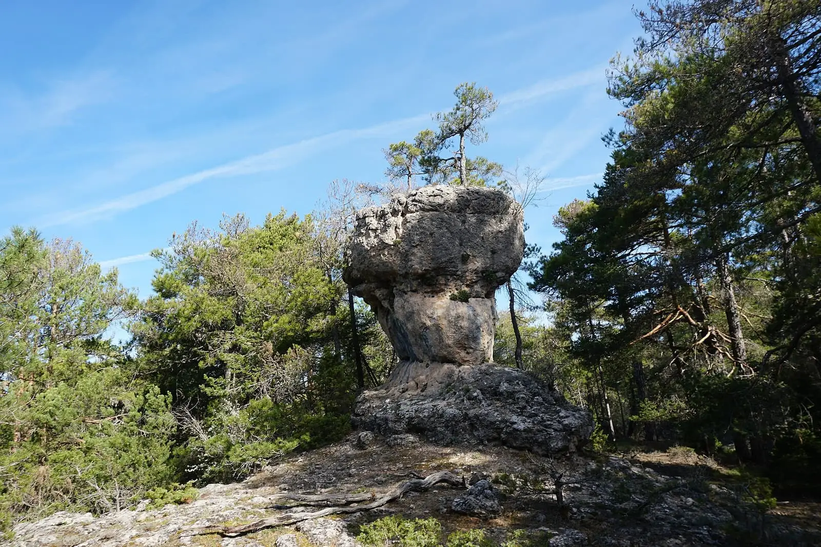
Los Callejones de Las Majadas are a striking karst landform developed in Late Cretaceous dolostone: intersecting passages or rock alleys called bogaces, leaving blocks of different shapes. Trail PNSC-S02 explores them over 3.98 km, of moderate difficulty, beside tormos, isolated rock towers.
- Municipality
- Las Majadas
- Karst
- Rock alleys
- Bogaces
- Tormos
- Las Majadas
Stone streets
Los Callejones in Las Majadas are a karst maze in Late Cretaceous dolostone. Water dissolved the rock along fissures, leaving streets, locally called bogaces, between blocks of very different shapes, the tormos, isolated rock towers. It is one of the area’s best karst landscapes, of stone and woodland.
Azerbaijan in Las Majadas
In 1999 Los Callejones stood in for Azerbaijan in Michael Apted’s James Bond film The World Is Not Enough, with Pierce Brosnan and Sophie Marceau. For about two weeks lorries and pipes arrived for an oil-pipeline set, and a temple entrance was built in papier-mâché among the rocks; a helicopter placed an office among the stone formations. According to the radio, several hundred provincial residents worked as extras, some as pipeline workers and others as locals opposing it. One extra remembers buses leaving Cuenca before dawn, waiting hours while lights were prepared with the actor’s double, a protest when work exceeded eight hours and five thousand pesetas per day. A Las Majadas hospitality worker remembers the actor greeting his mother with a kiss, neither of them recognising him. All of it was temporary scenery.
Plan your visit
PNSC-S2, Los Callejones, explores the passages and tormos in about 4 km. Nearby is PNSC-S9, Los Lagunillos, an easy 1 km walk along the upper Escabas among pine forests.
Before you travel
Do not leave the trails: it is easy to get lost among the rocks, and the stone is slippery when damp.
Combine with
The Tío Cogote viewpoint, Cascada del Fraile, Cueva de los Moros, with its legends, and Dehesa de los Olmos, with its seasonal waterfall.


Frequently asked questions
What are the callejones?
Passages or rock alleys, also called bogaces, intersecting through rock dissolution and leaving blocks of different shapes.
Which routes are there?
Los Callejones (PNSC-S02), a 3.98 km walk of moderate difficulty; and Los Lagunillos (PNSC-S09), an easy 1 km walk following the upper Escabas upstream.
Carry on from here
Lands and landscapes
From here, follow the memory of the land
These readings connect Callejones de Las Majadas with the stories, the work and the villages around it.
Where it is
● Reference point · ● Villages · ● Places · ━ Routes nearby
Location sketch. The map with paths and names loads as you scroll to it.
Reference villages: Las Majadas · Portilla · Uña · Villalba de la Sierra.
Open the full map and its historical layers →Where the data on this page come from
- Name
- Rewilding España source consulted, 4 October 2026
- Turismo de Cuenca / Ayuntamiento de Cuenca source consulted, 4 October 2026
- Location
- Rewilding España source consulted, 4 October 2026
- Municipality (INE code)
- Turismo de Cuenca / Ayuntamiento de Cuenca source consulted, 4 October 2026
«Source consulted»: the primary source has been read. «Reference located»: the source has been identified but not yet read. «Open question»: the figure needs confirmation.