Water · Tragacete
Source of the River Júcar
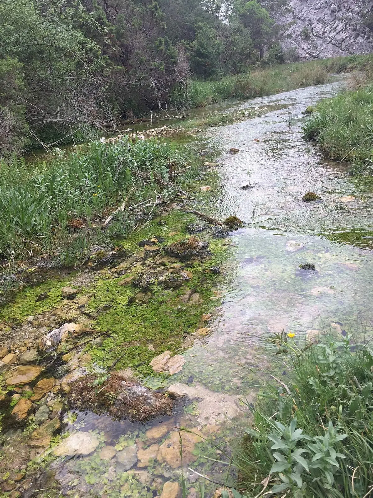
The Júcar rises in the municipality of Tragacete, at the Ojuelos de Valdeminguete spring in San Blas, at the head of the valley between the Muela de San Felipe and La Mogorrita. Water emerges diffusely from the San Felipe karst. From San Blas hostel, a trail leads to the Molino de la Virgen waterfall.
- Municipality
- Tragacete
- Júcar
- Source
- Tragacete
- San Blas
Where it rises
The Júcar rises in San Blas, near Tragacete, at the Ojuelos de Valdeminguete spring. It is at the head of the valley separating the Muela de San Felipe from the Muela de la Mogorrita, the province’s two highest summits. Water emerges diffusely from the San Felipe karst.
A long river
One of the peninsula’s great rivers begins here. It descends past Uña and the Ciudad Encantada, passes through Cuenca and follows its course to the Mediterranean.
Plan your visit
Tragacete is reached by road. From San Blas hostel, around four kilometres from the village, a trail follows an enclosed valley to the Molino de la Virgen waterfall, a drop of around twenty metres. The PR-CU 79, San Blas - San Felipe - Río Cuervo, a PR (short-distance trail), also passes here.
Before you travel
Observe the source: do not touch the spring outlets or throw anything into the water.
Combine with
The Molino de la Chorrera waterfall and the Tragacete visitor centre.
Frequently asked questions
Where does it rise?
In the municipality of Tragacete, in San Blas, at the Ojuelos de Valdeminguete.
Can you walk there?
The PR-CU 79 follows the river's first reaches to the Estrecho del Infierno and the Júcar springs.
Carry on from here
Rivers and basins
Following the water from Source of the River Júcar
Follow these watercourses to where they meet, to their villages and to the memories of their basin.
Lands and landscapes
From here, follow the memory of the land
These readings connect Source of the River Júcar with the stories, the work and the villages around it.
Where it is
● Reference point · ● Villages · ● Places · ━ Routes nearby
Location sketch. The map with paths and names loads as you scroll to it.
Reference villages: Tragacete · Vega del Codorno · Huélamo · Poyatos.
Open the full map and its historical layers →More springs, lakes and rivers nearby
See all →
Where the data on this page come from
- Name
- Rewilding España source consulted, 4 October 2026
- Turismo de Cuenca / Ayuntamiento de Cuenca source consulted, 4 October 2026
- Ministerio de Agricultura, Pesca y Alimentación source consulted, 5 October 2026
- Location
- Rewilding España source consulted, 4 October 2026
- Municipality (INE code)
- Turismo de Cuenca / Ayuntamiento de Cuenca source consulted, 4 October 2026
«Source consulted»: the primary source has been read. «Reference located»: the source has been identified but not yet read. «Open question»: the figure needs confirmation.